Gehlberg

Last updated
Gehlberg
Gehlberg-Kirche-1.JPG
Wappen Gehlberg.jpg
Location of Gehlberg within Suhl
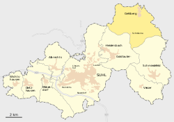
Suhl-Gehlberg.svg
Germany adm location map.svg
Red pog.svg
Gehlberg
Thuringia location map.svg
Red pog.svg
Gehlberg
Coordinates: 50°40′53″N10°47′26″E / 50.68139°N 10.79056°E / 50.68139; 10.79056
Country Germany
State Thuringia
Town Suhl
Area
  Total20.44 km2 (7.89 sq mi)
Elevation
720 m (2,360 ft)
Population
 (2017-12-31)
  Total502
  Density25/km2 (64/sq mi)
Time zone UTC+01:00 (CET)
  Summer (DST) UTC+02:00 (CEST)
Postal codes
98559
Dialling codes 036845
Website www.gehlberg.de
Gehlberg

Gehlberg is a village and a former municipality in Thuringia, Germany. Formerly in the district Ilm-Kreis, it is part of the town Suhl since January 2019.

Contents

Climate

Climate data for Schmücke: 938m (1991−2020)
MonthJanFebMarAprMayJunJulAugSepOctNovDecYear
Average high °C (°F)−0.8
(30.6)
0.0
(32.0)
3.6
(38.5)
8.9
(48.0)
13.3
(55.9)
16.4
(61.5)
18.5
(65.3)
18.5
(65.3)
13.7
(56.7)
8.5
(47.3)
3.5
(38.3)
0.2
(32.4)
8.7
(47.7)
Daily mean °C (°F)−2.8
(27.0)
−2.3
(27.9)
0.6
(33.1)
5.0
(41.0)
9.2
(48.6)
12.3
(54.1)
14.3
(57.7)
14.3
(57.7)
10.2
(50.4)
5.8
(42.4)
1.3
(34.3)
−1.8
(28.8)
5.5
(41.9)
Average low °C (°F)−4.7
(23.5)
−4.4
(24.1)
−1.9
(28.6)
1.8
(35.2)
5.6
(42.1)
8.7
(47.7)
10.9
(51.6)
11.0
(51.8)
7.4
(45.3)
3.6
(38.5)
−0.5
(31.1)
−3.7
(25.3)
2.8
(37.1)
Average precipitation mm (inches)133.6
(5.26)
104.1
(4.10)
106.0
(4.17)
73.4
(2.89)
96.5
(3.80)
90.9
(3.58)
129.9
(5.11)
96.2
(3.79)
111.0
(4.37)
110.9
(4.37)
119.7
(4.71)
142.5
(5.61)
1,314.7
(51.76)
Source: NOAA [1]


Twin towns — sister cities

Gehlberg is twinned with:

Related Research Articles

<span class="mw-page-title-main">Germany</span> Country in Central Europe

Germany, officially the Federal Republic of Germany, is a country in the western region of Central Europe. It is the second-most populous country in Europe after Russia, and the most populous member state of the European Union. Germany is situated between the Baltic and North seas to the north, and the Alps to the south. Its 16 constituent states are bordered by Denmark to the north, Poland and the Czech Republic to the east, Austria and Switzerland to the south, and France, Luxembourg, Belgium, and the Netherlands to the west. The nation's capital and most populous city is Berlin and its main financial centre is Frankfurt; the largest urban area is the Ruhr.

<span class="mw-page-title-main">German language</span> West Germanic language

German is a West Germanic language mainly spoken in Western Europe and Central Europe. It is the most widely spoken and official or co-official language in Germany, Austria, Switzerland, Liechtenstein, and the Italian province of South Tyrol. It is also an official language of Luxembourg and Belgium, as well as a recognized national language in Namibia. Outside Germany, it is also spoken by German communities in France (Alsace), Czech Republic, Poland, Slovakia, and Hungary (Sopron).

<span class="mw-page-title-main">Nazi Germany</span> Germany under control of the Nazi Party (1933–1945)

Nazi Germany, officially known as the German Reich until 1943, later the Greater German Reich, was the German state between 1933 and 1945, when Adolf Hitler and the Nazi Party controlled the country, transforming it into a totalitarian dictatorship.

<span class="mw-page-title-main">World War II</span> 1939–1945 global conflict

World War II or the Second World War, often abbreviated as WWII or WW2, was a global conflict that lasted from 1939 to 1945. The vast majority of the world's countries, including all of the great powers, fought as part of two opposing military alliances: the Allies and the Axis. Many participants threw their economic, industrial, and scientific capabilities behind this total war, blurring the distinction between civilian and military resources. Aircraft played a major role, enabling the strategic bombing of population centres and the delivery of the only two nuclear weapons ever used in war. World War II was by far the deadliest conflict in history, resulting in an estimated 70 to 85 million fatalities, mostly among civilians. Tens of millions died due to genocides, starvation, massacres, and disease. In the wake of the Axis defeat, Germany and Japan were occupied, and war crimes tribunals were conducted against German and Japanese leaders.

<span class="mw-page-title-main">Thuringian Forest</span> Mountain range in the German state of Thuringia

The Thuringian Forest, is a mountain range in the southern parts of the German state of Thuringia, running northwest to southeast. Skirting from its southerly source in foothills to a gorge on its north-west side is the Werra valley. On the other side of the Forest is an upper outcrop of the North German Plain, the Thuringian Basin, which includes the city Erfurt. The south and south-east continuation of the range is the highland often called the Thuringian-Vogtlandian Slate Mountains.

<span class="mw-page-title-main">FC Bayern Munich</span> German association football club

Fußball-Club Bayern München e. V., also known as FC Bayern, Bayern Munich, or simply Bayern, is a German professional sports club based in Munich, Bavaria. It is best known for its professional men's football team, which plays in the Bundesliga, the top tier of the German football league system. Bayern is the most successful club in German football history, having won a record 33 national titles, including 11 consecutively since 2013, and 20 national cups, along with numerous European honours.

<span class="mw-page-title-main">Suhl</span> City in Thuringia, Germany

Suhl is a city in Thuringia, Germany, located SW of Erfurt, 110 kilometres NE of Würzburg and 130 kilometres N of Nuremberg. With its 37,000 inhabitants, it is the smallest of the six urban districts within Thuringia. Together with its northern neighbour-town Zella-Mehlis, Suhl forms the largest urban area in the Thuringian Forest with a population of 46,000. The region around Suhl is marked by up to 1,000-meter-high mountains, including Thuringia's highest peak, the Großer Beerberg, approximately 5 kilometres NE of the city centre.

<span class="mw-page-title-main">Bundesliga</span> Association football league in Germany

The Bundesliga, sometimes referred to as the Fußball-Bundesliga or 1. Bundesliga, is a professional association football league in Germany. At the top of the German football league system, the Bundesliga is Germany's primary football competition. The Bundesliga comprises 18 teams and operates on a system of promotion and relegation with the 2. Bundesliga. Seasons run from August to May. Games are played on Fridays, Saturdays and Sundays. All of the Bundesliga clubs take part in the DFB-Pokal cup competition. The winner of the Bundesliga qualifies for the DFL-Supercup.

<span class="mw-page-title-main">Thunderegg</span> Nodule-like rock, that is formed within rhyolitic volcanic ash layers

A thunderegg is a nodule-like rock, similar to a filled geode, that is formed within rhyolitic volcanic ash layers. Thundereggs are rough spheres, most about the size of a baseball—though they can range from a little more than a centimeter to over a meter across. They usually contain centres of chalcedony which may have been fractured followed by deposition of agate, jasper or opal, either uniquely or in combination. Also frequently encountered are quartz and gypsum crystals, as well as various other mineral growths and inclusions. Thundereggs usually look like ordinary rocks on the outside, but slicing them in half and polishing them may reveal intricate patterns and colours. A characteristic feature of thundereggs is that the individual beds they come from can vary in appearance, though they can maintain a certain specific identity within them.

<span class="mw-page-title-main">Adolf Hitler</span> Dictator of Germany from 1933 to 1945

Adolf Hitler was an Austrian-born German politician who was the dictator of Germany from 1933 until his suicide in 1945. He rose to power as the leader of the Nazi Party, becoming the chancellor in 1933 and then taking the title of Führer und Reichskanzler in 1934. During his dictatorship, he initiated World War II in Europe by invading Poland on 1 September 1939. He was closely involved in military operations throughout the war and was central to the perpetration of the Holocaust, the genocide of about six million Jews and millions of other victims.

<span class="mw-page-title-main">Ilmenau</span> Town in Thuringia, Germany

Ilmenau is a town in Thuringia, central Germany. It is the largest town within the Ilm district with a population of 38,600, while the district capital is Arnstadt. Ilmenau is located approximately 33 km south of Erfurt and 135 km north of Nuremberg within the Ilm valley at the northern edge of the Thuringian Forest at an elevation of 500 metres.

<span class="mw-page-title-main">World War I</span> 1914–1918 global conflict

World War I, often abbreviated as WWI, was one of the deadliest global conflicts in history. It was fought between two coalitions, the Allies and the Central Powers. Fighting took place throughout Europe, the Middle East, Africa, the Pacific, and parts of Asia.

<span class="mw-page-title-main">Großer Beerberg</span>

The Großer Beerberg is a mountain, 982.9 m above sea level (NHN), whose summit is the highest point in the Thuringian Forest and the state of Thuringia. It is located between the three villages of Heidersbach, Goldlauter and Gehlberg in the borough of Suhl. The mountain is made of rhyolite that was formed through volcanic processes in the Rotliegendes rock of the Oberhof Formation, about 280 million years ago, and which was uplifted over the surrounding sediments to form a butte.

Oberes Geratal is a former Verwaltungsgemeinschaft in the district Ilm-Kreis, in Thuringia, Germany. The seat of the Verwaltungsgemeinschaft was in Gräfenroda. It was disbanded in January 2019.

<span class="mw-page-title-main">Neudietendorf–Ritschenhausen railway</span>

The Neudietendorf–Ritschenhausen railway connects Neudietendorf and Ritschenhausen in the German state of Thuringia. It is a mainly single-track main line operated by DB Netze.

Rudi Gering (1917–1998) was a German ski jumper. He was born in Thüringen in Germany and died somewhere in Bavaria.

<span class="mw-page-title-main">Schneekopf</span>

The Schneekopf near Gehlberg in the Thuringian county of Ilm-Kreis is 978 m above sea level (NHN) and thus the second highest peak in the Thuringian Forest after its western neighbour, the Großer Beerberg. The Adler Saddle between them is only about 59.4 metres lower than the two summits. To the east some distance away is its subpeak, the Sachsenstein, to the south are the Teufelskreise and Fichtenkopf. The Goldlauterberg further south marks the transition to the mountain of Großer Finsterberg.

<span class="mw-page-title-main">Plaue station</span>

Plaue (Thür) station is a junction station in the town of Plaue in the German state of Thuringia.

Suhl – Schmalkalden-Meiningen IV is an electoral constituency represented in the Landtag of Thuringia. It elects one member via first-past-the-post voting. Under the current constituency numbering system, it is designated as constituency 21. It covers the urban district of Suhl and a small part of Schmalkalden-Meiningen.

Ilm-Kreis II is an electoral constituency represented in the Landtag of Thuringia. It elects one member via first-past-the-post voting. Under the current constituency numbering system, it is designated as constituency 23. It covers the northern and western part of Ilm-Kreis.

References

  1. "Schmuecke Climate Normals 1991-2020". National Oceanic and Atmospheric Administration . Retrieved September 3, 2023.