
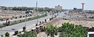
Arba Minch is a city and separate woreda in the southern part of Ethiopia. "Arba Minch" means "40 Springs", originated from the presence of more than 40 springs. It is located in the Gamo Zone of the Southern Nations, Nationalities, and Peoples Region about 500 kilometers south of Addis Ababa, at an elevation of 1285 meters above sea level. It is the largest town in Gamo Zone and the second town in SNNPR next to Hawassa, which is now the capital city of the newly formed Sidama Region. It is surrounded by Arba Minch Zuria woreda. This Town has plenty of natural gifts including the bridge of God, Crocodile ranch, crocodile market, different fruits and vegetables, different fishes farmed from Chamo and Abaya Lakes, more than 40 springs, different cereals, and crops, surprisingly having the two big Lakes in the country, lake Abaya and Chamo, respectively, next to Lake Tana, etc. This makes the town an attraction for domestic and international tourism.

Awash Subah is a market town in central Ethiopia. Located in Administrative Zone 3 of the Afar Region, above a gorge on the Awash River, after which the town is named, the town lies on the Addis Ababa–Djibouti Railway, which crosses the gorge by a bridge there. It is the largest settlement in Awash Fentale woreda.
Babile is a town located in East Hararghe, Oromia. It is inhabited mostly by Oromo peoples. The town has a latitude and longitude of 09°13′N42°20′E with an elevation of 1648 meters above sea level. It's the administrative center of Babille woreda.

Gabi Rasu, also known as Administrative Zone 3, is a zone in the Afar Region of Ethiopia. This zone is bordered on the south by the Oromia Region, on the southwest by the Amhara Region, on the west by Hari Rasu, on the north by Awsi Rasu, and on the east by the Somali Region.
Negele Borana or Neghelle, is a town and separate woreda in southern Ethiopia. Located in the Guji Zone of the Oromia Region on the road connecting Addis Ababa to Dolo Odo, it is the largest town in the Guji Zone, traditionally inhabited by the Borana Oromo. Specifically the town's inhabitants are mostly Soldiers and their families plus traders from different tribes living there since the HaileSillasie Regime. It has a latitude and longitude of 5°20′N39°35′E with an altitude of about 1,475 meters above sea level. Negele Borana principal importance is that a barrack revolt in this town is considered the first incident of the Ethiopian Revolution. Moyale town is greatly affected by the regional clashes between Borana and the Somali community.

Omorate is a town in southern Ethiopia near the Kenyan border. Located in the Debub Omo Zone of the Southern Nations, Nationalities and Peoples' Region, this village has a latitude and longitude of 4°48′N35°58′E with an elevation of 395 meters above sea level. It is the administrative center of Kuraz woreda.
Amibara is a woreda in Afar Region, Ethiopia. Part of the Administrative Zone 3, Amibara is bordered on the south by Awash Fentale, on the west by the Awash River which separates it from Dulecha, on the northwest by the Administrative Zone 5, on the north by Gewane, on the east by the Somali Region, and on the southeast by Oromia Region. Towns in Amibara include Awash Arba, Awash Sheleko, Melka Sedi and Melka Were.
Gewane is a woreda in Afar Region, Ethiopia. Part of the Administrative Zone 3, Gewane is bordered on the south by Amibara, on the west by Bure Mudaytu and Administrative Zone 5, on the north by the Administrative Zone 1, and on the east by the Somali Region; the Awash River defines parts of the boundary with Administrative Zone 5. The administrative centre is Gewane; other towns in Gewane include Meteka.
Bure Mudaytu is one of the Districts of Ethiopia, or woredas in the Afar Region of Ethiopia. Part of the Administrative Zone 3, Bure Mudaytu stretches along a narrow band covering the marshy lowlands along the Awash River, with the Administrative Zone 5 to the west and Gewane to the east. The administrative center of this woreda is Debel.

Saesi Tsaedaemba is one of the Districts of Ethiopia, or woredas, in the Tigray Region of Ethiopia. Located in the Misraqawi Zone at the eastern edge of the Ethiopian highlands, Saesi Tsaedaemba is bordered on the south by Kilte Awulaelo, on the southwest by Hawzen, on the west by Ganta Afeshum, on the northwest by Gulomahda, on the north by Irob, on the east by the Afar Region, and on the southeast by Atsbi Wenberta. Towns in Saesi Tsaedaemba include Edaga Hamus and Freweyni also known as Sinkata) where the woreda office is located.
Mieso is a woreda in Oromia Region, Ethiopia. Part of the West Hararghe Zone, Mieso is bordered on the south by Guba Koricha, on the west by the Afar Region, on the north by the Somali Region, on the east by Doba and on the southeast by Chiro. The administrative center for this woreda is Mieso; other towns in Mieso include Bordede, Asebot, Kora, and Gololcha.
Hosaena is a town and separate woreda in southern Ethiopia, and the administrative center of the Hadiya Zone. Located in the Southern Nations, Nationalities, and People's Region (SNNPR), Hosaena has a latitude and longitude of 7°33′N37°51′E with an elevation of 2177 meters above sea level. It was part of Limo woreda and is surrounded by it.
Semara is the capital of Afar Region, Ethiopia. It is a town on the Awash–Assab highway in north-east Ethiopia, having been planned and built to replace Asaita. Located in Administrative Zone 1, Semara has a latitude and longitude of 11°47′32″N41°0′31″E. One of the completed buildings is Semera University, which began holding classes in 2007.

Sekota, also spelled Sokota, Sakota, Soqota is a town and separate woreda in northern Ethiopia. The name is likely from the Agaw word sekut, "fortified village." Located in the Wag Hemra Zone of the Amhara Region, Sekota has a latitude and longitude of 12°37′31″N39°02′06″E and an elevation of 2266 meters above sea level. It is surrounded by woreda of Soqota.
Elidar( Qeelidaqar) is a town in north-eastern Ethiopia. Located in Administrative Zone 1 of the Afar Region, in the angle formed by the border with Djibouti to the south, and Eritrea to the northeast. It has a latitude and longitude of 12°3′N41°55′E with an elevation of 418 meters above sea level. Elidar is named for the salt pan that occupies the eastern end of Elidar woreda.
Cayyu(Diche Oto) is a town in north-eastern Ethiopia, located in Administrative Zone 1 of the Afar Region. During the Italian occupation, the settlement was known as Diciotto, Italian for "eighteen".
Meteka is a town in north-eastern Ethiopia. Located in Administrative Zone 3 of the Afar Region, 30 kilometers south of Gewane, it has a latitude and longitude of 9°52′N40°31′E with an elevation of 628 meters above sea level. It is one of two towns in Gewane woreda.
Mota is a town in northwest Ethiopia. It is located in the Misraq Gojjam Zone of the Amhara Region on the secondary road that links Dejen with Bahir Dar overlooking the Abay River. The town has a latitude and longitude of 11°5′N37°52′E with an elevation of 2,487 meters above sea level.
Berhale is a town in north-eastern Ethiopia. Located in Kilbet Rasu, Afar Region, this town has a latitude and longitude of 13°51′N40°01′E with an altitude of 639 meters above sea level. It is the largest town in Berhale woreda.
Bati is a town in north-central Ethiopia. Located in the Oromia Zone of the Amhara Region, east of Dessie this town has a latitude and longitude of 11°11′N40°1′E with an elevation of 1502 metres above sea level. It is the largest town in Bati woreda.
