Gibraltar Port Authority

Last updated

Gibraltar Port Authority
Gibraltar Port Authority Logo.png
The Port of Gibraltar (Aerial View from the North West).jpg
Agency overview
Formed1806
Jurisdiction British Gibraltar Territorial Waters
Headquarters North Mole, Gibraltar Harbour, Gibraltar
36°08′54″N5°21′55″W / 36.148453°N 5.365174°W / 36.148453; -5.365174 Coordinates: 36°08′54″N5°21′55″W / 36.148453°N 5.365174°W / 36.148453; -5.365174
MottoGateway to the Mediterranean
Minister responsible
  • Neil F. Costa, Minister for Tourism, Public Transport, and the Port
Agency executive
Key document
Website www.gibraltarport.com

The Gibraltar Port Authority develops and manages the Port of Gibraltar.

Contents

History

On 19 February 1706, Anne, Queen of Great Britain granted Free Port status to Gibraltar. [1] In the early 18th century, Gibraltar was principally a garrison where commerce was negligible.

Following the 1805 Battle of Trafalgar, Gibraltar was established as a port for international trade. The government-administered Gibraltar Port Authority was founded in 1806.[ citation needed ]

In 1823, the first steamship appeared in the Gibraltar Port which gradually evolved into a bunkering port.[ citation needed ]

The independent Gibraltar Port Authority was established in 2005 by the Gibraltar Port Authority Act. [2] The Act of Parliament also provided for the transfer of some responsibilities from the Government of Gibraltar to the Authority. Members of the Authority were appointed, effective 1 June 2006. [3] In 2005/2006, GPA's total revenue was £583,900, and its total expenditure £519,816.59. [4]

In July 2016, the GPA offloaded Tomahawk missiles, Spearfish torpedoes and Harpoon anti-ship missiles from a British nuclear-powered submarine that was damaged after colliding with a merchant vessel in the port of Gibraltar. The British authorities did not provide extensive information on this operation, which created tension with Spanish authorities. [5] In August 2016, the GPA signed a deal with Shell to study the implementation of LNG bunkering infrastructures in the port. [6]

In February 2017, the GPA impounded the super yacht (A (sailing yacht)) of Russian billionaire Andrey Melnichenko. [7] [8] In March 2017, the GPA expressed its concerns regarding the Brexit because its fuel reserves are located in the port of Algeciras, the Spanish coastal city facing Gibraltar. [9]

Description

Map of Gibraltar Gibraltar map-en-edit2.svg
Map of Gibraltar

Main functions

From 1997 to 2007, the GPA went from 27 registered ships to 236. [4]

Activities

All operational matters including navigational safety and the smooth running of the Port are overseen by the Captain of the Port. The principal services provided within Gibraltar Port are bunkering (supply of fuel to vessels) and cruise liner calls.

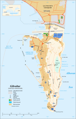
For the bunkering, the fuel is delivered by bunker barge to a vessel anchored in the Bay of Gibraltar or delivered to vessels alongside a berth where multiple shore fuelling stations are located.

Gibraltar is a popular tourist destination for cruise liner calls due to its location at the entrance to the Mediterranean. The vast majority of all cruise liner calls to Gibraltar come alongside the primary quayside, the North Mole, Western Arm, which makes access into town convenient for passengers and crew alike. Approximately 270,000 to 300,000 cruise liner passengers transit through the port annually.

Other services include the supply & provisions for transiting vessels, crew changes, a Gibraltar-Morocco ferry service, ship repairs (see Gibdock), lub-oils delivery, slops/waste discharge, class surveys, underwater cleaning/survey, Ship-to-Ship transfers.

Surveillance

The GPA employs a high specification Vessel Traffic Services (VTS) system. Supported by multiple radars and high-powered cameras, positioned in strategic locations around the Rock of Gibraltar, the VTS centre monitors the surrounding waters with high levels of accuracy on a 24/7 basis.

Governance

The Port's office is located on the North Mole, at the northern end of Gibraltar Harbour.

Related Research Articles

Cruise ship Passengers ship used for pleasure voyages

Cruise ships are large passenger ships used mainly for vacationing. Unlike ocean liners, which are used for transport, they typically embark on round-trip voyages to various ports-of-call, where passengers may go on tours known as "shore excursions". On "cruises to nowhere" or "nowhere voyages", cruise ships make two- to three-night round trips without visiting any ports of call.

Fuel oil Petroleum product burned to generate power

Fuel oil is a fraction obtained from the distillation of petroleum. It includes distillates and residues.

A cargo ship or freighter is a merchant ship that carries cargo, goods, and materials from one port to another. Thousands of cargo carriers ply the world's seas and oceans each year, handling the bulk of international trade. Cargo ships are usually specially designed for the task, often being equipped with cranes and other mechanisms to load and unload, and come in all sizes. Today, they are almost always built of welded steel, and with some exceptions generally have a life expectancy of 25 to 30 years before being scrapped.

Status of Gibraltar Political dispute in the Iberian Peninsula

Gibraltar, a British Overseas Territory, located at the southern tip of the Iberian Peninsula, is the subject of an irredentist territorial claim by Spain. It was captured in 1704 during the War of the Spanish Succession (1701–1714). The Spanish Crown formally ceded the territory in perpetuity to the British Crown in 1713, under Article X of the Treaty of Utrecht. Spain later attempted to recapture the territory during the thirteenth siege (1727) and the Great Siege (1779–1783). British sovereignty over Gibraltar was confirmed in later treaties signed in Seville (1729) and the Treaty of Paris (1783).

Bay of Gibraltar Bay at the southern tip of the Iberian Peninsula, shared by Spain and Gibraltar

The Bay of Gibraltar is a bay at the southern end of the Iberian Peninsula. It is around 10 km (6.2 mi) long by 8 km (5.0 mi) wide, covering an area of some 75 km2 (29 sq mi), with a depth of up to 400 m (1,300 ft) in the centre of the bay. It opens to the south into the Strait of Gibraltar and the Mediterranean Sea.

Marine propulsion Systems for generating thrust for ships and boats on water

Marine propulsion is the mechanism or system used to generate thrust to move a ship or boat across water. While paddles and sails are still used on some smaller boats, most modern ships are propelled by mechanical systems consisting of an electric motor or engine turning a propeller, or less frequently, in pump-jets, an impeller. Marine engineering is the discipline concerned with the engineering design process of marine propulsion systems.

Cold ironing

Cold ironing, or shore connection, shore-to-ship power (SSP) or alternative maritime power (AMP), is the process of providing shoreside electrical power to a ship at berth while its main and auxiliary engines are turned off. Cold ironing permits emergency equipment, refrigeration, cooling, heating, lighting and other equipment to receive continuous electrical power while the ship loads or unloads its cargo. Shorepower is a general term to describe supply of electric power to ships, small craft, aircraft and road vehicles while stationary.

Port of Southampton Passenger and cargo port in Southampton, England

The Port of Southampton is a passenger and cargo port in the central part of the south coast of England. The modern era in the history of the Port of Southampton began when the first dock was inaugurated in 1843. The port has been owned and operated by Associated British Ports since 1982, and is the busiest cruise terminal and second largest container port in the UK. The volume of port traffic categorises Southampton as a Medium-Port City globally.

Cruise ship pollution in the United States

Cruise ships carrying several thousand passengers and crew have been compared to “floating cities,” and the volume of wastes that they produce is comparably large, consisting of sewage; wastewater from sinks, showers, and galleys (graywater); hazardous wastes; solid waste; oily bilge water; ballast water; and air pollution. The waste streams generated by cruise ships are governed by a number of international protocols and U.S. domestic laws, regulations, and standards, but there is no single law or rule. Some cruise ship waste streams appear to be well regulated, such as solid wastes and bilge water. But there is overlap of some areas, and there are gaps in others.

USS <i>Artemis</i> (SP-593)

USS Artemis (SP-593), launched as the steam yacht Cristina then upon sale the yacht was renamed Artemis. The yacht was purchased by the United States Navy during World War I and the name was retained. Artemis was armed with guns and depth charges and sent to Europe as a patrol craft to protect Allied ships from German submarines and other dangers. The patrol yacht was renamed Arcturus in 1918. Post-war she was returned to the United States and turned over to the United States Coast and Geodetic Survey. Later, again Artemis, the vessel was in civilian operation until burning and sinking in 1927.

South Mole, Gibraltar Harbour

The South Mole is a breakwater located in the southern section of Gibraltar Harbour, in the British Overseas Territory of Gibraltar, at the southern end of the Iberian Peninsula. Previously known as the New Mole and New Mole Extension, the South Mole, with the rest of harbour, is just north of the east entrance to the Strait of Gibraltar.

Detached Mole, Gibraltar Harbour

The Detached Mole is a breakwater located at the western aspect of the middle section of Gibraltar Harbour, in the British Overseas Territory of Gibraltar, at the southern end of the Iberian Peninsula. The Detached Mole, with the rest of harbour, is just north of the east entrance to the Strait of Gibraltar and was the site of the Detached Mole Battery. In addition to the role the breakwater plays in the defence of and access to the harbour, the Detached Mole provides berths for ships. The area adjacent to the mole is also a source of recreational and research opportunities, with dive sites at the wrecks of sunken ships.

North Mole, Gibraltar Harbour

The North Mole is a breakwater located in the northern section of Gibraltar Harbour, in the British Overseas Territory of Gibraltar, at the southern end of the Iberian Peninsula. The North Mole, with the rest of harbour, is just north of the east entrance to the Strait of Gibraltar. The breakwater was formerly known as the Commercial Mole, and is the site of the commercial port in the harbour. It was the consequence of a late nineteenth century plan by the British Admiralty to create a modern dockyard and large defensive harbour in Gibraltar.

Marina Bay, Gibraltar Port in Gibraltar

Marina Bay is the largest of three marinas in the British Overseas Territory of Gibraltar, at the southern end of the Iberian Peninsula. It is located in the Bay of Gibraltar, between the North Mole of Gibraltar Harbour and the runway of Gibraltar International Airport. Marina Bay and the adjacent Ocean Village Marina together have been incorporated into the Ocean Village Project.

Queensway Quay Marina, Gibraltar Port in Gibraltar

The Queensway Quay Marina is one of three marinas in the British Overseas Territory of Gibraltar, at the southern end of the Iberian Peninsula. The yachting facility is located at the eastern aspect of the middle section of Gibraltar Harbour. It is the site of what may be the oldest wharf in Gibraltar, Ragged Staff Wharf.

Gibraltar Cruise Terminal

The Gibraltar Cruise Terminal is located at the northern end of the Western Arm of the North Mole at Gibraltar Harbour. Construction of the facility in the British Overseas Territory of Gibraltar was completed in 1997. In the fifteen years since its opening, the terminal handled approximately three million cruise passengers. In May 2011, the explosion of a sullage tank on the Western Arm, while a cruise ship was berthed nearby, ultimately resulted in the loss of life of a dock worker. In October 2011, the Government of Gibraltar announced plans for expansion and renovation of the cruise terminal.

Port of Gibraltar Port in Gibraltar

The Port of Gibraltar, also known as Gibraltar Harbour, is a seaport in the British Overseas Territory of Gibraltar. It was a strategically important location during the Napoleonic Wars and after 1869 served as a supply point for ships travelling to India through the Suez Canal. The harbour of Gibraltar was transformed in the nineteenth century as part of the British Government's policy of enabling the Royal Navy to defeat its next two largest rival navies combined. Both Gibraltar and Malta were to be made torpedo proof, and as a result the North and South Mole were extended and the Detached Mole was constructed. Three large dry docks were constructed and plans were available by 1894. Over 2,000 men were required and had to be billeted in old ships which had not been required since convict labour was abandoned. The demand for stone and sand necessitated building the Admiralty Tunnel right through the Rock of Gibraltar.

Shipping in Gibraltar is important because of Gibraltar's strategic position on one side of the entrance to the Mediterranean Sea. The Strait of Gibraltar is a globally important shipping lane. Gibraltar has become a place known for its expertise with shipping and it has annually 7,000 ship calls.

Port of Inverness Port in Scotland


The Port of Inverness is a port on the east coast of Scotland, at Inverness, Highland council area, at the mouth of the River Ness. It is one of Scotland's most sheltered and deep natural ports. The port is owned and operated by Inverness Harbour Trust, established by Act of Parliament in 1847. The port was first recorded in history in 1249.

<i>Gas Vitality</i>

The Gas Vitality is the first and latest liquefied natural gas (LNG) bunkering vessel to be based in France. The vessel is the first in a series of two ships to constructed for Emerald Green Maritime at the Jiangnan facilities of Hudong Zhonghua Shipbuilding.

References