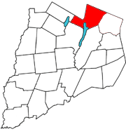
Springfield is a town in Otsego County, New York, United States. The population was 1,358 at the 2010 census.

Otsego Lake is a 4,046-acre (16.37 km2) lake located in Otsego County in the U.S. state of New York. It is the source of the Susquehanna River and largest lake in Otsego County. The Village of Cooperstown is located at the lake's southern end. Glimmerglass State Park is located on the lake's northeastern shore, and includes Hyde Hall, a large mansion constructed in 1817, that overlooks the lake. The Glimmerglass Opera, opened in June 1987, is located on the western shore.

Canadarago Lake is a 1,917-acre (7.76 km2) lake located in Otsego County, New York and is the source of Oaks Creek. The Village of Richfield Springs is located at the lake's northern end. It is the second largest lake in Otsego County, lying to the west of and parallel to the larger Otsego Lake. The lake's name is also spelled "Candajarago Lake" or "Caniadaraga Lake".

Cranberry Lake is a lake on the east branch of the Oswegatchie River in the Adirondack Park in New York in the United States. It is the third largest lake in the Adirondack Park. About 75 percent of the shoreline is owned by State of New York; the 118,000-acre (480 km2) Five Ponds Wilderness Area abuts its south shore, and the Cranberry Lake Wild Forest covers much of its remaining shoreline.

Otego Creek is a 32.7-mile-long (52.6 km) tributary of the Susquehanna River in Otsego County, New York. Otego Creek rises in the Town of Otsego and flows south through the Towns of Hartwick and Laurens, before joining the Susquehanna River southwest of the City of Oneonta.

Indian Lake is a 12-mile (19 km) long, 4,255-acre (1,722 ha) reservoir with a southwest to northeast orientation in the towns of Indian Lake and Lake Pleasant in Hamilton County, in the Adirondack Park of New York State, in the United States. The hamlet of Indian Lake is located 2 miles (3.2 km) north of the north end of Indian Lake. New York State Route 30 runs along the west shore of the lake. Most of the shore is part of the Forest Preserve. Indian Lake is fed by the Jessup River, and drains through the Indian River into Lake Abanakee, and from there through the Indian River to the Hudson River.

Otsego Lake is located in northwest Michigan at 44°57′20″N84°41′32″W, south of the city of Gaylord in Otsego County. The lake spans the boundary between Otsego Lake Township to the south and Bagley Township to the north. Otsego Lake State Park is located on the southeast shore of the lake and Otsego County Park is on the northwest shore. The lake has many private cottages and homes with direct access to the lake and parks.

Saratoga Lake is a lake in the eastern part of Saratoga County, New York. The lake is approximately 4.5 miles (7.2 km) long, about 1.5 miles (2.4 km) wide at its widest point, and about 95 feet (29 m) deep.
Trout Brook, also known as White Creek is a river that is located in northern Otsego County, New York. The river starts at the outlet of Allen Lake and flows southeast before flowing into Otsego Lake south of Springfield Center. It is a third-order tributary on the northwest side of Otsego Lake and has an average gradient of 96 feet/mile.
Negro Lake is a lake located southwest of Partlow, New York. The outlet of the lake flows through an unnamed creek into Witchhopple Lake. Fish species present in Negro Lake are brook trout, white sucker, sunfish, yellow perch, and lake trout. Access by hiking Bushwhack Trail, located on northwest shore of Witchhopple Lake. No motors are allowed on Negro Lake.
Twitchell Lake is located northeast of Big Moose, New York. The outlet is Twitchell Creek which flows into Stillwater Reservoir. Fish species present in the lake are brook trout, yellow perch, and black bullhead. There is a state owned beach launch located on Twitchell Road. There is not a horsepower motor limit on Twitchell Lake. Twitchell Mountain is located northwest of Twitchell Lake.
Moss Lake also known as Whipple Lake is located northwest of Eagle Bay, New York. The outlet flows into North Branch Moose River. Fish species present in the lake are brook trout, lake trout, atlantic salmon, brown trout, yellow perch, and black bullhead. There is trail access located off Big Moose Lake Road. There is no ice fishing allowed on Moss Lake.
Clear Lake is located northeast of Stillwater, New York. The outflow creek flows into Witchhopple Lake. Fish species present in the lake are brown bullhead, and brook trout. Access via trail off Red Horse Trail and Salmon Lake Trail on the south shore. No motors are allowed on Clear Lake.
Horn Lake is a lake located north of Forest Lodge, New York. The outlet creek flows into the Indian River. Fish species present in the lake are pumpkinseed sunfish, and brook trout. There is carry down on the northwest shore via trail. No motors are allowed on Horn Lake.
Sagamore Lake is a lake located south of Raquette Lake, New York. Sagamore Lake was known as Shedd Lake before being renamed "Sagamore Lake" by Alfred G. Vanderbilt after he purchased Great Camp Sagamore in 1901. South Inlet is the outlet creek, which flows into Raquette Lake. Fish species present in the lake are brook trout, lake whitefish, lake trout, white sucker, black bullhead, yellow perch, and sunfish. There is access by trail from Sagamore Road on the northwest shore. Only non-motorized boats are allowed on the lake.
Cedar Lake is located northwest of Sled Harbor, New York. Fish species present in the lake are brook trout, black bullhead, and white sucker. There is trail access on the north and west shores from Sled Harbor. There is also trail access to Whitney Lake. No motors are allowed on this lake.
G Lake is a lake located west of Higgins Bay, New York. Fish species present in the lake are brook trout, and brown trout. There is carry down off trail from G Lake Road along the west shore. The name is derived from the shape of the body of water, which forms something that resembles a letter “G".
Goodyear Lake is a man-made lake created by the building of the Colliersville Dam. The lake is located southwest of the hamlet of Portlandville in the Town of Milford in Otsego County, New York.
Lake of the Twin Fawns also called "Duck Pond" is a small lake in Otsego County, New York. It is located northwest of Laurens within Gilbert Lake State Park. Lake of the Twin Fawns either drains west via an unnamed creek which flows into Stony Creek or south via Lake Brook which flows into Gilbert Lake.

Basswood Pond is a small lake in Otsego County, New York. It is located north of Burlington within Basswood Pond State Forest. Basswood Pond drains south via an unnamed creek which flows into Butternut Creek. The pond is located within the Basswood Pond State Forest, which includes roughly 7.5 miles (12.1 km) hiking trails.
