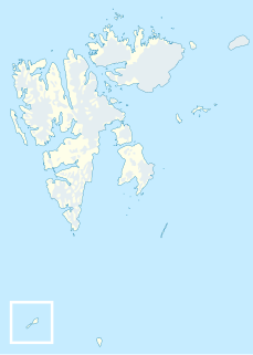
Phippsøya is the largest island in Sjuøyane, an archipelago north of Nordaustlandet, Svalbard in Arctic Norway. It is located some 22 km north of Nordkapp on Svaldbard proper and 8.5 km south of Rossøya, the northernmost island of the Svalbard archipelago. Phippsøya is separated from Parryøya to the south by the 1.3 km wide Straumporten sound, from Martensøya to the southeast by the 1.1 km wide Trollsundet and from Tavleøya to the northwest by the 1 km wide Marmorsundet.

Nordkappsundet is a 10-15 km wide strait between Chermsideøya off the north of Nordaustlandet in the south and Sjuøyane in the north, Svalbard in Arctic Norway. Named after Nordkapp on Chermsideøya, the northern extreme of mainland Svalbard.
Adlersparrefjorden is a fjord of Nordaustlandet, Svalbard, an eastern branch of Duvefjorden at the northern coast. It has a length of about 10 kilometers, and has three branches. A land tongue of 0.5 kilometers separates the fjord from Finn Malmgren Fjord at the eastern side of Glenhalvøya. Adlersparrefjorden is named after naval officer Axel Adlersparre.

Finn Malmgren Fjord is a fjord in Orvin Land at Nordaustlandet, Svalbard, between Glenhalvøya and Bergstrømodden. A land tongue of 0.5 kilometers separates the fjord from Adlersparrefjorden. Finn Malmgrenfjorden is named after Arctic explorer Finn Malmgren.

Lady Franklinfjorden is a fjord in Gustav V Land at Nordaustlandet, Svalbard. The fjord has a length of about 25 kilometers. Lady Franklinfjorden is named after Jane Franklin, the wife of Arctic explorer John Franklin.
Platenhalvøya is a peninsula at Nordaustlandet, Svalbard, between Zorgdragerfjorden and Duvefjorden. The peninsula constitutes the northeastern part of Prins Oscars Land. The mountains Binneyfjellet and Goodenoughfjellet are among the highest peaks of Nordaustlandet.
Ekstremfjorden is a fjord at the northern coast of Nordaustlandet, Svalbard, east of Laponiahalvøya. It mouths into the western part of Nordenskiöldbukta.

Akselsundet is a sound between Van Mijenfjorden and Bellsund at Spitsbergen, Svalbard. It has a width of about 1.2 kilometers, located north of Akseløya, and is the main entrance to Van Mijenfjorden. There are strong tidal currents in the strait, up to five to six knots. The entrance is marked by a light at Birkelandodden, the northern point of Akseløya.
Storøya is an island in the Svalbard archipelago. It is located east of Nordaustlandet, separated from Nordaustlandet by the strait of Storøysundet. The southern part of the island is covered by the glacier Storøyjøkulen.
Storøyjøkulen is an ice cap covering the southern part of the island Storøya in the Svalbard archipelago, east of Nordaustlandet. The glacier reaches a height of about 250 m.a.s.l. The southern thip of glacier forms the headland Sørodden.
Sørodden is a headland and the most southern point of the island Storøya in the Svalbard archipelago, east of Nordaustlandet. The headland is also the southern part of the glacier Storøyjøkulen.
Bergströmodden is a headland in Orvin Land at Nordaustlandet, Svalbard. It is located north of the mountain Boydfjellet, at the mouth of Finn Malmgren Fjord, east of Alpini Island. The headland is named after Swedish politician Axel Bergström.

Claravågen is a bay cutting into the peninsula Storsteinhalvøya in Gustav V Land at Nordaustlandet, Svalbard. It is almost completely closed, except for the sound Claravågsundet leading through the narrow ridge of Molanderryggen. Inside the bay is the bay Arovika located east of the spit Engströmodden, and inside Arovika is the lagoon Wärmelaguna. The bay is named after Clara Maria Kulling.
Boydfjellet is a mountain in Orvin Land at Nordaustlandet, Svalbard. It is located at the eastern side of Finn Malmgren Fjord, and has a height of 300 m.a.s.l. The mountain is named after American Arctic explorer Louise Arner Boyd.
Repøyane is the name of two islands off Orvin Land at Nordaustlandet, Svalbard. The two islands, Nordre and Søre Repøya, are located at the northern side of Glenhalvøya, at the mouth of Duvefjorden. The two islands are separated by the Poortsundet sound, and Gilessundet separates Søre Repøya from Glenhalvøya.
Poortsundet is a sound that separates Nordre Repøya from Søre Repøya, off Orvin Land at Nordaustlandet, Svalbard. The Poortsundet sound has a width of about 1.4 nautical miles. It is named after Arctic explorer William Poort.
Nordre Repøya is the northern island of the two Repøyane, off Orvin Land at Nordaustlandet, Svalbard. The island rises to a height of 230 m.a.s.l. It is separated from Søre Repøya by the sound Poortsundet. The island is named after Dutch whaler and map publisher Outger Rep van Oostzaan.

Straumporten is a 1340 m wide sound between the southernmost part, Migmatittodden of Phippsøya and northeast side, Gullberget of Parryøya, in Sjuøyane north of Nordaustlandet in Svalbard, Norway.


