Glacier Country, Montana

Last updated

Glacier Country, Montana is an eight-county region in the U.S. state of Montana. [1] Glacier Country includes Flathead, Glacier, Lake, Lincoln, Mineral, Missoula, Ravalli and Sanders counties. Glacier Country is home to Glacier National Park, Flathead Lake, the Blackfeet Indian Reservation, Flathead Indian Reservation, 24 state parks, five national forests and Montana's second largest city, Missoula, Montana. As of 2022, the population of Glacier Country was 366,712.

Contents

Western Montana’s Glacier Country is the officially recognized destination stewardship organization for the Glacier Country tourism region in the U.S. state of Montana. Along with its in-region partner convention and visitor bureaus (CVBs), the organization is essential to the economic and social well-being of the 75+ communities it represents, driving direct economic impact through the visitor economy and fueling development across the entire economic spectrum by creating familiarity, attracting visitors, sustaining air service and improving quality of life for the people who call this place home.

Regions

Flathead County

Flathead County is located in the U.S. state of Montana and includes the western side of Glacier National Park as well as the northern half of Flathead Lake and includes land that lies within the Flathead Indian Reservation. As of 2024, the population of Flathead County was 111,814. [2] The main commercial centers for this region are Kalispell and Whitefish. Kalispell is the commercial core for northwest Montana, and has a population of around 28,450 people, making it the second largest city in Glacier Country, Montana. [3] Whitefish is the third largest city in northwest Montana, with 8,915 people. [4] Both cities are served by Glacier Park International Airport.

Glacier County

Glacier County is located in the U.S. state of Montana between the Great Plains and the Rocky Mountains, part of a region known to the Blackfeet as the "Backbone of the World." Most of the land in the county lies within the Blackfeet Indian Reservation. Glacier County includes the eastern side of Glacier National Park. As of 2024, the population of Glacier County was 13,681. [5] The county is bordered by 75 miles of international boundary with three ports of entry (Roosville, Piegan and Del Bonita) open year-round and one seasonal (Chief Mountain) international border crossing into Alberta, Canada.

Lake County

Lake County is located in the U.S. state of Montana. As of 2024, the population of Lake County was 32,853. [6] Lake County includes the southern half of Flathead Lake, and over two-thirds of the county’s land lies within the Flathead Indian Reservation.

Lincoln County

Lincoln County is located in the U.S. state of Montana. As of 2024, the population of Lincoln County was 21,525. [7] Libby, Montana is the county seat of Lincoln County. Libby has a population of 3,097 people. [8]

Mineral County

Mineral County is located in the U.S. state of Montana. As of 2024, the population of Mineral County was 5,058. [9] Superior, Montana is the county seat of Mineral County and has a population of 918 people. [10]

Missoula Country

Missoula County is located in the U.S. state of Montana and includes land that lies within the Flathead Indian Reservation (the community of Evaro). As of 2024, the population of Missoula Country was 121,041. [11] Missoula Country includes the city of Missoula, Montana. Missoula is the largest city in all of Western Montana, and the second largest in Montana. As of 2024 the city of Missoula had surpassed 76,000 people. [12] Missoula is the core commercial and shopping hub in all of Western Montana, and is also considered the cultural hub of Western Montana. Missoula is home to the University of Montana, which in 2024 had over 10,000 students. [13] Missoula is served by the Missoula Montana Airport. Missoula has a semi-pro baseball team, the Missoula Paddleheads. Downtown Missoula is a thriving area, and is known as the main shopping district of Western Montana. Missoula's nickname is the Garden City for its dense trees and green landscape, and because Missoula winters are slightly milder than in the rest of the state.

Ravalli County

Ravalli County is located in the U.S. state of Montana. As of July 2024, the population of Ravalli County was 47,298. [14] Its county seat is Hamilton. Ravalli County is part of a north/south mountain valley bordered by the Sapphire Mountains on the East and the Bitterroot Mountains on the West. It is often referred to as the Bitterroot Valley, named for the Bitterroot Flower.

Sanders County

Sanders County is located in the U.S. state of Montana and includes land that lies within the Flathead Indian Reservation. As of July 2024, the population of Sanders County was 12,442. [15] Thompson Falls, Montana is the county seat of Sanders County and has a population of 1,447. [16]

See also

Related Research Articles

<span class="mw-page-title-main">Ravalli County, Montana</span> County in Montana, United States

Ravalli County is a county in the southwestern part of the U.S. state of Montana. As of the 2020 census, the population was 44,174. Its county seat is Hamilton.
<span class="mw-page-title-main">Missoula County, Montana</span> County in Montana, United States

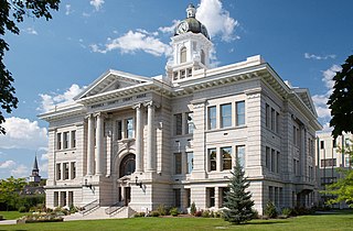
Missoula County is a county located in the State of Montana. As of the 2020 census, the population was 117,922, making it Montana's third most populous county. Its county seat and most populous city is Missoula. The county was founded in 1860.

<span class="mw-page-title-main">Flathead County, Montana</span> County in Montana, United States

Flathead County is a county located in the U.S. state of Montana. At the 2020 census, its population was 104,357, making it the state's fourth most populous county. Its county seat is Kalispell. Its numerical designation is 7. Its northern border is on the state's north border, making it contiguous with the Canada–US border, facing British Columbia.
<span class="mw-page-title-main">Kalispell, Montana</span> City in Montana, United States

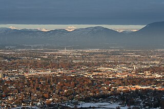
Kalispell is a city in Montana and the county seat of Flathead County, Montana, United States. The 2020 census put Kalispell's population at 24,558. Among cities in Montana, it is the 8th largest by area, 7th most populous, and 8th fastest growing from 2010 to 2020. In Montana's northwest region, it is the largest city and the commercial center of the Kalispell Micropolitan Statistical Area. The name Kalispell is a Salish word meaning "flat land above the lake".

<span class="mw-page-title-main">Whitefish, Montana</span> City in Montana, United States

Whitefish is a city in Flathead County, Montana, United States. According to the 2020 United States Census, there were 7,751 people in the city.

<span class="mw-page-title-main">U.S. Route 93</span> Highway in the western United States

U.S. Route 93 (US 93) is a major north–south 1,359-mile (2,187 km) U.S. Numbered Highway in the western United States, that connects U.S. Route 60 (US 60) in Wickenburg, Arizona, with British Columbia Highway 93 at the Canadian border. The highway passes through Kingman, Arizona; Las Vegas, Nevada; Twin Falls, Idaho; and Missoula, Montana.

<span class="mw-page-title-main">Flathead Indian Reservation</span> Indian reservation in United States, Confederated Salish and Kootenai

The Flathead Indian Reservation, located in western Montana on the Flathead River, is home to the Bitterroot Salish, Kootenai, and Pend d'Oreilles tribes – also known as the Confederated Salish and Kootenai Tribes of the Flathead Nation. The reservation, often referred to as the Flathead Nation, or simply Flathead or by its official acronym C.S.K.T., was created through the July 16, 1855, Treaty of Hellgate.

<span class="mw-page-title-main">Confederated Salish and Kootenai Tribes</span> Indigenous tribe in Montana, United States

The Confederated Salish and Kootenai Tribes of the Flathead Reservation are a federally recognized tribe in the U.S. state of Montana. The government includes members of several Bitterroot Salish, Kootenai and Pend d'Oreilles tribes and is centered on the Flathead Indian Reservation.

<span class="mw-page-title-main">Bitterroot Salish</span> Group of Native Americans of the Flathead Nation in Montana, United States

The Bitterroot Salish are a Salish-speaking group of Native Americans, and one of three tribes of the Confederated Salish and Kootenai Tribes of the Flathead Nation in Montana. The Flathead Reservation is home to the Kootenai and Pend d'Oreilles tribes also. Bitterroot Salish or Flathead originally lived in an area west of Billings, Montana extending to the continental divide in the west and south of Great Falls, Montana extending to the Montana–Wyoming border. From there they later moved west into the Bitterroot Valley. By request, a Catholic mission was built here in 1841. In 1891 they were forcibly moved to the Flathead Reservation.

<span class="mw-page-title-main">Flathead Lake</span> Lake in Montana, United States

Flathead Lake is a large natural lake in northwest Montana, United States.

<span class="mw-page-title-main">Flathead National Forest</span> National forest in Montana, United States

The Flathead National Forest is a national forest in the western part of the U.S. state of Montana. The forest lies primarily in Flathead County, south of Glacier National Park. The forest covers 2,404,935 acres of which about 1 million acres (4,000 km2) is designated wilderness. It is named after the Flathead Native Americans who live in the area.

<span class="mw-page-title-main">Bitterroot Valley</span> Valley in southwestern Montana

The Bitterroot Valley is located in southwestern Montana, along the Bitterroot River between the Bitterroot Range and Sapphire Mountains, in the Northwestern United States.

<span class="mw-page-title-main">Hellgate Treaty</span> 1855 treaty between the United States and Bitterroot Salish

The Treaty of Hellgate was a treaty agreement between the United States and the Bitterroot Salish, Upper Pend d'Oreille, and Lower Kutenai tribes. The treaty was signed at Hellgate on 16 July 1855. Signatories included Isaac Stevens, superintendent of Indian affairs and governor of Washington Territory; Victor, chief of the Bitterroot Salish; Alexander, chief of the Pend d'Oreilles; Michelle, chief of the Kutenais; and several subchiefs. The treaty was ratified by Congress, signed by President James Buchanan, and proclaimed on 18 April 1859. It established the Flathead Indian Reservation.
<span class="mw-page-title-main">Montana Highway Patrol</span> American highway patrol agency

The Montana Highway Patrol (MHP) is the highway patrol agency for the U.S. state of Montana, for which it has state wide jurisdiction.

The Flathead Valley is a region located in the northwestern part of the U.S. state of Montana.
<span class="mw-page-title-main">Index of Montana-related articles</span>

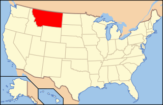
The following is an alphabetical list of articles related to the U.S. state of Montana.

<span class="mw-page-title-main">Regions of Montana</span> Overview of the Regional designations of Montana

The Regional designations of Montana vary widely within the U.S state of Montana. The state is a large geographical area that is split by the Continental Divide, resulting in watersheds draining into the Pacific Ocean, Gulf of Mexico and Hudson's Bay. The state is approximately 545 miles (877 km) east to west along the Canada–United States border and 320 miles (510 km) north to south. The fourth largest state in land area, it has been divided up in official and unofficial ways into a variety of regions. Additionally, Montana is part of a number of larger federal government administrative regions.

<span class="mw-page-title-main">U.S. Route 93 in Montana</span> Highway in Montana

U.S. Highway 93 is a north–south United States Numbered Highway in the state of Montana.

References

  1. "About". Western Montana's Glacier Country. Retrieved 12 July 2024.
  2. "Flathead County". Data Commons. Retrieved 11 July 2024.
  3. "Kalispell". Data Commons. Retrieved 11 July 2024.
  4. "Whitefish". Data Commons. Retrieved 11 July 2024.
  5. "Glacier County". Data Commons. Retrieved 11 July 2024.
  6. "Lake County". Data Commons. Retrieved 11 July 2024.
  7. "Lincoln County". Data Commons. Retrieved 11 July 2024.
  8. "Libby". Data Commons. Retrieved 11 July 2024.
  9. "Mineral County". Data Commons. Retrieved 11 July 2024.
  10. "Superior". Data Commons. Retrieved 11 July 2024.
  11. "Missoula County". Data Commons. Retrieved 11 July 2024.
  12. "Missoula". Data Commons. Retrieved 11 July 2024.
  13. "Spring Enrollment Figures Highlight UM's Continued Growth". University of Montana. Retrieved 11 July 2024.
  14. "Ravalli County". Data Commons. Retrieved 11 July 2024.
  15. "Sanders County". Data Commons. Retrieved 11 July 2024.
  16. "Thompson Falls". Data Commons. Retrieved 11 July 2024.