
Ravalli County is a county in the southwestern part of the U.S. state of Montana. As of the 2020 census, the population was 44,174. Its county seat is Hamilton.
Missoula County is a county located in the State of Montana. As of the 2020 census, the population was 117,922, making it Montana's third most populous county. Its county seat and most populous city is Missoula. The county was founded in 1860.

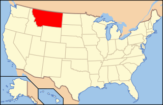
Flathead County is a county located in the U.S. state of Montana. At the 2020 census, its population was 104,357, making it the state's fourth most populous county. Its county seat is Kalispell. Its numerical designation is 7. Its northern border is on the state's north border, making it contiguous with the Canada–US border, facing British Columbia.
Kalispell is a city in Montana and the county seat of Flathead County, Montana, United States. The 2020 census put Kalispell's population at 24,558. Among cities in Montana, it is the 8th largest by area, 7th most populous, and 8th fastest growing from 2010 to 2020. In Montana's northwest region, it is the largest city and the commercial center of the Kalispell Micropolitan Statistical Area. The name Kalispell is a Salish word meaning "flat land above the lake".

Whitefish is a city in Flathead County, Montana, United States. According to the 2020 United States Census, there were 7,751 people in the city.

U.S. Route 93 (US 93) is a major north–south 1,359-mile (2,187 km) U.S. Numbered Highway in the western United States, that connects U.S. Route 60 (US 60) in Wickenburg, Arizona, with British Columbia Highway 93 at the Canadian border. The highway passes through Kingman, Arizona; Las Vegas, Nevada; Twin Falls, Idaho; and Missoula, Montana.

The Flathead Indian Reservation, located in western Montana on the Flathead River, is home to the Bitterroot Salish, Kootenai, and Pend d'Oreilles tribes – also known as the Confederated Salish and Kootenai Tribes of the Flathead Nation. The reservation, often referred to as the Flathead Nation, or simply Flathead or by its official acronym C.S.K.T., was created through the July 16, 1855, Treaty of Hellgate.

The Confederated Salish and Kootenai Tribes of the Flathead Reservation are a federally recognized tribe in the U.S. state of Montana. The government includes members of several Bitterroot Salish, Kootenai and Pend d'Oreilles tribes and is centered on the Flathead Indian Reservation.

The Bitterroot Salish are a Salish-speaking group of Native Americans, and one of three tribes of the Confederated Salish and Kootenai Tribes of the Flathead Nation in Montana. The Flathead Reservation is home to the Kootenai and Pend d'Oreilles tribes also. Bitterroot Salish or Flathead originally lived in an area west of Billings, Montana extending to the continental divide in the west and south of Great Falls, Montana extending to the Montana–Wyoming border. From there they later moved west into the Bitterroot Valley. By request, a Catholic mission was built here in 1841. In 1891 they were forcibly moved to the Flathead Reservation.

Flathead Lake is a large natural lake in northwest Montana, United States.

The Flathead National Forest is a national forest in the western part of the U.S. state of Montana. The forest lies primarily in Flathead County, south of Glacier National Park. The forest covers 2,404,935 acres of which about 1 million acres (4,000 km2) is designated wilderness. It is named after the Flathead Native Americans who live in the area.
The Bitterroot Valley is located in southwestern Montana, along the Bitterroot River between the Bitterroot Range and Sapphire Mountains, in the Northwestern United States.

The Treaty of Hellgate was a treaty agreement between the United States and the Bitterroot Salish, Upper Pend d'Oreille, and Lower Kutenai tribes. The treaty was signed at Hellgate on 16 July 1855. Signatories included Isaac Stevens, superintendent of Indian affairs and governor of Washington Territory; Victor, chief of the Bitterroot Salish; Alexander, chief of the Pend d'Oreilles; Michelle, chief of the Kutenais; and several subchiefs. The treaty was ratified by Congress, signed by President James Buchanan, and proclaimed on 18 April 1859. It established the Flathead Indian Reservation.
The Montana Highway Patrol (MHP) is the highway patrol agency for the U.S. state of Montana, for which it has state wide jurisdiction.
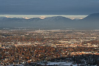
The Flathead Valley is a region located in the northwestern part of the U.S. state of Montana.
The following is an alphabetical list of articles related to the U.S. state of Montana.

The Regional designations of Montana vary widely within the U.S state of Montana. The state is a large geographical area that is split by the Continental Divide, resulting in watersheds draining into the Pacific Ocean, Gulf of Mexico and Hudson's Bay. The state is approximately 545 miles (877 km) east to west along the Canada–United States border and 320 miles (510 km) north to south. The fourth largest state in land area, it has been divided up in official and unofficial ways into a variety of regions. Additionally, Montana is part of a number of larger federal government administrative regions.
U.S. Highway 93 is a north–south United States Numbered Highway in the state of Montana.