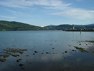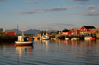
Saltdal is a municipality in Nordland county, Norway. It is part of the traditional district of Salten. The administrative centre of the municipality is the village of Rognan. Other villages in Saltdal include Røkland and Lønsdal.

Røst is a small island municipality in Nordland county, Norway. It is part of the traditional district of Lofoten. The administrative centre of the municipality is the village of Røstlandet on the island of Røstlandet.

Værøy is an island municipality in Nordland county, Norway. It is part of the traditional district of Lofoten. The administrative centre of the municipality is the village of Sørland on the main island of Værøya. The other village in Værøy is Nordland. Most of the residents live in the Sørland area surrounding the main harbor. The old Værøy Lighthouse sits at the end of that harbor.

Moskenes is a municipality in Nordland county, Norway. The municipality comprises the southern part of the island of Moskenesøya in the traditional district of Lofoten. The administrative centre of the municipality is the village of Reine. Other villages include Sørvågen, Hamnøy, and Å.

Mo i Rana is a town and the administrative centre of the municipality of Rana in Nordland county, Norway. It is located in the Helgeland region of Nordland, just south of the Arctic Circle. Some of the outlying areas of the town include the suburbs of Båsmoen and Ytteren in the north and Selfors in the east and Åga/Hauknes/Dalsgrenda in the south.

Ōno is a town located in Ibi District, Gifu Prefecture, Japan. As of 1 December 2018, the town had an estimated population of 23,111 in 7906 households and a population density of 680 persons per km2.The total area of the town was 803.44 square kilometres (310.21 sq mi).

Higashishirakawa is a village located in Kamo District, Gifu Prefecture, Japan. As of 31 December 2018, the village had an estimated population of 2,278 and a population density of 26 persons per km2, in 842 households. The total area of the village was 87.09 square kilometres (33.63 sq mi). Higashishirakawa has been selected as one of The Most Beautiful Villages in Japan.

Kawakita is a town located in Nomi District, Ishikawa Prefecture, Japan. As of 31 January 2018, the town had an estimated population of 6,282 in 1939 households, and a population density of 430 persons per km2. The total area of the town was 14.64 square kilometres (5.65 sq mi).

Miharu is a town located in Fukushima Prefecture, Japan. As of 1 March 2018, the town had an estimated population of 17,870 in 6283 households, and a population density of 250 persons per km². The total area of the town was 72.76 square kilometres (28.09 sq mi).

Kawasaki is a town located in Miyagi Prefecture, Japan. As of 1 August 2017, the town had an estimated population of 8,950, and a population density of 33 persons per km² in 3,298 households. The total area of the town is 270.77 square kilometres (104.54 sq mi).

Brønnøysund is a town and the administrative centre of Brønnøy Municipality in Nordland county, Norway. It is also a former municipality within Nordland county. The village of Brønnøysund originally was declared a ladested in 1923 which made it an independent municipality. After merging with Brønnøy in 1964, it lost its town status. Then in 2000, it once again received town status. The town lies along the coast and is often called "the coastal town in the middle of Norway." Brønnøysund is also the regional center of Southern Helgeland.

Andenes (help·info) is the administrative centre of Andøy Municipality which is located in the Vesterålen district of Nordland county, Norway. The village of Andenes is the northernmost settlement of the island of Andøya. To the east is the island of Senja, and to the west the endless horizon of the North Atlantic Ocean. Andenes Lighthouse sits along the harbor and can be seen for long distances. Andøya Airport, Andenes is located just south of the village, off of Norwegian County Road 82.

Glomfjord is a village in the municipality of Meløy in Nordland county, Norway. The industrial community is located along Norwegian County Road 17 at the head of the Glomfjorden, just north of the Arctic Circle. The 1.14-square-kilometre (280-acre) village has a population (2018) of 1,077 and a population density of 945 inhabitants per square kilometre (2,450/sq mi).

Inndyr is the administrative centre of the municipality of Gildeskål in Nordland county, Norway. The village is located on the mainland part of the municipality, about 6 kilometres (3.7 mi) north of Norwegian County Road 17. The village lies along the Sørfjorden and it looks out to the west over the nearby islands of Fugløya, Fleina, and Femris.

Tjøtta is a village in Alstahaug Municipality in Nordland county, Norway. It is located on the southern tip of the island of Tjøtta, which is located south of the large island of Alsta. The village is located on an island, but it does have a mainland road connection via Norwegian County Road 17 and a series of bridges heading north to the town of Sandnessjøen. The historic Tjøtta Church is located in the village.

Bodø or Bådåddjo (Lule Sami) is a town in Bodø Municipality in Nordland county, Norway. The town the administrative centre of Bodø Municipality and of Nordland county. It is located on the Bodø peninsula between the Vestfjorden and the Saltfjorden. Bodø is located just north of the Arctic Circle. It is the largest urban area and town in Nordland county and it is the second-largest town in North Norway.

Vega is an island in Vega Municipality in Nordland county, Norway. The 108-square-kilometre (42 sq mi) island is the largest island in the 6,500 islands in the Vegaøyan archipelago, all of which is a UNESCO World Heritage Site. The island lies in the Norwegian Sea, about 18 kilometres (11 mi) west of the mainland of Norway. The islands of Igerøya and Ylvingen lie between Vega and the mainland. The main villages on the island are Gladstad, the administrative centre of the municipality, and Holand.


