
Park & Arbourthorne ward—which includes the districts of Arbourthorne, Gleadless, and Norfolk Park—is one of the 28 electoral wards in City of Sheffield, England. It is located in the southeastern part of the city and covers an area of 1.74 square miles (4.5 km2). The population of this ward in 2001 was 17,500 people in 7,800 households. The ward population at the 2011 Census was 19,133. It is one of the five wards that form the Sheffield Heeley parliamentary constituency.

Richmond is a suburb of Sheffield in South Yorkshire, England. It lies in the eastern part of the city.

Gleadless Valley ward—which includes the districts of Gleadless Valley, Heeley, Lowfield, and Meersbrook—is one of the 28 electoral wards in City of Sheffield, England. It is located in the southern part of the city and covers an area of 4.5 km2. The population of this ward in 2011 was 21,089 people in 9,516 households. It is one of the five wards that form the Sheffield Heeley parliamentary constituency in the House of Commons. Gleadless Valley actually describes the valley that separates Hemsworth from Herdings, and is a broad area that covers several housing estates: Hemsworth, Herdings and Rollestone. Gleadless Valley is bordered by Gleadless and Norton.

Gleadless is a suburb and parish within the City of Sheffield, it lies five km south east of the city centre. It is bordered by the adjoining suburbs of Gleadless Valley to the west, Frecheville to the east and Intake to the north. The land to the south is the rural area of North East Derbyshire district which is outside the city boundary. Gleadless was formerly a country hamlet, then village before becoming part of the expanding city of Sheffield in 1921. The word Gleadless comes from the Old English language and means either “forest clearings haunted by a kite” or “bright clearing”.
West Derby Cemetery, Lower House Lane, Croxteth. Opened in January 1884 it has been used for Church of England, Roman Catholic and Jewish burials. Various buildings at the cemetery are Grade II listed buildings.

St John's Church, Ranmoor is a large parish church in Ranmoor, a suburb of the City of Sheffield, England. It is a Church of England church in the Diocese of Sheffield, and it is the second church to be built on this site. The original church, designed by E. M. Gibbs, was opened 24 April 1879. This building was almost entirely destroyed by fire on 2 January 1887; all that survived was the 200-foot-tall (61 m) tower and spire. A new church, designed by Flockton & Gibbs, was built that incorporated the old tower and spire. The church reopened on 9 September 1888; it is a Grade II* listed building.

The Meers Brook is a stream in Sheffield, England and one of the main tributaries of the River Sheaf. The Meers Brook originates in Gleadless and flows downhill through Gleadless Valley and Meersbrook then, culverted, continues underneath Heeley to pour into the River Sheaf near Saxon Road and Clyde Road in Lowfield.
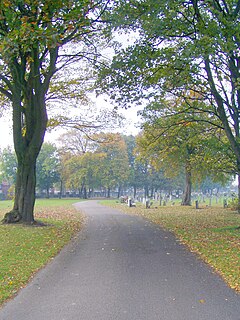
The City Road Cemetery is a cemetery in the City of Sheffield, England that opened in May 1881 and was originally Intake Road Cemetery. Covering 100 acres (40 ha) it is the largest and is the head office for all the municipally owned cemeteries in Sheffield. The cemetery contains Sheffield Crematorium, whose first cremation was on 24 April 1905.

Tinsley Park Cemetery is one of the city of Sheffield's many cemeteries. It was opened in 1882, and covers 19 acres (77,000 m2). The cemetery is still open to burials, and since the first burial on 2 June 1882 over 59,000 burials have taken place. There are buried in the cemetery 42 Commonwealth service personnel from World War I and 32 from World War II.

Armley Park is a large public park located next to Stanningley Road in Armley, on the outskirts of Leeds, in West Yorkshire, Northern England.

Sheffield Outer Ring Road is one of two main routes circumventing Sheffield, England, a partial ring around Sheffield City Centre and its suburbs.

Intake is a suburb and former village located 5 miles (8 km) south-east of Sheffield city centre, South Yorkshire, England. Due to expansion during the 20th century, the village became a part of the city of Sheffield. Intake is linked to Frecheville via Birley Moor Road, and to Gleadless via Hollinsend Road.

The A6102 is a 4 digit A road in South Yorkshire, England. It begins in the Greenhill area of Sheffield, at a junction with the A61. The first segment of the road between Greenhill and Darnall is part of the Sheffield Outer Ring Road.

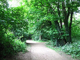
The Sheffield Round Walk is a 14 mi (23 km) walk through the south west of Sheffield, South Yorkshire, England. Starting from Hunters Bar, it travels along the Porter valley to Ringinglow. It then descends through the Limb valley and Ecclesall Woods to Abbeydale Road, before climbing through Ladies Spring Wood to Graves Park. The walk then passes through the Gleadless valley, Meersbrook Park and Chelsea Park before returning to Hunters Bar.

The Memorial to Heroes of the Marine Engine Room is a granite monument located on St. Nicholas Place, at the Pier Head, in Liverpool, England.
Gleadless Valley is a housing estate and electoral ward of the City of Sheffield in England. The population of the ward at the 2011 Census was 21,089. It lies 2.5 miles (4.0 km) south-southeast of the city centre. Formerly a rural area, Gleadless Valley was developed as a large housing project with around 4000 dwellings by Sheffield City Council between 1955 and 1962. It is an area of undulating land drained by the Meers Brook, which has its source on the high ground in the woodland at Gleadless. Adjacent are Gleadless to the east, Norton to the south-west, Heeley to the west and Arbourthorne to the north.

Holy Cross Church, Gleadless Valley, is a Church of England church building in the City of Sheffield, England. It is situated on Spotswood Mount and is a distinctive building constructed in 1964/65 and designed by the architects Braddock & Martin-Smith. It is positioned in a spectacular position among the houses on the Rollestone hillside. It has a canted front which is triangular in shape which has a large white cross at its apex. The interior features full height stained glass windows of the Virgin Mary and St John by John Baker Ltd.

Chingford War Memorial is a Grade II listed war memorial cross at the junction of King's Head Hill and The Ridgeway, Chingford, London, E4.
Hull General Cemetery was established by a private company in 1847 on Spring Bank in the west of Kingston upon Hull, East Riding of Yorkshire, England. In 1862 the Hull Corporation established a cemetery adjacent, now known as Western Cemetery, and in c. 1890 expanded the cemetery west across Chanterlands Avenue onto an adjacent site.

The Rifle Brigade War Memorial in London commemorates the service of the Rifle Brigade in the First and Second World Wars. It stands at the junction of Grosvenor Gardens and Hobart Place near Victoria Station in the City of Westminster, on land donated by the 2nd Duke of Westminster.
