
Hoover Dam is a concrete arch-gravity dam in the Black Canyon of the Colorado River, on the border between the U.S. states of Nevada and Arizona. Constructed between 1931 and 1936, during the Great Depression, it was dedicated on September 30, 1935, by President Franklin D. Roosevelt. Its construction was the result of a massive effort involving thousands of workers, and cost over 100 lives. Bills passed by Congress during its construction referred to it as Hoover Dam, but the Roosevelt administration named it Boulder Dam. In 1947, Congress restored the name Hoover Dam.

Page is a city in Coconino County, Arizona, United States, near the Glen Canyon Dam and Lake Powell. As of the 2010 census, the population of the city was 7,247.

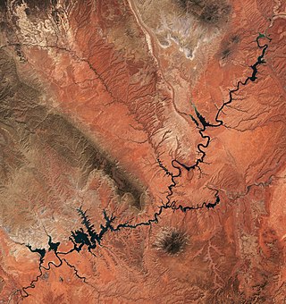
The Colorado River is one of the principal rivers in the Southwestern United States and in northern Mexico. The 1,450-mile-long (2,330 km) river, the 5th longest in the United States, drains an expansive, arid watershed that encompasses parts of seven U.S. states and two Mexican states. The name Colorado derives from the Spanish language for "colored reddish" due to its heavy silt load. Starting in the central Rocky Mountains of Colorado, it flows generally southwest across the Colorado Plateau and through the Grand Canyon before reaching Lake Mead on the Arizona–Nevada border, where it turns south toward the international border. After entering Mexico, the Colorado approaches the mostly dry Colorado River Delta at the tip of the Gulf of California between Baja California and Sonora.

Rainbow Bridge is a natural arch in southern Utah, United States. With a span of 275 feet (84 m), as reported in 1974 by the Bureau of Reclamation, and height of 290 feet (88 m), it is one of the largest natural arches in the world. At the top it is 42 feet (13 m) thick and 33 feet (10 m) wide. The bridge, which is of cultural importance to a number of area Native American tribes, has been designated a Traditional Cultural Property by the National Park Service. Rainbow Bridge National Monument was protected in 1910, and it is administered by Glen Canyon National Recreation Area.

Glen Canyon Dam is a concrete arch-gravity dam in the southwestern United States, located on the Colorado River in northern Arizona, near the city of Page. The 710-foot-high (220 m) dam was built by the Bureau of Reclamation (USBR) from 1956 to 1966 and forms Lake Powell, one of the largest man-made reservoirs in the U.S. with a capacity of more than 25 million acre-feet (31 km3). The dam is named for Glen Canyon, a series of deep sandstone gorges now flooded by the reservoir; Lake Powell is named for John Wesley Powell, who in 1869 led the first expedition to traverse the Colorado River's Grand Canyon by boat.

Lake Mead is a reservoir formed by the Hoover Dam on the Colorado River in the Southwestern United States. It is located in the states of Nevada and Arizona, 24 mi (39 km) east of Las Vegas. It is the largest reservoir in the US in terms of water capacity. Lake Mead provides water to the states of Arizona, California, and Nevada as well as some of Mexico, providing sustenance to nearly 20 million people and large areas of farmland.
Lake Powell is a reservoir on the Colorado River in Utah and Arizona, United States. It is a major vacation destination visited by approximately two million people every year. It holds 24,322,000 acre-feet (3.0001×10¹⁰ m3) of water when full, second in the United States to only Lake Mead - though Lake Mead has fallen below Lake Powell in size several times during the 21st century in terms of volume of water, depth and surface area.

Lees Ferry is a site on the Colorado River in Coconino County, Arizona in the United States, about 7.5 miles (12.1 km) southwest of Page and 9 miles (14 km) south of the Utah–Arizona state line.

The Paria River is a tributary of the Colorado River, approximately 95 miles (153 km) long, in southern Utah and northern Arizona in the United States. It drains a rugged and arid region northwest of the Colorado, flowing through roadless slot canyons along part of its course.

Navajo Bridge is the name of twin steel spandrel arch bridges that cross the Colorado River in the Grand Canyon National Park in northern Coconino County, Arizona, United States. The newer of the two spans carries vehicular traffic on U.S. Route 89A (US 89A) over Marble Canyon between Bitter Springs and Jacob Lake, allowing travel into a remote Arizona Strip region north of the Colorado River including the North Rim of Grand Canyon National Park.

The Colorado River Compact is a 1922 agreement that regulates water distribution among seven states in the Southwestern United States. The contract is about the area within the drainage basin of the Colorado River.

Parker Dam is a concrete arch-gravity dam that crosses the Colorado River 155 miles (249 km) downstream of Hoover Dam. Built between 1934 and 1938 by the Bureau of Reclamation, it is 320 feet (98 m) high, 235 feet (72 m) of which are below the riverbed (the deep excavation was necessary in order to reach the bedrock on which the foundation of the dam was built), making it the deepest dam in the world. The portion of the dam above the foundation stands 85 feet (25.9 m) tall, making it the only dam in the world that stands more underground than above ground. The dam's primary functions are to create a reservoir, and to generate hydroelectric power. The reservoir behind the dam is called Lake Havasu and can store 647,000 acre⋅ft (798,000,000 m3; 2.11×10¹¹ US gal; 1.76×10¹¹ imp gal). The dam straddles the Arizona-California state border at the narrows the river passes through between the Whipple Mountains in San Bernardino County, California and the Buckskin Mountains in La Paz County, Arizona.

Lake Havasu is a large reservoir formed by Parker Dam on the Colorado River, on the border between San Bernardino County, California, and Mohave County, Arizona. Lake Havasu City sits on the Arizonan side of the lake with its Californian counterpart of Havasu Lake directly across the lake. The reservoir has an available capacity of 619,400 acre-feet (0.7640 km3). The concrete arch dam was built by the United States Bureau of Reclamation between 1934 and 1938. The lake's primary purpose is to store water for pumping into two aqueducts. Prior to the dam construction, the area was home to the Mojave people. The lake was named after the Mojave word for blue. In the early 19th century, it was frequented by beaver trappers. Spaniards also began to mine the areas along the river.

The Mike O'Callaghan–Pat Tillman Memorial Bridge is an arch bridge in the United States that spans the Colorado River between the states of Arizona and Nevada. The bridge is located within the Lake Mead National Recreation Area approximately 30 miles (48 km) southeast of Las Vegas, and carries Interstate 11 and U.S. Route 93 over the Colorado River. Opened in 2010, it was the key component of the Hoover Dam Bypass project, which rerouted US 93 from its previous routing along the top of Hoover Dam and removed several hairpin turns and blind curves from the route. It is jointly named for Mike O'Callaghan, Governor of Nevada from 1971 to 1979, and Pat Tillman, an American football player who left his career with the Arizona Cardinals to enlist in the United States Army and was killed in Afghanistan in 2004.

Flaming Gorge Dam is a concrete thin-arch dam on the Green River, a major tributary of the Colorado River, in northern Utah in the United States. Flaming Gorge Dam forms the Flaming Gorge Reservoir, which extends 91 miles (146 km) into southern Wyoming, submerging four distinct gorges of the Green River. The dam is a major component of the Colorado River Storage Project, which stores and distributes upper Colorado River Basin water.

The Colorado River Storage Project is a United States Bureau of Reclamation project designed to oversee the development of the upper basin of the Colorado River. The project provides hydroelectric power, flood control and water storage for participating states along the upper portion of the Colorado River and its major tributaries.

Glen Canyon Dam, a concrete arch dam on the Colorado River in the American state of Arizona, is viewed as carrying a large amount of risk, most notably due to siltation. The Colorado and San Juan rivers deposit large volumes of silt into Lake Powell, slowly decreasing its capacity. The sediment will eventually build up against the dam and could affect its safe operation and lead to its failure.

Bridge Canyon Dam, also called Hualapai Dam, was a proposed dam in the lower Grand Canyon of the Colorado River, in northern Arizona in the United States. It would have been located near Bridge Canyon Rapids in an extremely rugged and isolated portion of the canyon, 235 miles (378 km) downstream of Lees Ferry and at the uppermost end of Lake Mead.
The Marble Canyon Dam, also known as the Redwall Dam, was a proposed dam on the Colorado River in Arizona, United States. The dam was intended to impound a relatively small reservoir in the central portion of Marble Canyon to develop hydroelectric power. Plans centered on two sites between miles 30 and 40 in the canyon. At one point a 38-mile (61 km) tunnel was proposed to a site just outside Grand Canyon National Park to develop the site's full power generation potential, reducing the Colorado River to a trickle through the park.

Echo Park Dam was proposed in the 1950s by the U.S. Bureau of Reclamation as a central feature of the Colorado River Storage Project. Situated on the Green River, a major tributary of the Colorado River, the dam was proposed for the Echo Park district of Dinosaur National Monument, flooding much of the Green and Yampa river valleys in the monument. The dam was bitterly opposed by preservationists, who saw the encroachment of a dam into an existing national park as another Hetch Hetchy, to be opposed as an appropriation of protected lands for development purposes. The Echo Park project was abandoned in favor of Glen Canyon Dam on the main stem of the Colorado, in lands that were not at that time protected. This was eventually regarded as a strategic mistake by conservation organizations.

