
Freising is a Landkreis (district) in Bavaria, Germany. Following a recent ranking of the German magazine Focus-Money comparing all German districts it is number one concerning economic growth abilities. It is bounded by the districts of Kelheim, Landshut, Erding, Munich, Dachau and Pfaffenhofen. The district is located north of the Munich metropolitan area. The Isar and Amper rivers run in parallel from southwest to northeast. North of the rivers there is the Hallertau, a hilly region mainly used for growing hop.
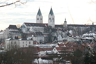
Freising is a university town in Bavaria, Germany, and the capital of the Freising Landkreis (district), with a population of about 50,000.

Ismaning is a municipality in Bavaria, Germany, located near Munich.

The Amper, called the Ammer upstream of the Ammersee, through which it runs, is the largest tributary of the Isar in southern Bavaria, Germany. It flows generally north-eastward, reaching the Isar in Moosburg, about 185 kilometres (115 mi) from its source in the Ammergau Alps, with a flow of 45 m³/s. Including its tributary, Linder, it is 209.5 km (130.2 mi) long. Major tributaries are the Glonn, which rises near Augsburg; the Würm, which is the outflow of Lake Starnberg; and the Maisach.

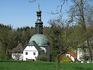
Glonn is a market town in the Ebersberg district in Upper Bavaria, Germany, about 30 km (19 mi) southeast of Munich.

Markt Indersdorf is a municipality in the district of Dachau in Bavaria in Germany.
Röhrmoos is a municipality in the district of Dachau in Bavaria in Germany. It is located ca. 25 km northwest of München. The community is located between the Amper and Glonn valleys.
Moosach is a municipality in the Upper Bavarian district of Ebersberg and a member of the Verwaltungsgemeinschaft of Glonn.

Weichs is a municipality in the district of Dachau in Bavaria in Germany. There are four main villages in the municipality: Weichs, Aufhausen, Ebersbach, and Fränking. In addition, there are several smaller villages: Albertshof, Biechlhof, Breitenwiesen, Daxberg, Edenholzhausen, Edenpfaffenhofen, Erlbach, Erlhausen, Hölzböck, Jedenhofen, and Zillhofen.

Große Laber is a river in Bavaria, Germany, a right tributary of the Danube.
The 1999 Pentecost flood was a 100-year flood around the Pentecost season in 1999 that mostly affected Bavaria, Vorarlberg and Tirol. It was caused by heavy rainfall coinciding with the regular Alpine meltwater.

The Munich–Regensburg railway is a double track, electrified main line railway, linking Munich and Regensburg in the German state of Bavaria, with a total length of 138.1 km. It was opened in 1858 and 1859 and is one of the oldest railways in Germany.

Braunau is a river of Bavaria, Germany. It flows into the Glonn near Tuntenhausen.

Gersprenz is a river that starts in the Odenwald, Hesse and flows into the river Main near Aschaffenburg, Bavaria, Germany. Including its source river Mergbach, it is 62.1 km (38.6 mi) long, without the Mergbach it is 51.3 km (31.9 mi) long.

Moosach is a 38-kilometre-long (24 mi) left tributary of the river Isar near Munich in Bavaria, Germany. It could also be described as a tributary of the river Amper, because of the stream Mühlbach that splits away carrying about 30% of the water just before the Moosach joins the Isar. After passing through Freising, the main flow enters the Isar near Oberhummel. The Mühlbach branch continues through Moosburg and enters the Amper close to its confluence with the Isar.
The Westerbach is a right tributary of the Kahl in the northern Spessart in Lower Franconia, Bavaria, Germany.

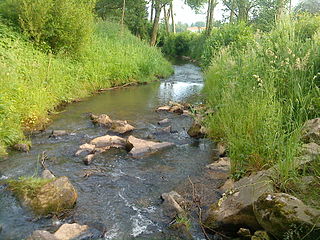
Glonn is a river in Bavaria, Germany.
Glonn is a market town in the Ebersberg district in Upper Bavaria, Germany.
Mauerner Bach is a river of Bavaria, Germany. It is a left tributary of the Amper in Wang.

