Gmina Koprzywnica

Last updated
Gmina Koprzywnica
Koprzywnica Commune
Gmina
POL gmina Koprzywnica COA.svg
Coat of arms
Coordinates(Koprzywnica): 50°35′26″N21°35′1″E / 50.59056°N 21.58361°E / 50.59056; 21.58361 Coordinates: 50°35′26″N21°35′1″E / 50.59056°N 21.58361°E / 50.59056; 21.58361
CountryFlag of Poland.svg  Poland
Voivodeship Świętokrzyskie
County Sandomierz
Seat Koprzywnica
Area
  Total 69.19 km2 (26.71 sq mi)
Population (2013 [1] )
  Total 6,901
  Density 100/km2 (260/sq mi)
   Urban 2,575
  Rural 4,326
Website http://www.koprzywnica.pl

Gmina Koprzywnica is an urban-rural gmina (administrative district) in Sandomierz County, Świętokrzyskie Voivodeship, in south-central Poland. Its seat is the town of Koprzywnica, which lies approximately 16 kilometres (10 mi) south-west of Sandomierz and 76 km (47 mi) south-east of the regional capital Kielce.

Gmina administrative division of Poland

The gmina is the principal unit of the administrative division of Poland, similar to a municipality. As of 2010 there were 2,478 gminy throughout the country. The word gmina derives from the German word Gemeinde, meaning "community".

Sandomierz County County in Świętokrzyskie, Poland

Sandomierz County is a unit of territorial administration and local government (powiat) in Świętokrzyskie Voivodeship, south-central Poland. It came into being on January 1, 1999, as a result of the Polish local government reforms passed in 1998. Its administrative seat and largest town is Sandomierz, which lies 83 kilometres (52 mi) east of the regional capital Kielce. The county also contains the towns of Koprzywnica, lying 16 km (10 mi) south-west of Sandomierz, and Zawichost, 16 km (10 mi) north-east of Sandomierz.

Świętokrzyskie Voivodeship Voivodeship in Poland

Świętokrzyskie Voivodeship, Świętokrzyskie Province, or Holy Cross Province is one of the 16 voivodeships (provinces) into which Poland is divided. It is situated in southeastern Poland, in the historical province of Lesser Poland, and takes its name from the Świętokrzyskie mountain range. Its capital and largest city is Kielce.

Contents

The gmina covers an area of 69.19 square kilometres (26.7 sq mi), and as of 2006 its total population is 7,043 (out of which the population of Koprzywnica amounts to 2,531, and the population of the rural part of the gmina is 4,512).

Villages

Apart from the town of Koprzywnica, Gmina Koprzywnica contains the villages and settlements of Beszyce, Błonie, Ciszyca, Dmosice, Gnieszowice, Kamieniec, Krzcin, Łukowiec, Niedźwice, Postronna, Sośniczany, Trzykosy, Zarudcze, Zbigniewice and Zbigniewice-Kolonia.

Beszyce Village in Świętokrzyskie, Poland

Beszyce is a village in the administrative district of Gmina Koprzywnica, within Sandomierz County, Świętokrzyskie Voivodeship, in south-central Poland. It lies approximately 6 kilometres (4 mi) west of Koprzywnica, 20 km (12 mi) south-west of Sandomierz, and 71 km (44 mi) south-east of the regional capital Kielce.

Błonie, Świętokrzyskie Voivodeship Village in Świętokrzyskie, Poland

Błonie is a village in the administrative district of Gmina Koprzywnica, within Sandomierz County, Świętokrzyskie Voivodeship, in south-central Poland. It lies approximately 3 kilometres (2 mi) east of Koprzywnica, 15 km (9 mi) south-west of Sandomierz, and 78 km (48 mi) south-east of the regional capital Kielce.

Ciszyca, Świętokrzyskie Voivodeship Village in Świętokrzyskie, Poland

Ciszyca is a village in the administrative district of Gmina Koprzywnica, within Sandomierz County, Świętokrzyskie Voivodeship, in south-central Poland. It lies approximately 5 kilometres (3 mi) east of Koprzywnica, 14 km (9 mi) south-west of Sandomierz, and 80 km (50 mi) south-east of the regional capital Kielce.

Neighbouring gminas

Gmina Koprzywnica is bordered by the city of Tarnobrzeg and by the gminas of Klimontów, Łoniów and Samborzec.

Tarnobrzeg Place in Subcarpathian, Poland

Tarnobrzeg is a city in south-eastern Poland, on the east bank of the river Vistula, with 49,419 inhabitants, as of December 31, 2009. Situated in the Subcarpathian Voivodeship since 1999, it had previously been the capital of Tarnobrzeg Voivodeship (1975–1998). Tarnobrzeg lies in the Sandomierz Basin, and directly borders the town of Sandomierz. Its history dates back to the year 1593, when it was granted Magdeburg rights, and belonged to the Tarnowski family. For centuries Tarnobrzeg remained a small town, which did not develop until the post-World War II period, when it became center of an industrial area, based on rich sulfur deposits.

Gmina Klimontów is a rural gmina in Sandomierz County, Świętokrzyskie Voivodeship, in south-central Poland. Its seat is the village of Klimontów, which lies approximately 22 kilometres (14 mi) west of Sandomierz and 65 km (40 mi) south-east of the regional capital Kielce.

Gmina Łoniów is a rural gmina in Sandomierz County, Świętokrzyskie Voivodeship, in south-central Poland. Its seat is the village of Łoniów, which lies approximately 21 kilometres (13 mi) south-west of Sandomierz and 74 km (46 mi) south-east of the regional capital Kielce.

Related Research Articles

Gmina Dwikozy is a rural gmina in Sandomierz County, Świętokrzyskie Voivodeship, in south-central Poland. Its seat is the village of Dwikozy, which lies approximately 7 kilometres (4 mi) north-east of Sandomierz and 84 km (52 mi) east of the regional capital Kielce.

Gmina Samborzec is a rural gmina in Sandomierz County, Świętokrzyskie Voivodeship, in south-central Poland. Its seat is the village of Samborzec, which lies approximately 8 kilometres (5 mi) south-west of Sandomierz and 78 km (48 mi) east of the regional capital Kielce.

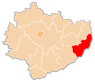
Gmina Zawichost is an urban-rural gmina in Sandomierz County, Świętokrzyskie Voivodeship, in south-central Poland. Its seat is the town of Zawichost, which lies approximately 16 kilometres (10 mi) north-east of Sandomierz and 88 km (55 mi) east of the regional capital Kielce.

Dmosice Village in Świętokrzyskie, Poland

Dmosice is a village in the administrative district of Gmina Koprzywnica, within Sandomierz County, Świętokrzyskie Voivodeship, in south-central Poland. It lies approximately 8 kilometres (5 mi) west of Koprzywnica, 21 km (13 mi) west of Sandomierz, and 68 km (42 mi) south-east of the regional capital Kielce.

Gnieszowice Village in Świętokrzyskie, Poland

Gnieszowice is a village in the administrative district of Gmina Koprzywnica, within Sandomierz County, Świętokrzyskie Voivodeship, in south-central Poland. It lies approximately 3 kilometres (2 mi) north-west of Koprzywnica, 17 km (11 mi) south-west of Sandomierz, and 73 km (45 mi) south-east of the regional capital Kielce.

Kamieniec, Sandomierz County Village in Świętokrzyskie, Poland

Kamieniec is a village in the administrative district of Gmina Koprzywnica, within Sandomierz County, Świętokrzyskie Voivodeship, in south-central Poland. It lies approximately 5 kilometres (3 mi) east of Koprzywnica, 12 km (7 mi) south-west of Sandomierz, and 80 km (50 mi) south-east of the regional capital Kielce.

Krzcin Village in Świętokrzyskie, Poland

Krzcin is a village in the administrative district of Gmina Koprzywnica, within Sandomierz County, Świętokrzyskie Voivodeship, in south-central Poland. It lies approximately 4 kilometres (2 mi) south-east of Koprzywnica, 17 km (11 mi) south-west of Sandomierz, and 78 km (48 mi) south-east of the regional capital Kielce.

Łukowiec, Świętokrzyskie Voivodeship Village in Świętokrzyskie, Poland

Łukowiec is a village in the administrative district of Gmina Koprzywnica, within Sandomierz County, Świętokrzyskie Voivodeship, in south-central Poland. It lies approximately 4 kilometres (2 mi) south-east of Koprzywnica, 15 km (9 mi) south-west of Sandomierz, and 80 km (50 mi) south-east of the regional capital Kielce.

Niedźwice Village in Świętokrzyskie, Poland

Niedźwice is a village in the administrative district of Gmina Koprzywnica, within Sandomierz County, Świętokrzyskie Voivodeship, in south-central Poland. It lies approximately 6 kilometres (4 mi) west of Koprzywnica, 19 km (12 mi) south-west of Sandomierz, and 71 km (44 mi) south-east of the regional capital Kielce.

Postronna Village in Świętokrzyskie, Poland

Postronna is a village in the administrative district of Gmina Koprzywnica, within Sandomierz County, Świętokrzyskie Voivodeship, in south-central Poland. It lies approximately 7 kilometres (4 mi) north-west of Koprzywnica, 18 km (11 mi) west of Sandomierz, and 70 km (43 mi) south-east of the regional capital Kielce.

Sośniczany Village in Świętokrzyskie, Poland

Sośniczany is a village in the administrative district of Gmina Koprzywnica, within Sandomierz County, Świętokrzyskie Voivodeship, in south-central Poland. It lies approximately 3 kilometres (2 mi) north-east of Koprzywnica, 13 km (8 mi) south-west of Sandomierz, and 76 km (47 mi) south-east of the regional capital Kielce.

Trzykosy Village in Świętokrzyskie, Poland

Trzykosy is a village in the administrative district of Gmina Koprzywnica, within Sandomierz County, Świętokrzyskie Voivodeship, in south-central Poland. It lies approximately 5 kilometres (3 mi) north-west of Koprzywnica, 17 km (11 mi) south-west of Sandomierz, and 72 km (45 mi) south-east of the regional capital Kielce.

Zbigniewice-Kolonia Village in Świętokrzyskie, Poland

Zbigniewice-Kolonia is a village in the administrative district of Gmina Koprzywnica, within Sandomierz County, Świętokrzyskie Voivodeship, in south-central Poland. It lies approximately 7 kilometres (4 mi) north-west of Koprzywnica, 19 km (12 mi) south-west of Sandomierz, and 70 km (43 mi) south-east of the regional capital Kielce.

Gmina Obrazów is a rural gmina in Sandomierz County, Świętokrzyskie Voivodeship, in south-central Poland. Its seat is the village of Obrazów, which lies approximately 9 kilometres (6 mi) west of Sandomierz and 75 km (47 mi) east of the regional capital Kielce.

References