| Gmina Łąck Łąck Commune | |||
|---|---|---|---|
| Gmina | |||
| |||
| Coordinates(Łąck): 52°28′N19°37′E / 52.467°N 19.617°E Coordinates: 52°28′N19°37′E / 52.467°N 19.617°E | |||
| Country | |||
| Voivodeship | Masovian | ||
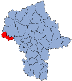
| County | Płock County | ||
| Seat | Łąck | ||
| Area | |||
| • Total | 93.74 km2 (36.19 sq mi) | ||
| Population (2006) | |||
| • Total | 4,932 | ||
| • Density | 53/km2 (140/sq mi) | ||


Gmina Łąck is a rural gmina (administrative district) in Płock County, Masovian Voivodeship, in east-central Poland. Its seat is the village of Łąck, which lies approximately 11 kilometres (7 mi) south-west of Płock and 99 km (62 mi) west of Warsaw.

The gmina is the principal unit of the administrative division of Poland, similar to a municipality. As of 2010 there were 2,478 gminy throughout the country. The word gmina derives from the German word Gemeinde, meaning "community".

Płock County is a unit of territorial administration and local government (powiat) in Masovian Voivodeship, east-central Poland. It came into being on January 1, 1999, as a result of the Polish local government reforms passed in 1998. Its administrative seat is the city of Płock, although the city is not part of the county. The county contains three towns: Gąbin, 17 km (11 mi) south of Płock, Drobin, 29 km (18 mi) north-east of Płock, and Wyszogród, 39 km (24 mi) south-east of Płock.

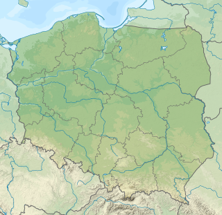
Mazovian Voivodeship or Mazovia Province is the largest and most populous of the 16 Polish provinces, or voivodeships, created in 1999. It occupies 35,579 square kilometres (13,737 sq mi) of east-central Poland, and has 5,324,500 inhabitants. Its principal cities are Warsaw in the centre of the Warsaw metropolitan area, Radom (226,000) in the south, Płock (127,000) in the west, Siedlce (77,000) in the east, and Ostrołęka (55,000) in the north. The capital of the voivodeship is the national capital, Warsaw.
Contents
The gmina covers an area of 93.74 square kilometres (36.2 sq mi), and as of 2006 its total population is 4,932.
The gmina contains part of the protected area called Gostynin-Włocławek Landscape Park.

Protected areas or conservation areas are locations which receive protection because of their recognized natural, ecological or cultural values. There are several kinds of protected areas, which vary by level of protection depending on the enabling laws of each country or the regulations of the international organizations involved.
Gostynin-Włocławek Landscape Park is a protected area in north-central Poland, established in 1979, covering an area of 389.50 square kilometres (150.39 sq mi).