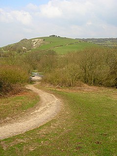
West Bagborough is a village and civil parish in Somerset, England, about 5 miles (8.0 km) north of Taunton in the Somerset West and Taunton district. In 2011 the village had a population of 358.

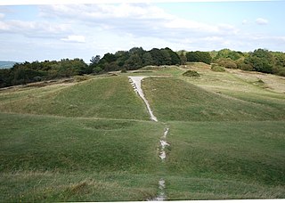
Chanctonbury Ring is a prehistoric hill fort atop Chanctonbury Hill on the South Downs, on the border of the civil parishes of Washington and Wiston in the English county of West Sussex. A ridgeway, now part of the South Downs Way, runs along the hill. It forms part of an ensemble of associated historical features created over a span of more than 2,000 years, including round barrows dating from the Bronze Age to the Saxon periods and dykes dating from the Iron Age and Roman periods.

Maes Knoll is an Iron Age hill fort in Somerset, England, located at the eastern end of the Dundry Down ridge, south of the city of Bristol and north of the village of Norton Malreward near the eastern side of Dundry Hill. It is a Scheduled Ancient Monument.

Abbots Ripton is a village and civil parish in Cambridgeshire, England. Abbots Ripton is situated within Huntingdonshire which is a non-metropolitan district of Cambridgeshire as well as being an historic county of England. Abbots Ripton lies approximately 4 miles (6 km) north of Huntingdon on the B1090.

Streat is a village and parish in the Lewes district of East Sussex, England, 3 miles (4.8 km) south-east of Burgess Hill and 5 miles (8.0 km) west of Lewes, within the South Downs National Park.

Newtimber is a small village and civil parish in the Mid Sussex District of West Sussex, England. It is located north-west of Brighton. The parish also includes the hamlet of Saddlescombe. The parish lies almost wholly with the South Downs National Park, with the exception of a small section of the parish north of the B2117 road. The planning authority for Newtimber is therefore the South Downs National Park Authority (SDNPA), the statutory planning authority for the National Park area. The downland scarp, which includes Newtimber Hill, Newtimber Holt, Saddlescombe chalk quarry and Summer Down, is mostly part of the Beeding Hill to Newtimber Hill, designated Site of Special Scientific Interest.

Poynings is a village and civil parish in the Mid Sussex District of West Sussex, England. The parish lies wholly with the South Downs National Park. To its south is Brighton and Hove, to its west is the Fulking parish, to its east is the Newtimber parish and to its north is Albourne parish. The planning authority for Poynings is the South Downs National Park Authority (SDNPA), the statutory planning authority for the National Park area.

Eggardon Hill is a prehistoric hillfort on a hill in Dorset, England. It is located on chalk uplands approximately four miles to the east of the town of Bridport.

The A505 is an A-class road in England. It follows part of the route of the Icknield Way and the corresponding Icknield Way Path and runs from Leighton Buzzard, Bedfordshire to the A11, Cambridgeshire near Abington and Sawston. Being built in the East of England countryside, the majority of the road is flat, and some of the road is raised.

White Sheet Hill, also known as Whitesheet Hill, is a hill in the English county of Wiltshire. As one of the most westerly areas of downland in Britain the area is noted for its chalky farmland which contains a rich variety of rare and protected fauna and flora. The hill is also the site of a neolithic causeway camp and barrows; and an Iron Age hill fort. The Roman road which runs along the hill was at one time the main route through the Selwood Forest. The hill is part of the Stourhead estate and has been in the ownership of the National Trust since 1946.

Clayton to Offham Escarpment is a 422.5-hectare (1,044-acre) linear biological Site of Special Scientific Interest (SSSI) which runs from Clayton in West Sussex to Lewes in East Sussex. Its ownership and management is divided between over fifteen landowners and farmers. Parts of Ditchling's Downs, e.g. TQ 323 133, and the scarp between Blackcap and Mount Harry, e.g. TQ 378 124, are owned by the National Trust. What remains of Ditchling Tenantry Down common at Ditchling Beacon is leased to the Sussex Wildlife Trust.

Callestick is a hamlet in Cornwall, England, UK. It is 5 miles (8.0 km) north-west from Truro and about 1 mile (1.6 km) south of Perranzabuloe. Little Callestick lies to the northeast, near Chyverton House.

The Devil's Humps are four Bronze Age barrows situated on Bow Hill on the South Downs near Stoughton, West Sussex. They are situated on a downland ridgeway crossed by an ancient trackway, above Kingley Vale. The Devil's Humps are counted among the most impressive round barrows surviving on the South Downs. The Devil's Humps are within the Kingley Vale National Nature Reserve. The two bell barrows together with two pond barrows and a cross dyke are listed as Scheduled Ancient Monument 1008371, while the two bowl barrows are listed as Scheduled Ancient Monument 1008372.

Priddy Nine Barrows Cemetery and Ashen Hill Barrow Cemetery are a collection of round barrows, dating from the Bronze Age, near Priddy in the English county of Somerset. They are designated as ancient monuments.

Taunton Deane was a local government district with borough status in Somerset, England. It merged with West Somerset to form Somerset West and Taunton on 1 April 2019. Its council was based in Taunton. The district was formed on 1 April 1974, under the Local Government Act 1972, by a merger of the Municipal Borough of Taunton, Wellington Urban District, Taunton Rural District, and Wellington Rural District. Taunton Deane was granted borough status in 1975, enabling the mayoralty of Taunton to be continued, when other districts did not have mayors. The district was given the name of an alternate form of the Taunton Deane Hundred.

Mendip is a local government district of Somerset in England. The Mendip district covers a largely rural area of 285 square miles (738 km2) ranging from the Mendip Hills through on to the Somerset Levels. It has a population of approximately 110,000. The administrative centre of the district is Shepton Mallet but the largest town is Frome.

There are over 670 scheduled monuments in the ceremonial county of Somerset in South West England. The county consists of a non-metropolitan county, administered by Somerset County Council, which is divided into five districts, and two unitary authorities. The districts of Somerset are West Somerset, South Somerset, Taunton Deane, Mendip and Sedgemoor. The two administratively independent unitary authorities, which were established on 1 April 1996 following the breakup of the county of Avon, are North Somerset and Bath and North East Somerset. These unitary authorities include areas that were once part of Somerset before the creation of Avon in 1974.

Asthall barrow is a high-status Anglo-Saxon burial mound from the seventh century AD. It is located in Asthall, Oxfordshire, and was excavated in 1923 and 1924.


