Khagaria is a town in Indian state of Bihar and the administrative headquarters of Khagaria district. Khagaria is a part of Munger division. It is located at 25.5°N 86.48°E and has an average elevation of 36 metres (118 feet). The Khagaria Junction railway station serves the town.It is situated about 25 km north of Munger.

Munger, formerly spelt as Monghyr, is a twin city and a Municipal Corporation situated in the Indian state of Bihar. It is the administrative headquarters of Munger district and Munger Division. Munger was one of the major cities in Eastern India and undivided Bengal during Mughal period and British Raj. It is one of the major political, cultural, educational and commercial center of Bihar and Eastern India. Munger is situated about 180km from east of capital city Patna, about 480km west of Eastern India's largest city Kolkata and 1200km from country's capital New Delhi.

Saharsa is a city and municipal corporation in the Saharsa District in the eastern part of the state of Bihar, India. It is situated near the eastern banks of the Kosi River. It serves as the administrative headquarters for Saharsa District and is also the Divisional Headquarter of the Kosi Division.

Khagaria district is an administrative district in the state of Bihar in India. The district headquarters are located at Khagaria. Earlier it was a part of Munger District as a sub-division that was created in 1943–44. It was upgraded to the status of a district on 10 May 1981. Khagaria district is a part of Munger Division.
Jaleswar is a town located in the Balasore district of Odisha, in India. It consists of 144 villages, with four major areas: Bada Bazar, Nua Bazar, Station Bazar, and Purana Bazar. Jaleswar is considered one of the new municipalities in the state, and Jaleswar forms a state assembly constituency along with Balipal Block.

Jamalpur is a community development block that forms an administrative division in Bardhaman Sadar South subdivision of Purba Bardhaman district in the Indian state of West Bengal.
Jamalpur Sadar is an upazila of Jamalpur District in the Division of Mymensingh, Bangladesh.
Muktagachha is a town and municipality in Mymensingh District in the division of Mymensingh. It is the administrative centre and urban centre of Muktagachha Upazila.

Bardhaman Sadar South subdivision is an administrative subdivision of the Purba Bardhaman district in the state of West Bengal, India.Great revolutionary Rash behari Bose was born in village Subaldaha.This village is under this sub division.

Jamalpur Junction railway station, station code JMP, is the railway station serving the Munger–Jamalpur twin cities in the Munger district in the Indian State of Bihar.

Shri Krishna Setu is a rail-cum-road bridge across the Ganges, at Munger in the Indian state of Bihar and named after first Chief Minister of Bihar Shri Krishna Singh. The bridge connects the Munger-Jamalpur twin cities in Munger District to various districts of North Bihar. Srikrishna Setu Munger Ganga Bridge is the third rail-cum-road bridge over Ganga in Bihar.

Beldaur Assembly Constituency is an assembly constituency in Khagaria district in the Indian state of Bihar.

Parbatta Assembly constituency is an assembly constituency in Khagaria district in the Indian state of Bihar.
Bahu Jamalpur, also known as Chhoti Bahu, is a village in Rohtak District, Haryana, India. Former Prime Minister of Fiji Mahendra Chaudhry's ancestral village is Bahu Jamalpur with his grandfather, Ram Nath Chaudhry, emigrating from here to Fiji in 1902.
Jamalpur is a village in the Bawani Khera tehsil and Bawani Khera of Bhiwani district in Haryana state of India. It lies approximately 8 kilometres (5.0 mi) north west of Bawani Khera and 25 kilometres (16 mi) south east of the district headquarters town of Bhiwani.
Rajdham is a village in Gogari block of Khagaria district of Bihar State, India.

Munger University is a state university and was established on 18 March 2018 through bifurcation of Tilka Manjhi Bhagalpur University, Bhagalpur. The university started operating academically from the 2018–19 academic year.

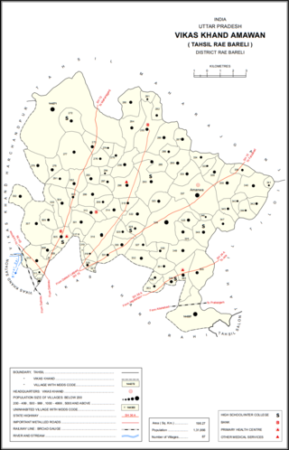
Jamalpur Karaundi is a village in Amawan block of Rae Bareli district, Uttar Pradesh, India. It is located 11 km from Raebareli, the district headquarters. As of 2011, its population is 630, in 125 households.

Jamalpur Nankari is a village in Rahi block of Rae Bareli district, Uttar Pradesh, India. It is located 4 km from Rae Bareli, the district headquarters. As of 2011, it has a population of 1,203 people, in 242 households. It has one primary school and no healthcare facilities.

Tejgaon is a village in Sareni block of Rae Bareli district, Uttar Pradesh, India. It is located 14 km from Lalganj, the tehsil headquarters. As of 2011, it has a population of 4,431 people, in 738 households. It has one primary school and one medical clinic, and it hosts both a weekly haat and a permanent market. It belongs to the nyaya panchayat of Malkegaon.


