Golden Triangle (Yorkshire)

Last updated

A map with a broad boundary of the Golden Triangle (click to expand) Golden Triangle (Yorkshire).svg
A map with a broad boundary of the Golden Triangle (click to expand)
Leeds's affluent district of Roundhay, lies within the area. Street Lane shops.jpg
Leeds's affluent district of Roundhay, lies within the area.
Wetherby is situated at the approximate centre of the triangle. Wetherby from the South.jpg
Wetherby is situated at the approximate centre of the triangle.
Harrogate is situated to the far north of the triangle. HarrogateCenotaph(DSPugh)Aug2005.jpg
Harrogate is situated to the far north of the triangle.

The Golden Triangle is a term commonly used by estate agents for the area of West and North Yorkshire lying between Harrogate, York and North Leeds. Lying in the centre of this area is Wetherby on the fringes of West Yorkshire. Despite mainly being an affluent area the area does consist of some deprived areas such as Swarcliffe, Cranmer Bank and Hallfields. The most expensive street in the golden triangle is Fulwith Mill Lane on the South Side of Harrogate, where the average house price is £1.7 million. [1]

Contents

Boundaries

The exact boundaries are disputed, in particular around north Leeds, but the Outer Ring Road is often quoted as the boundary so that the area includes Whinmoor, Swarcliffe, Cross Gates and Garforth but not Seacroft, this definition is supported by Leeds City Council. Affluent areas such as Roundhay and Gledhow lie within the confines of the ring road, but are usually included in the area. To the north, the town of Knaresborough would also lie within the boundaries of the golden triangle.

Usage

The term is mostly applied by estate agents, however, it has been used by local councils within this area and also by the local media. Publications such as the Yorkshire Evening Post , the Wetherby News and the Harrogate Advertiser have used the term on many occasions.

Demography

While there have been no studies into the demography of the area as a whole. Census studies in the areas within the 'triangle', show most parts of the area have a predominantly white demographic. This remains constant irrespective of the social demographic.

The social demographic does however vary throughout the area. Swarcliffe for with a population of 6,751, of which 4,544 were considered to be "hard-pressed", or experiencing financial difficulty. [2] Conversely Linton compromises almost exclusively wealthy professional residents.

Housing

Early-19th-century semis in Boston Spa. Early 'semis' in Boston Spa - geograph.org.uk - 617988.jpg
Early-19th-century semis in Boston Spa.
York lies to the east York Aerial View.jpg
York lies to the east
Pockets of urban decay exist within the triangle such as these flats (now demolished) in Swarcliffe. Elmet Towers, Swarcliffe.jpg
Pockets of urban decay exist within the triangle such as these flats (now demolished) in Swarcliffe.

With the exception of certain small pockets of the area, house prices have traditionally been high in the area, the price hikes in the area often being attributed to the economic growth in the commercial centre of Leeds. As a result, there has often been great demand to build housing in this area. In 2006, Leeds City Council, York City Council and Harrogate Borough Council established a programme aiming to help people afford property in the area. [3] [4] While house prices grew in the area during the prosperous years of economic boom, [5] [6] they fell in line with the rest of the country during the recession of 2008 and 2009.

The types of housing in this area vary greatly. Land scarcity and high demand have meant new developments are often of a dense nature. Recently, new proposals have been put forward to build on former green belt in this area. The building of housing on the 'Church Fields' site in Boston Spa began in 2012, [7] and plans have also been put forward to build on fields in the Spofforth Hill area of Wetherby. [8] For many years there has been debate about expanding the Leeds urban boundaries north along the A58 corridor towards Wetherby by building on fields around Whinmoor, Swarcliffe and Shadwell.

Economy

Much of the area is commuter belt for the commercial centre of Leeds which functions as a large financial and commercial centre. There are however other buoyant industries within this area such as tourism (mainly in York, but to an extent also in Leeds and Harrogate), manufacturing (which is prevalent to the east of Leeds as well as in Wetherby and Thorp Arch) and agriculture, which exists in various areas around the 'triangle'.

Tourism

Besides the city centres of York and Leeds as well as the town of Harrogate, there are attractions in the area which bring visitors to the area such as Roundhay Park, RHS Garden Harlow Carr, The Market Town of Knaresborough and racecourses in York and Wetherby.

Leeds and Harrogate also gain visitors due to their proximity to the Yorkshire Dales national park, while York does due to its proximity to the North York Moors national park. Within the golden triangle itself, Almscliffe Crag has proved popular with hikers.

Transport

The area has many road and rail transport links. The A1(M) runs through the area, while the M1 terminates in this area, merging with the A1(M). The area is slightly wider than the triangle formed by the A59, A61 and A64 trunk roads. Both York and Leeds have mainline railway stations and are linked themselves by a direct line via Cross Gates and also a commuter line via Headingley, Horsforth, Knaresborough and Harrogate. Many areas in the 'triangle' however are without rail links such as Roundhay, Gledhow, Shadwell and Wetherby. Leeds Bradford International Airport lies just to the west of the area.

Politics

The area does not contain any particularly safe seats for any political party. North Leeds and central York generally return Labour MPs while Harrogate has in the past delivered both Liberal Democrat and Conservative MPs and Wetherby has elected both Labour and Conservative MPs in the recent past. Leeds City Council has been led by the three main parties in its history, control of York has alternated between the Liberal Democrats and the Labour Party and Harrogate is a Conservative-Liberal Democrat battleground.

See also

Related Research Articles

<span class="mw-page-title-main">Wetherby</span> Town and civil parish in West Yorkshire, England

Wetherby is a market town and civil parish in the City of Leeds, West Yorkshire, England. It is close to West Yorkshire county's border with North Yorkshire, and lies approximately 12 miles from Leeds City Centre, 12 mi (19 km) from York and 8 mi (13 km) from Harrogate. The town stands on the River Wharfe, and for centuries has been a crossing place and staging post on the Great North Road midway between London and Edinburgh.

<span class="mw-page-title-main">Harrogate</span> Town in North Yorkshire, England

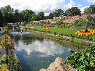
Harrogate is a spa town in the district and county of North Yorkshire, England. Historically in the West Riding of Yorkshire, the town is a tourist destination and its visitor attractions include its spa waters and RHS Harlow Carr gardens. 13 miles (21 km) away from the town centre is the Yorkshire Dales National Park and the Nidderdale AONB.

<span class="mw-page-title-main">Moortown, Leeds</span> Suburb of Leeds in West Yorkshire, England

Moortown is an affluent suburb of Leeds, West Yorkshire, England in the LS17 and LS8 postcode districts. It is a civil parish and sits in the Moortown ward of Leeds City Council in the north east of the city.

<span class="mw-page-title-main">Borough of Harrogate</span> Former local government district in England

The Borough of Harrogate was a local government district with borough status in North Yorkshire, England, from 1974 to 2023. Its council was based in the town of Harrogate, but it also included surrounding settlements, including the cathedral city of Ripon, and almost all of the Nidderdale Area of Outstanding Natural Beauty. At the 2011 Census, the borough had a population of 157,869.

<span class="mw-page-title-main">Seacroft</span> Suburb of Leeds, West Yorkshire, England

Seacroft is an outer-city suburb/township consisting mainly of council estate housing covering an extensive area of east Leeds, West Yorkshire, England. It lies in the LS14 Leeds postcode area, around 4 miles (6.4 km) east of Leeds city centre.

<span class="mw-page-title-main">Roundhay</span> Suburb of Leeds, West Yorkshire, England

Roundhay is a large suburb in north-east Leeds, West Yorkshire, England. Roundhay had a population of 22,546 in 2011.

<span class="mw-page-title-main">Harrogate line</span> Passenger rail line in England

The Harrogate line is a passenger rail line through parts of North Yorkshire and the West Yorkshire area of northern England connecting Leeds to York by way of Harrogate and Knaresborough. Service on the line is operated by Northern, with a few additional workings by London North Eastern Railway starting and terminating at Harrogate. West Yorkshire Metro's bus and rail MetroCard ticket is available for journeys between Leeds and Harrogate.

<span class="mw-page-title-main">Pendas Fields</span>

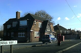
Pendas Fields, or Penda's Fields is a private, suburban housing estate in Leeds, West Yorkshire, England. It is considered part of Cross Gates, as is Manston. Swarcliffe is close, and Cock Beck runs nearby. The area falls within the Cross Gates and Whinmoor wards of the Leeds Metropolitan Council.

<span class="mw-page-title-main">Cross Gates</span> Suburb in east Leeds, West Yorkshire, England

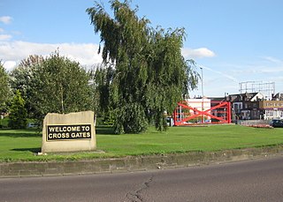
Cross Gates is a suburb in east Leeds, West Yorkshire, England.

<span class="mw-page-title-main">Spofforth, North Yorkshire</span> Village in North Yorkshire, England

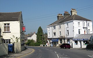
Spofforth is a village in the civil parish of Spofforth with Stockeld in the Harrogate district of North Yorkshire, England, about 3 miles (4.8 km) north west of Wetherby and 5 miles (8 km) south of Harrogate on the River Crimple, a tributary of the River Nidd.

<span class="mw-page-title-main">Shadwell, West Yorkshire</span> Village and civil parish in West Yorkshire, England

Shadwell is a village and civil parish in north-east Leeds, West Yorkshire, England. The village is 6 miles (9.7 km) to the north east of Leeds city centre.

<span class="mw-page-title-main">Swarcliffe</span> Area of the City of Leeds, West Yorkshire, England

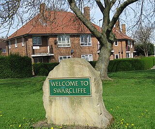
Swarcliffe, originally the Swarcliffe Estate, is a district of Leeds, West Yorkshire, England. It is 4.9 miles (8 km) east of Leeds city centre, and within the LS14 and LS15 Leeds postcode area. The district falls within the Cross Gates and Whinmoor ward of the Leeds Metropolitan Council.

<span class="mw-page-title-main">A661 road</span> Road in England

The A661 is an A road running between Wetherby and Harrogate in West and North Yorkshire, England. The road is 8.4 miles (14 km) in length.

<span class="mw-page-title-main">History of Seacroft</span>

Seacroft pre-dates the Domesday book, with evidence of a settlement in the area from the Neolithic Age. Seacroft remained largely unchanged for centuries as a small Yorkshire village, until in the 1950s the area was developed into Leeds' largest council estate. In the 1960s and 1970s the building of Whinmoor and Swarcliffe enclosed Seacroft within other suburbs.

<span class="mw-page-title-main">City of Leeds</span> Metropolitan District in West Yorkshire, England

Leeds, also known as the City of Leeds, is a metropolitan borough with city status in West Yorkshire, England. The metropolitan borough includes the administrative centre of Leeds and the towns of Farsley, Garforth, Guiseley, Horsforth, Morley, Otley, Pudsey, Rothwell, Wetherby and Yeadon. It has a population of 809,036 (2021), making it technically the second largest city in England by population behind Birmingham, since London is not a single local government entity. Local governance sits with Leeds City Council and the city's 32 Parish Councils.

<span class="mw-page-title-main">Chapel Allerton</span> Suburb of Leeds in West Yorkshire, England

Chapel Allerton is an inner suburb of north-east Leeds, West Yorkshire, England, 2 miles (3.2 km) from the city centre.

<span class="mw-page-title-main">Harrogate–Church Fenton line</span> Disused railway line in Yorkshire, England

The Harrogate–Church Fenton line was a railway line in North Yorkshire, opened by the York and North Midland Railway between 1847 and 1848, linking Harrogate and Church Fenton.

<span class="mw-page-title-main">Roundhay (ward)</span> Electoral ward in Leeds, England

Roundhay is an electoral ward of Leeds City Council in north east Leeds, West Yorkshire, covering the suburb of the same name, Gledhow and Oakwood.

Wetherby and Easingwold is a proposed constituency of the House of Commons in the UK Parliament, partly in North Yorkshire and partly in West Yorkshire. Further to the completion of the 2023 Periodic Review of Westminster constituencies, it will first be contested at the next general election.

References

  1. "Zoopla Stats" . Retrieved 16 May 2020.
  2. "2009 Population ACORN Profile" (PDF). CACI. 2009. Retrieved 27 July 2011.
  3. "England | North Yorkshire | Help for 'golden triangle' buyers". BBC News . London: BBC. 27 August 2006. Retrieved 18 April 2011.
  4. Fletcher, Michelle (2011). "Leeds Housing Partnership - Regional Issues". Leeds Housing Partnership. Retrieved 18 April 2011.
  5. "Leeds' golden housing boom". BBC News. 6 February 2002.
  6. "Making It Work" (PDF). Harrogate.gov.uk. Archived from the original (PDF) on 10 March 2012. Retrieved 7 December 2012.
  7. "New homes in Boston Spa - Church Fields - New Homes by Taylor Wimpey". Taylorwimpey.co.uk. Retrieved 7 December 2012.
  8. "Spofforth Hill homes plans go on show - Business". Wetherby News. 29 November 2012. Retrieved 7 December 2012.