
Amesbury is a town and civil parish in Wiltshire, England. It is known for the prehistoric monument of Stonehenge which is within the parish. The town is claimed to be the oldest occupied settlement in Great Britain, having been first settled around 8820 BC. The parish includes the hamlets of Ratfyn and West Amesbury, and part of Boscombe Down military airfield.

Lacock is a village and civil parish in the county of Wiltshire, England, about 3 miles (5 km) south of the town of Chippenham, and about 3.7 miles (6.0 km) outside the Cotswolds area. The village is owned almost in its entirety by the National Trust and attracts many visitors by virtue of its unspoiled appearance.

Mere is a market town and civil parish in Wiltshire, England. It lies at the extreme southwestern tip of Salisbury Plain, close to the borders of Somerset and Dorset. The parish includes the hamlets of Barrow Street, Burton, Charnage, Limpers Hill, Rook Street and Southbrook.

Melksham is a town and civil parish on the River Avon in Wiltshire, England, about 4.5 miles (7 km) northeast of Trowbridge and 6 miles (10 km) south of Chippenham. At the 2021 census, the parish had a population of 18,113.
Enford is a village and civil parish in Wiltshire, England, in the northeast of Salisbury Plain. The village lies 10 miles (16 km) southeast of Devizes and 14 miles (23 km) north of Salisbury. The parish includes nine small settlements along both banks of the headwaters of the River Avon. Besides Enford, these are Compton, Coombe, East Chisenbury, Fifield, Littlecott, Longstreet, New Town and West Chisenbury.

The River Bourne is a river in the English county of Wiltshire, a tributary of the Salisbury Avon. It flows in a generally southerly direction for about 48 km. In its upper reaches the river is a winterbourne, often dry in summer.

Wilsford is a small village and civil parish in the Vale of Pewsey in the English county of Wiltshire, about 4 miles (6 km) southwest of Pewsey.

Codford is a civil parish south of Salisbury Plain in the Wylye Valley in Wiltshire, England. Its settlements are the adjacent villages of Codford St Peter and Codford St Mary, which lie some 7 miles (11 km) southeast of Warminster.

Allington is a village and civil parish in Wiltshire, England, about 3 miles (5 km) southeast of Amesbury and 7 miles (11 km) northeast of Salisbury. The parish includes the village of Boscombe; both villages are on the River Bourne and the A338 road. Most of the west boundary of the parish is also the county boundary with Hampshire.
Berwick St John is a village and civil parish in southwest Wiltshire, England, about 5 miles (8 km) east of Shaftesbury in Dorset. The parish includes the Ashcombe Park estate, part of the Ferne Park estate, and most of Rushmore Park.

Bulford is a village and civil parish in Wiltshire, England, near Salisbury Plain. The village is close to Durrington and about 1.5 miles (2.4 km) north of the town of Amesbury. The Bulford Camp army base is separate from the village but within the parish.

Minety (/'maɪn.tiː/) is a village in north Wiltshire, England, between Malmesbury – 6 miles (9.7 km) to the west – and Swindon. It takes its name from the water mint plant found growing in ditches around the village, and has previously been known as Myntey. It has a primary school and a successful rugby club.

Porton is a village in the Bourne valley, Wiltshire, England, about 5 miles (8 km) northeast of Salisbury. It is the largest settlement in Idmiston civil parish.

Market Lavington is a civil parish and large village with a population of about 2,200 on the northern edge of Salisbury Plain in Wiltshire, England, 5 miles (8.0 km) south of the market town of Devizes. The village lies on the B3098 Westbury–Urchfont road which skirts the edge of the Plain. The parish includes the hamlets of Northbrook, Lavington Sands and Fiddington Sands.

Britford is a village and civil parish beside the River Avon about 1.5 miles (2.4 km) south-east of Salisbury in Wiltshire, England. The village is just off the A338 Salisbury-Bournemouth road. The 2011 Census recorded a parish population of 592.

Downton is a village and civil parish on the River Avon in southern Wiltshire, England, about 6 miles (10 km) southeast of the city of Salisbury. The parish is on the county boundary with Hampshire and is close to the New Forest; it includes the villages of Wick and Charlton-All-Saints, and the small ancient settlement of Witherington. The Trafalgar Park estate erased the former settlement of Standlynch. The parish church, Trafalgar House, and two more houses are Grade I listed.
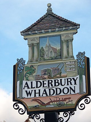
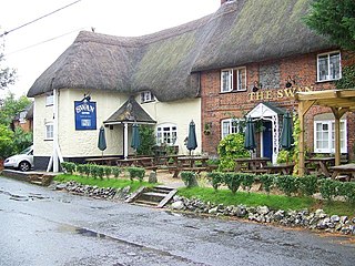
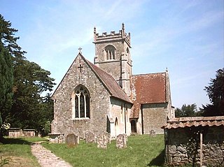
Alderbury is a village and civil parish in Wiltshire, England, in the south of the county around 3 miles (5 km) southeast of Salisbury.

Tilshead is a village and civil parish in the county of Wiltshire in Southern England, about 9 miles (14 km) northwest of the town of Amesbury. It is close to the geographical centre of Salisbury Plain, on the A360 road approximately midway between the villages of Shrewton and West Lavington and is near the source of the River Till. Its population in 2011 was 358, down from a peak of 989 inhabitants in 1951.

Idmiston is a village and civil parish in Wiltshire, England. The village is about 3 miles (4.8 km) southeast of Amesbury and 6 miles (10 km) northeast of Salisbury. The parish includes the villages of Porton and Gomeldon; all three villages are on the River Bourne and are linked by the A338 road.

Laverstock is a village and civil parish on the north-east and east outskirts of Salisbury in the ceremonial county of Wiltshire, England. The parish is shaped like a figure 7 and incorporates Ford hamlet, the eastern half of the former manor of Milford, the area near the ancient settlement of Old Sarum, and part of the Hampton Park district on the edge of Salisbury.
