
Chandrapur district is a district in the Nagpur Division in the Indian state of Maharashtra. Chandrapur was the largest district in India until the Gadchiroli and Sironcha tehsils were separated as Gadchiroli district in 1981. In 2011, the district population was 2,204,307.

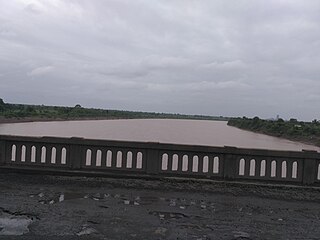
Chandrapur is a city and a municipal corporation in Chandrapur district, Maharashtra state, India. It is the district headquarters of Chandrapur district. Chandrapur is a fort city founded by Khandkya Ballal Sah, a Gond king of the 13th century. The city sits at the confluence of the Erai river and Zarpat river. The area around the city is rich in coal seams.. Hence, Chandrapur is also known as the "Black Gold City".
Gadchiroli ( [ɡəɖt͡ʃiɾoliː]) is a city and a municipal council in Gadchiroli district in the state of Maharashtra, central India. It is located on eastern side of Maharashtra, and is the administrative headquarters of the district. Gadchiroli is called a lung of Maharashtra as it has almost 35% of this district has forest cover. The main river flowing through city is the Wainganga River. The landscape is lush and green during the monsoon season which is prone to flooding. Gadchiroli is known for its forests. Teak is grown commercially and bamboos are used for various crafts.

Hansraj Ahir is an Indian politician and current Chairman of the National Commission for Backward classes. He is a former Union Minister of State for Home Affairs and Minister of State for Chemicals and Fertilizers in the First Modi Ministry. He was the former member of the 16th Lok Sabha in India. He was member of 11th Lok Sabha, 14th Lok Sabha, 15th Lok Sabha. He is famous for exposing Coal Mining Scam specially pouni-3 in WCL.
The Painganga River is the chief river of the Buldhana district, Hingoli district, Nanded district, Yavatmal district, Chandrapur district and Washim district in the Maharashtra state in India. It flows along the southeast boundaries of the district in a winding, meandering course. It is deeply entrenched and difficult to navigate. It rises in the Ajantha range and is a major tributary of the Wardha River, the other major river in the district. It is also divided Marathwada and Vidarbha near Umarkhed and Himayatnagar.

Chandrapur is one of the 48 Lok Sabha (parliamentary) constituencies of Maharashtra state in western India. This constituency is spread over Chandrapur and Yavatmal districts.
Bhadrawati-Warora is one of the six constituencies of the Maharashtra Vidhan Sabha located in the Chandrapur district.
Wani Assembly constituency is one of the 288 constituencies of the Maharashtra Vidhan Sabha and one of the seven which are located in the Yavatmal district.
Chandrapur Airport is located at Morwa, 9 km north-west of Chandrapur, Maharashtra, India. The airstrip was constructed in 1967 by the Public Works Department and is spread over 22 hectares. Neither navigational aids nor night landing facilities are available on the airstrip.
Chandrapur is a census town in the Barasat I CD block in the Barasat Sadar subdivision in the North 24 Parganas district in the Indian state of West Bengal. It is a part of Kolkata Urban Agglomeration.
Ballarpur Assembly constituency is one of the 288 Vidhan Sabha constituencies of Maharashtra state, western India. This constituency is located in Chandrapur district. The delimitation of the constituency happened in 2008.
Chandrapur Assembly constituency is one of the 288 Vidhan Sabha constituencies of Maharashtra state, western India. This constituency is located in Chandrapur district. The delimitation of the constituency happened in 2008.
Chandrapur railway station is a railway station serving Chandrapur city in Chandrapur district of Maharashtra state of India. It is under the Nagpur CR railway division of Central Railway zone of Indian Railways. It is located on the New Delhi–Chennai main line of Indian Railways.
Chanda Fort Railway Station is one of the two main railway stations serving Chandrapur city in Chandrapur district in Maharashtra state in India. It is under Nagpur SEC railway division of South East Central Railway zone of Indian Railways. It is located on Gondia–Nagbhid–Balharshah line of Indian Railways.
Chandrapur is a village in Katwa I CD block in Katwa subdivision of Purba Bardhaman district in the state of West Bengal, India.
Chandrapur is a village and gram panchayat in Rajnagar CD Block in Suri Sadar subdivision of Birbhum district in the Indian state of West Bengal.
National Highway 930, commonly referred to as NH 930 is a national highway in India. It is a spur road of National Highway 30. NH-930 traverses the states of Chhattisgarh and Maharashtra in India.
National Highway 930D, commonly referred to as NH 930D is a national highway in India. It is a spur road of National Highway 930. NH-930D traverses the state of Maharashtra in India.
Chandrapur Greenfield Airport is a greenfield airport to be built at Murti, 42 kilometres south of Chandrapur, Maharashtra, India. The Maharashtra Airport Development Company (MADC) is the nodal agency for the project. The airport will be developed in two phases. The first phase will be built on 720 acres of land, with a 2000 metre runway capable of handling turboprop aircraft like the Bombardier Q400 and ATR 72. In the second phase, the runway will be extended to 3000 metres to accommodate narrow-body jet aircraft like the Airbus A-320. The Airports Authority of India submitted its pre-feasibility report in January 2018, approving the site for the construction of a greenfield airport. Following this, the State government gave approval for the project and sanctioned funds for acquisition of 463 acres of private land and other administrative process. The land acquisition for the airport is expected to be completed by the end of financial year 2020/21.
Krishna Chandrapur is a census town and a gram panchayat within the jurisdiction of the Mathurapur police station in the Mathurapur I CD block in the Diamond Harbour subdivision of the South 24 Parganas district in the Indian state of West Bengal.
