Gonivada is a small village, 20km from Davangere in Karnataka state in India. It is well connected by Davangere-Shimoga Karnataka state highway. The main occupation of the villagers is agriculture, the same as thousands of other villages in India. The land is semi-fertile with black and red soil. The chief agricultural product is paddy rice, followed by sugarcane as there is a sugar factory nearby. Off late, areca nut culitvation is also quite popular due to commercial benefits. The population of the village is around 2000.
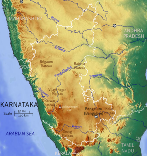
Karnataka is a state in the south western region of India. It was formed on 1 November 1956, with the passage of the States Reorganisation Act. Originally known as the State of Mysore, it was renamed Karnataka in 1973. The state corresponds to the Carnatic region. The capital and largest city is Bangalore (Bengaluru).
India, also known as the Republic of India, is a country in South Asia. It is the seventh largest country by area and with more than 1.3 billion people, it is the second most populous country as well as the most populous democracy in the world. Bounded by the Indian Ocean on the south, the Arabian Sea on the southwest, and the Bay of Bengal on the southeast, it shares land borders with Pakistan to the west; China, Nepal, and Bhutan to the northeast; and Bangladesh and Myanmar to the east. In the Indian Ocean, India is in the vicinity of Sri Lanka and the Maldives, while its Andaman and Nicobar Islands share a maritime border with Thailand and Indonesia.
Shivamogga previously known as Shimoga, is a large city and the district headquarters of Shivamogga District in the center of the state of Karnataka, India. The city lies on the banks of the Tunga River. Being situated at the foot of the hilly region of the Western Ghats, the city is nicknamed "Gateway to Malenadu", "Malenadu" meaning "Rain Land".
A geographic coordinate system is a coordinate system that enables every location on Earth to be specified by a set of numbers, letters or symbols. The coordinates are often chosen such that one of the numbers represents a vertical position and two or three of the numbers represent a horizontal position; alternatively, a geographic position may be expressed in a combined three-dimensional Cartesian vector. A common choice of coordinates is latitude, longitude and elevation. To specify a location on a plane requires a map projection.
This page is based on this Wikipedia article Text is available under the CC BY-SA 4.0 license; additional terms may apply. Images, videos and audio are available under their respective licenses.
Related Research Articles
Davangere is a city in the centre of the southern Indian state of Karnataka. It is the sixth largest city in the state, and the administrative headquarters of eponymous Davangere District. Hitherto being a cotton hub and hence popularly known before as the Manchester of Karnataka, the commercial ventures of the city is now dominated by education and agro-processing industries. Davanagere became a separate district in 1997, when it was separated from the erstwhile undivided district of Chitradurga for administration conveniences. Davanagere is known for rich culinary traditions which encompass the diversity of entire Karnataka's dishes due to its geographical position in the state as its epicenter. Notable among them is its aromatic benne dose that is associated with the name of the city.
The Mysore region is an unofficial region that is part of Karnataka state in southern India. It forms approximately the southern half of the non-coastal areas of that state. The area corresponds almost exactly to that of the erstwhile princely state of Mysore. Almost all of that principality, with the exception of a few areas that now lie in neighbouring states, is comprehended by this term.
Bayaluseeme or Bayalu Seeme is the area lying to the east of Malenadu, a region of Karnataka state in India. The area is largely open plain, with few hillocks. It includes the districts of Bangalore, Bagalkot, Bijapur, Chitradurga, Davanagere, Dharwad, Gadag, Hassan, Haveri, Mandya, Tumkur, the eastern edge of Uttara Kannada.
Nyamathi is talluk place located in Davangere District of the Karnataka state, India. It is approximately 65 km south of Davangere and 26 km north of Shimoga. Nyamathi derived from Kannada words nyaya mati.it is famous for his business aspects, it is also consider as a wholesale sector
Harapanahalli is a City in Ballari district in the Indian state of Karnataka.
Karekatte is a village in the Indian state of Karnataka. Karekatte is located on Davanagere-Channagiri connecting road. At a distance of about 34 km (21 mi) from the Davanagere (District). At a distance of about 28.6 km (18 mi) from the Channagiri (Taluk).
The Varada River is a river in central Karnataka, India. It is a tributary of the Tungabhadra River.
Banasihalli is a small village in Hosadurga Taluk of Chitradurga district, Karnataka state, India. It is around 15 km from Hosadurga. Population is around 1000 and agriculture is the main occupation. Coconut and Arecanut are main agricultural products. The place is surrounded by rocky mountains. Lingayat is the main caste of people. There is a government primary school for education. The place is well connected to Hosadurga and Chitradurga by buses.
Neglur is a village in the southern state of Karnataka, India. It is located in the Haveri taluk of Haveri district in Karnataka.
Kaikeri is a village in the southern state of Karnataka, India. It is located in the Virajpet taluk of Kodagu district.
Adarvalli is a village in the southern state of Karnataka, India. It is located in the Sakleshpur taluk of Hassan district in Karnataka.
Akkunji is a village in the southern state of Karnataka, India. It is located in the Siddapur taluk of Uttara Kannada district in Karnataka.
Hampiholi is a village on the banks of river Malaprabha in Belgaum district, 14 kilometres (8.7 mi) from Ramdurga taluk in the southern state of Karnataka, India.
Jalikatti is a village in Belgaum district in the southern state of Karnataka, India.
Kondajji is a village in Harihar taluk, in the Davangere district, Karnataka. It is situated about 13 kilometres (8.1 mi) from the city of Davangere
Davangere railway station is a railway station in Davangere, state of Karnataka, India. It is one of the major railway stations in the South Western Railway zone of Indian Railways. The station is situated on P.B. road in Davangere, exactly opposite to the city municipal corporation. It was created during the British rule and was renovated recently.. Amenities inside station include free Google Wifi, filtered water facility, refreshment stalls and retiring rooms.
Sultanipura is a village in the Taluk and District of Davangere, Karnataka in India. It is located 20 kilometers from Davangere. It is one of the smallest village in davangere, having around 50-60 families in total.
Belalagere is a village in Channagiri taluk, Davanagere district in the Indian state of Karnataka. It is around 30 km from Davangere.
Aremallapur is a village in the southern state of Karnataka, India. It is located in the Ranebennur taluk of Haveri district in Karnataka.
Pamenahalli is a village in Harihara Taluk in Davangere District of Karnataka State, India. It comes under Sarathi Panchayath. It belongs to Bangalore Division. It is located 17 km towards west from District headquarters Davanagere. 298 km from State capital Bangalore.