
British Columbia is the westernmost province of Canada. Situated in the Pacific Northwest between the Pacific Ocean and the Rocky Mountains, the province has a diverse geography, with rugged landscapes that include rocky coastlines, sandy beaches, forests, lakes, mountains, inland deserts and grassy plains. British Columbia borders the province of Alberta to the east; the territories of Yukon and Northwest Territories to the north; the U.S. states of Washington, Idaho and Montana to the south, and Alaska to the northwest. With an estimated population of over 5.6 million as of 2024, it is Canada's third-most populous province. The capital of British Columbia is Victoria, while the province's largest city is Vancouver. Vancouver and its suburbs together make up the third-largest metropolitan area in Canada, with the 2021 census recording 2.6 million people in Metro Vancouver. British Columbia is Canada's third-largest province in terms of total area, after Quebec and Ontario.

The Lower Mainland is a geographic and cultural region of the mainland coast of British Columbia that generally comprises the regional districts of Metro Vancouver and the Fraser Valley. Home to approximately 3.05 million people as of the 2021 Canadian census, the Lower Mainland contains sixteen of the province's 30 most populous municipalities and approximately 60% of the province's total population.
Columbia most often refers to:
The Pacific Northwest, sometimes referred to as Cascadia, is a geographic region in Western North America bounded by its coastal waters of the Pacific Ocean to the west and, loosely, by the Rocky Mountains to the east. Though no official boundary exists, the most common conception includes the U.S. states of Oregon, Washington, Idaho, and the Canadian province of British Columbia. Some broader conceptions reach north into Alaska and Yukon, south into northern California, and east into western Montana. Other conceptions may be limited to the coastal areas west of the Cascade and Coast mountains.
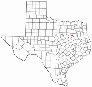
Goodlow is a city in Navarro County, Texas, United States. Its population was 178 in the 2020 census.

The University of Northern British Columbia (UNBC) is a university serving the northern region of the Canadian province of British Columbia. The main campus is located in Prince George, with additional campuses located in Prince Rupert, Terrace, Quesnel, and Fort St. John. Because of its northern latitude, UNBC is a member of the University of the Arctic. In the 2020–21 academic year, 4,253 students were enrolled at UNBC.

In the province of British Columbia in Canada, a regional district is an administrative subdivision of the province that consists of a geographic region with specific boundaries and governmental authority. As of January 2020, there were 28 regional districts in the province. Regional districts should not be confused with counties of British Columbia, which function as court house boundaries solely for the administration of justice.

The Peace River Regional District is a regional district in northeastern British Columbia, Canada. The regional district comprises seven municipalities and four electoral areas. Its member municipalities are the cities of Fort St. John and Dawson Creek, the district municipalities of Tumbler Ridge, Chetwynd, Taylor, and Hudson's Hope, and the village of Pouce Coupe. The district's administrative offices are in Dawson Creek.
The demographics of Metro Vancouver indicate a multicultural and multiracial region. Metro Vancouver is a metropolitan area, with its major urban centre being Vancouver, British Columbia, Canada. The Vancouver census metropolitan area, as defined by Statistics Canada, encompasses roughly the same territory as the Metro Vancouver Regional District, a regional district in British Columbia. The regional district includes 23 local authorities. Figures provided here are for the Vancouver census metropolitan area and not for the City of Vancouver.

Valemount is a village municipality of 1,018 people in east central British Columbia, Canada, 320 kilometres (200 mi) from Kamloops, British Columbia. It is between the Rocky, Monashee, and Cariboo Mountains. It is the nearest community to the west of Jasper National Park, and is also the nearest community to Mount Robson Provincial Park, which features Mount Robson, the tallest mountain in the Canadian Rockies. Outdoor recreation is popular in summer and winter—hiking, skiing, snowmobiling, cross-country skiing, mountain biking and horseback riding are common activities. Valemount is one of 14 designated resort municipalities in British Columbia.
Eugene Goodlow is an American former professional football player who was a wide receiver for four seasons in the National Football League (NFL). In 1981 and 1982 he played for the Winnipeg Blue Bombers of the Canadian Football League (CFL), where he led the league in receptions and was an All-Star in 1981. Goodlow became the first player in CFL history to reach 100 receptions in a season during the 1981 season. In 1982, he signed a seven-year, $1.6 million contract with the New Orleans Saints. He then joined the San Diego Chargers in 1987.
All Saints Catholic Church was located at Goodlow Street opposite Kemper Lane in Cincinnati, Ohio and was once known as Christ Church. The parish was organized by Rev. S. McMahon in 1837. The Parish served the English-speaking community, most members came from the growing Irish population of Cincinnati. The original Church was dedicated on November 9, 1845. The Parent Parishes was the Old Cathedral on Sycamore, now known as. All Saints had a congregation of 200 families in 1896. The Parish was closed in 1936.

