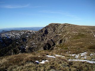
The Alpine National Park is a national park located in the Central Highlands and Alpine regions of Victoria, Australia. The 646,000-hectare (1,600,000-acre) national park is located northeast of Melbourne. It is the largest National Park in Victoria, and covers much of the higher areas of the Great Dividing Range in Victoria, including Victoria's highest point, Mount Bogong at 1,986 metres (6,516 ft) and the associated subalpine woodland and grassland of the Bogong High Plains. The park's north-eastern boundary is along the border with New South Wales, where it abuts the Kosciuszko National Park. On 7 November 2008 the Alpine National Park was added to the Australian National Heritage List as one of eleven areas constituting the Australian Alps National Parks and Reserves.

The Nightcap National Park is a national park situated within the Nightcap Range in the Northern Rivers region of New South Wales, Australia. The 8,080-hectare (20,000-acre) park was created in April 1983 and is situated 35 kilometres (22 mi) north of Lismore. The national park is classed by the IUCN World Commission on Protected Areas as Category II and is part of the Shield Volcano Group of the World Heritage Site Gondwana Rainforests of Australia inscribed in 1986 and added to the Australian National Heritage List in 2007.

The Errinundra National Park is a national park located in the Gippsland region of Victoria, Australia. The 26,875-hectare (66,410-acre) national park is situated 373 kilometres (232 mi) east of Melbourne via the Princes Highway and is centred on the Errinundra Plateau, a southwards extension of the Monaro Tablelands of New South Wales.

The Tarra-Bulga National Park is a small national park located in the South Gippsland region of eastern Victoria, Australia approximately 240 kilometres (150 mi) south east of Melbourne. The park is located 33 kilometres (21 mi) south of Traralgon on the Traralgon-Balook Road and 24 kilometres (15 mi) north of Yarram.

Yarra Ranges National Park is located in the Central Highlands of Australia's southeastern state Victoria, 107 kilometres northeast of Melbourne. Established in 1995 and managed by the statutory authority Parks Victoria, the park features a carbon-rich, temperate rain forest and subalpine eucalypt forest on its northern plateau. It is home to large stands of mountain ash, the second tallest tree species in the world. A wide diversity of fauna make their home across the park's 76,003 hectares, including kangaroos, wallabies, wombats, platypi and 120 species of native birds. The Yarra, O'Shaunessy and Taggerty rivers flow through the Park, and with several reservoirs form an important source of drinking water for Melbourne. Among the conservation challenges facing Yarra Ranges National Park are climate change and invasive species of weeds.

This article relates to the flora of New Zealand, especially indigenous strains. New Zealand's geographical isolation has meant the country has developed a unique variety of native flora. However, human migration has led to the importation of many other plants as well as widespread damage to the indigenous flora, especially after the advent of European colonisation, due to the combined efforts of farmers and specialised societies dedicated to importing European plants & animals.

The Valdivian temperate forests (NT0404) is an ecoregion on the west coast of southern South America, in Chile and extending into Argentina. It is part of the Neotropical realm. The forests are named after the city of Valdivia. The Valdivian temperate rainforests are characterized by their dense understories of bamboos, ferns, and for being mostly dominated by evergreen angiosperm trees with some deciduous specimens, though conifer trees are also common.

Temperate rainforests are coniferous or broadleaf forests that occur in the temperate zone and receive heavy rain.

The Pacific temperate rainforests of western North America is the largest temperate rain forest region on the planet as defined by the World Wildlife Fund. The Pacific temperate rainforests lie along the western side of the Pacific Coast Ranges along the Pacific Northwest Coast of North America from the Prince William Sound in Alaska through the British Columbia Coast to Northern California, and are part of the Nearctic realm, as also defined by the World Wildlife Fund. The Pacific temperate rain forests are characterized by a high amount of rainfall, in some areas more than 300 cm (10 ft) per year and moderate temperatures in both the summer and winter months.

Nothofagus cunninghamii, commonly known as myrtle beech or Tasmanian myrtle, is the dominant species of cool temperate rainforests in Tasmania and Southern Victoria. It has low fire resistance and grows best in partial shade conditions.

The Styx Valley is a valley located adjacent to the Tasmanian Wilderness World Heritage Site on the island of Tasmania, Australia. The Styx River is the main drainage system of the valley that lies about 100 kilometres (62 mi) northwest of Hobart, with the nearest town being Maydena.

The Central Highlands is a large region in central Victoria, Australia. The term is mainly used in a geological context to describe that part of the Great Dividing Range that is west of the range's alpine areas but does not extend to the western end of the range in the state's west. The area is situated east of Ballarat, south of Bendigo, north and east of Melbourne, and west of the alpine areas. Major towns of the Central Highlands include Castlemaine, Creswick, Daylesford, Gisborne, Kyneton and Woodend. All these towns are located in what is usually referred to as the West Central Highlands. The more mountainous and more sparsely populated eastern part of the Central Highlands is referred to as the East Central Highlands and has extensive areas of temperate rainforest.

Alsophila cunninghamii, synonym Cyathea cunninghamii, also known as the gully tree fern and slender tree fern, is a species of tree fern indigenous to New Zealand including North Island, South Island and Chatham Islands; also to Victoria, possibly New South Wales, southeastern Queensland and Tasmania in Australia. It grows in damp forest, often emerging from stream gullies and riverbanks. Brownsey noted that it has a lower tolerance for drought than other related species. The erect trunk may be 20 m tall and is usually 6–15 cm in diameter, occasionally as much as 20 cm. Fronds are tri- to tetrapinnate and 3 m or more in length. The rachis and stipe are slender, black brown, warty and covered with brown scales. Sori occur along each side of the pinnule midvein and are covered by hood-like indusia. A. cunninghamii is an uncommon and slow-growing tree fern.
Alsophila × marcescens, synonym Cyathea × marcescens, commonly known as the skirted tree fern, is a tree fern endemic to the Cape Otway ranges in Victoria and Tasmania, Australia. It is a natural hybrid, apparently Alsophila australis × Alsophila cunninghamii. Large and Braggins (2004) note that it has characteristics midway between these two species. The spores of A. × marcescens are usually malformed although sterile. The trunk of this plant is erect and up to 10 m tall. Fronds may be bi- or tripinnate and 3–4 m in length. Dead fronds often persist, forming a characteristic skirt around the trunk. The stipe is thick, black and warty. The rachis and trunk are covered in shiny, dark brown scales. Sori are borne near the fertile pinnule midvein and are protected by thin indusia that are saucer-like in appearance.

The Upper Florentine Valley is a valley in the south of Tasmania, Australia, is an area recognised for its landscape and old growth forests. It is situated along the Gordon River Road near Maydena in the southwest of the island, roughly three hours drive from Hobart and comprises around 60 square kilometres (23 sq mi) of temperate rainforest and tall eucalypt forest. The Upper Florentine forms part of the Florentine catchment upstream (south) from Churchill Creek. Geographically it is an area of generally low relief valleys and flats. The area is a known habitat for threatened species of flora and fauna, including myrtle elbow orchid, grey goshawk, and spotted-tail quoll.
Victoria, Australia contains approximately 32,000 hectares of temperate rainforest in various regions, which represents 0.14% of the State's total area. The areas with rainforest include: East Gippsland, Strzelecki Ranges, Wilsons Promontory, Central Highlands, and Otway Ranges. The rainforests vary between cool temperate, warm temperate, and mixed cool temperate.

Lane Cove Bushland Park is located in suburban Lane Cove, 5 kilometres from the centre of Sydney, Australia. It is regarded as one of the more interesting areas of fungi in the country. In the year 2000, Bushland Park was placed on the Register of the National Estate, under the Australian Heritage Commission Act, 1975. Average annual rainfall is 1220 mm. Soils are moderately fertile, based on Hawkesbury sandstone and Ashfield Shale. The climate is warm and humid.

The Toolangi State Forest region in southern Australia extends from Mount Monda in the south up to Murrindindi in the north and includes the township of Toolangi. The forest is mainly eucalypt forest that has regrown from the 1939 Victoria Bushfires.
Tasmania is home to 'Australia’s largest cool temperate rainforests... Most of Tasmania’s rainforests occur in the North-West and throughout the North East highlands. Cool temperate rainforests typically have a heavy rainfall, cool climate, favor high altitudes and have a limited availability of light.

The North American inland temperate rainforest is a 7 million hectare disjunct temperate rainforest spreading over parts of British Columbia in Canada as well as Washington, Idaho and Montana on the US side. Its patches are located on the windward slopes of the Rocky Mountains and the Columbia Mountains, extending roughly over 1000km from 54° North to 45° North. It is one of the largest inland temperate and boreal rainforests in the world.