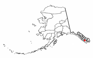
Naukati Bay is a census-designated place (CDP) in the Prince of Wales-Hyder Census Area of the Unorganized Borough of the U.S. state of Alaska. The population was 113 at the 2010 census, down from 135 in 2000.
Signy Island is a small subantarctic island in the South Orkney Islands of Antarctica. It was named by the Norwegian whaler Petter Sørlle (1884–1933) after his wife, Signy Therese.

A nautical chart is a graphic representation of a sea area and adjacent coastal regions. Depending on the scale of the chart, it may show depths of water and heights of land, natural features of the seabed, details of the coastline, navigational hazards, locations of natural and human-made aids to navigation, information on tides and currents, local details of the Earth's magnetic field, and human-made structures such as harbours, buildings, and bridges. Nautical charts are essential tools for marine navigation; many countries require vessels, especially commercial ships, to carry them. Nautical charting may take the form of charts printed on paper or computerized electronic navigational charts. Recent technologies have made available paper charts which are printed "on demand" with cartographic data that has been downloaded to the commercial printing company as recently as the night before printing. With each daily download, critical data such as Local Notices to Mariners are added to the on-demand chart files so that these charts are up to date at the time of printing.
A hydrographic office is an organization which is devoted to acquiring and publishing hydrographic information.
Piloting or pilotage is the process of navigating on water or in the air using fixed points of reference on the sea or on land, usually with reference to a nautical chart or aeronautical chart to obtain a fix of the position of the vessel or aircraft with respect to a desired course or location. Horizontal fixes of position from known reference points may be obtained by sight or by radar. Vertical position may be obtained by depth sounder to determine depth of the water body below a vessel or by altimeter to determine an aircraft's altitude, from which its distance above the ground can be deduced. Piloting a vessel is usually practiced close to shore or on inland waterways. Pilotage of an aircraft is practiced under visual meteorological conditions for flight.

The term territorial waters is sometimes used informally to refer to any area of water over which a sovereign state has jurisdiction, including internal waters, the territorial sea, the contiguous zone, the exclusive economic zone, and potentially the extended continental shelf. In a narrower sense, the term is used as a synonym for the territorial sea.
Vindication Island is a small uninhabited island in the South Sandwich Islands. It lies about 2 miles (3.2 km) from Candlemas Island, separated by the Nelson Channel. The island is mostly ice free.
Admiralty most often refers to:

Goose Pond is a 625-acre (2.5 km2) water body located in Grafton County in western New Hampshire, United States, in the towns of Canaan and Hanover. It is considered a great pond by the state of New Hampshire. The lake has 6.3 miles (10.1 km) of shoreline, and is approximately 3 miles (5 km) long by 0.5 miles (0.8 km) wide. All but the northernmost end of the pond is in the town of Canaan. The average depth of the pond is approximately 10 feet (3.0 m), with the deepest part approximately 35 feet (11 m). The lake is part of the Mascoma River watershed, flowing to the Connecticut River.

Quita Sueño Bank is a reef formation of Colombia which was once claimed by the United States, located 110 km north-northeast of Providencia Island.

West Point Light was a lighthouse at the United States Military Academy in West Point, New York. It was located at Gee's Point and was sometimes referred to as Gee's Point Light.
North Brother Island Light was a lighthouse located on North Brother Island in the East River in New York City. The lighthouse was at the southern tip of the island. Before the lighthouse was erected, the island was uninhabited and saw no formal use. The tower utilized an occulting light which lit for five seconds and eclipsed for five seconds. It stood 47 feet above the water.

Growler Rock is a rock 1 nautical mile (2 km) northwest of Lions Rump in the western part of King George Bay, King George Island, in the South Shetland Islands. It was charted and named during 1937 by Discovery Investigations personnel on the Discovery II. The term "growler" is used to denote small pieces of ice barely showing above water.
Largo Island is an elongated island, 2 kilometres (1 nmi) in extent, which is the largest of the Duroch Islands, Graham Land, Antarctica. It lies 2 kilometres (1 nmi) west of Halpern Point, Trinity Peninsula. The Chilean Antarctic Expedition, 1947–48, charted the feature as three islands to which the personal names Rozas, Swett, and Horn were applied. It was charted as one island by Martin Halpern, leader of the University of Wisconsin geological party in this area, 1961–62, who reported the name "Largo" to be the only one used by Chilean officials at the nearby General Bernardo O'Higgins Station.

The Tizard Bank, 10°15′N114°30′E is a partially sunken atoll and one of the significant maritime features of the north-western part of the Spratly Islands. It is claimed by the People's Republic of China, the Republic of China, and Vietnam, and various parts of it are occupied by these states.
Neptune Islands Conservation Park is a protected area occupying most of the Neptune Islands in South Australia about 55 km (34 mi) south-south east of Port Lincoln. It was established in 1967 principally to protect a New Zealand fur seal breeding colony. The conservation park was subsequently expanded to include the adjoining waters in order to control and manage berleying activities used to attract great white sharks. As of 2002, the conservation park is the only place in Australia where shark cage diving to view great white sharks is legally permitted.

Nepean Bay is a bay located on the north-east coast of Kangaroo Island in the Australian state of South Australia about 130 kilometres south-south-west of Adelaide. It was named by the British navigator, Matthew Flinders, after Sir Evan Nepean on 21 March 1802.
Seal Island is an island located in Investigator Strait off the south coast of Yorke Peninsula in the Australian state of South Australia about 7 kilometres south south-west of Stenhouse Bay. Since 1972, it has been part of the Althorpe Islands Conservation Park.

Pondalowie Bay is a bay in the Australian state of South Australia located on the west coast of the south-west tip of Yorke Peninsula in Spencer Gulf about 12 kilometres west of Marion Bay. The coastline of Pondalowie Bay is both within the gazetted locality of Inneston and the Innes National Park.

Detroit Harbor is a bay between the southern end of Washington Island, and the northern end of Detroit Island. It is located in Washington, Door County, Wisconsin. An unincorporated community also named Detroit Harbor is found on the northern side of the bay. There are three islands inside of the bay, Snake Island, Big Susie Island, and Little Susie Island. The bay is dredged on either side to allow boats through, forming the East and West channels. Both car and passenger ferries to Washington Island go through Detroit Harbor, before they dock. The United States Coast Guard maintains operations in Detroit Harbor through the Washington Island Station. Detroit Harbor is designated as a Wisconsin state natural area by the Wisconsin Department of Natural Resources.
