
West Godavari district is one of the nine districts in the Coastal Andhra region of the Indian state of Andhra Pradesh. The administrative headquarters of the district is situated at Eluru. As of 2011 census of India, the district has an area of 7,742 km2 (2,989 sq mi) and a population of 3,936,966. It is bounded by Krishna district on the west, East Godavari district on the east, Bay of Bengal on the south and the state of Telangana on the north.

Chintalapudi is a town municipality and mandal headquarters in West Godavari district of the Indian state of Andhra Pradesh.
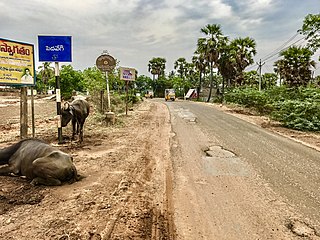
Pedavegi is a village in West Godavari district in the state of Andhra Pradesh in India, 10 km north of Eluru. It is administered under Eluru revenue division. Pedavegi also serves as the mandal headquarters of Pedavegi mandal. The nearest railway station is Denduluru (DEL) located at a distance of 9.15 km.
Vijayarai is a village in West Godavari district of the Indian state of Andhra Pradesh. It is located in Pedavegi mandal of Eluru revenue division. It is located at a distance of 15 km from district headquarters Eluru city.
Ramasingavaram is a village in West Godavari district of the Indian state of Andhra Pradesh. It is located in Pedavegi mandal of Eluru revenue division. Eluru is the nearest railway station located at a distance of more than 10 Km from Ramasingavaram.

Denduluru is a village in the West Godavari district of the Indian state of Andhra Pradesh. It is located on the north-east side of district headquarters Eluru at a distance of 11 km. It is a member of the Eluru revenue division. The Bhimalingadibba or the mounds are one of the centrally protected monuments of national importance.
Guntupalle is a village in West Godavari district of the Indian state of Andhra Pradesh. It is located in Kamavarapukota mandal of Eluru revenue division. It is located at a distance of 42 km from district headquarters Eluru city. It is well known tourist destination famously known for Guntupalli caves.The nearest train station is Eluru railway station.
Tadikalapudi is a village in West Godavari district of the Indian state of Andhra Pradesh. It is located in Kamavarapukota mandal of Eluru revenue division. It is located at a distance of 26 km from district headquarters Eluru city.
Somavarappadu is a village in West Godavari district of the Indian state of Andhra Pradesh. It is located to the north of district headquarters Eluru at a distance of 6 km. It is under Eluru revenue division.

Galayagudem is a village in West Godavari district of the Indian state of Andhra Pradesh. It is located on the north side of district headquarters Eluru at a distance of 10 km. It is under of Eluru revenue division. The nearest train station is Denduluru(DEL) located at a distance of 5.44 Km.
Komatilanka is a village in West Godavari district in the state of Andhra Pradesh in India. The nearest railway station is Kaikolur (KKLR) located at a distance of 4.57 km.
Sreeparru is a village in West Godavari district in the state of Andhra Pradesh in India. It is 22 km from the city of Eluru, the headquarters of West Godavari Dist.
Velivennu is a second largest village in Undrajavaram mandal, West Godavari district of the Indian state of Andhra Pradesh. It is located in between Tanuku and Nidadavole at a equidistant distance of 12 km and 82 km from Eluru. It is under of Kovvur revenue division.
Vanguru is a village in West Godavari district of the Indian state of Andhra Pradesh. It is located in Pedavegi mandal of Eluru revenue division. It is located at a distance of 4 km from district headquarters Eluru city.
Kalaparru is a village in West Godavari district of the Indian state of Andhra Pradesh. It is located in Pedapadu mandal of Eluru revenue division. It is located at a distance of 13 km from district headquarters Eluru city. The nearest train station is Vatlur railway station located at a distance of 3.89 Km.
Pinakadimi is a village in West Godavari district of the Indian state of Andhra Pradesh. It is located in Pedavegi mandal of Eluru revenue division. It is located at a distance of 7 km from district headquarters Eluru city.
Dondapadu is a village in West Godavari district of the Indian state of Andhra Pradesh. It is located in Pedavegi mandal of Eluru revenue division. It is located at a distance of 5 km from district headquarters Eluru city.
Rayannapalem' is a village in West Godavari district of the Indian state of Andhra Pradesh. It is located in Pedavegi mandal of Eluru revenue division. is located about 11 miles from Eluru. The nearest railway station is POWERPET railway station and ELURU railway station located at a distance of more than 10 Km.
Ganapavaram mandal is one of the 48 mandals in West Godavari district of the Indian state of Andhra Pradesh. It is under the administration of Eluru revenue division and the headquarters are located at Ganapavaram. Ganapavaram Mandal is bounded by Nidamarru Mandal towards west, Pentapadu Mandal towards North, Undi Mandal towards South, Unguturu Mandal towards North. Tadepalligudem, Bhimavaram, Tanuku, Eluru are the nearby Cities to Ganapavaram. It is located 55 km from Eluru and 22 km from Bhimavaram.
Eduru is a village in West Godavari district in the state of Andhra Pradesh in India. The nearest railway station is at Krishnapatnam (KAPT) located at a distance of 15.83 Km

