
Central Asia stretches from the Caspian Sea in the west to China in the east and from Afghanistan in the south to Russia in the north. The region consists of the former Soviet republics of Kazakhstan, Kyrgyzstan, Tajikistan, Turkmenistan, and Uzbekistan. It is also colloquially referred to as "the stans" as the countries generally considered to be within the region all have names ending with the Persian suffix "-stan", meaning "land of".

Belukha Mountain, located in the Katun Mountains, is the highest peak of the Altai Mountains in Russia. It is part of the World Heritage Site entitled Golden Mountains of Altai.
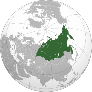
North Asia or Northern Asia, sometimes also referred to as Siberia or Eurasia, is partly a subregion of Asia, consisting of the Russian regions east of the Ural Mountains: Siberia, Ural and the Russian Far East. The region is sometimes also known as Asian Russia. North Asia is bordered to the north by the Arctic Ocean, to the west by Eastern Europe, to the south by Central and East Asia and to the east by the Pacific Ocean and North America. North Asia covers an area of approximately 13,100,000 square kilometres (5,100,000 sq mi) or 8.8% of the earth's land area, or 1.5 times the size of Brazil. It is the largest subregion of Asia by area, but is also the least populated, with an approximate total population of only 33 million people or 0.74% of Asia’s population. North Asia is solely administrated by Russia, and makes up more than 75% of the territory of the country, but only 22% of its population, at a density of 2.5 people per km2. The region of Western Siberia and occasionally Kazakhstan is usually called Northwestern Asia or Northwest Asia;, although the name sometimes refers to Caucasus or nearby provinces.

Wuzhi Mountain is the highest mountain in Hainan, China, towering 1,840 metres (6,040 ft) above the center of Hainan Island. The surrounding areas of Wuzhi Mountain are inhabited mainly by the Li ethnic group. It is located adjacent to Wuzhishan City but is not part of that city's administrative area.

Khan Tengri is a mountain of the Tian Shan mountain range. It is located on the China—Kyrgyzstan—Kazakhstan border, east of lake Issyk Kul. Its geologic elevation is 6,995 m (22,949 ft), but its glacial cap rises to 7,010 m (22,999 ft). For this reason, in mountaineering circles, including for the Soviet Snow Leopard award criteria, it is considered a 7,000-metre peak. The name "Khan Tengri" literally means "King Heaven" in Kazakh and possibly references the deity Tengri. In some other local languages, it is known as Khan Tangiri Shyngy, Kan-Too Chokusu, Pik Khan-Tengry, and Hantengri Feng.

Alatau or Ala-Too is a generic name for a number of mountain ranges in Central Asia, characterized by interleaving areas of vegetation, scattered rocks and snows.

Pik Talgar is a northern peak in the Tian Shan mountain range in Kazakhstan, named after Talgar river and city. It is the highest peak of the Trans-Ili Alatau. Due to its close proximity to the former capital of Kazakhstan, Almaty, it is a popular mountaineering destination. Sources differ on Pik Talgar's elevation, but the 4,979 m height is widely quoted.

The Eurasian Steppe, also called the Great Steppe or the steppes, is the vast steppe ecoregion of Eurasia in the temperate grasslands, savannas, and shrublands biome. It stretches from Bulgaria, Romania and Moldova through Ukraine, Russia, Kazakhstan, Xinjiang, and Mongolia to Manchuria, with one major exclave, the Pannonian steppe or Puszta, located mostly in Hungary and partially in Serbia and Croatia.

Huangmaojian is a 1,930-meter (6,330 ft) mountain in Longquan County in southwest of Zhejiang province in eastern China. The mountain is the highest peak of Zhejiang and part of the Wuyi Mountains that have their bulk in Fujian province. Huangmaojian is an ultra prominent peak. The mountain is located within the Fengyangshan–Baishanzu National Nature Reserve.

An ultra-prominent peak, or Ultra for short, is a mountain summit with a topographic prominence of 1,500 metres (4,900 ft) or more; it is also called a P1500. There are approximately 1,524 such peaks on Earth. Some peaks, such as the Matterhorn and Eiger, are not Ultras because they are connected to higher mountains by high cols and therefore do not achieve enough topographic prominence.
Sauyr Zhotasy, also known as Muz Tau, is the highest point in the Saur Range, and of the entire Saur-Tarbagatai mountain system, part of the Tien Shan, on the border between Kazakhstan and China. It lies 100 kilometres (60 mi) southeast of Zaysan Lake. Despite its low elevation, it is well separated from higher ranges in its area ; it is therefore ranked highly by topographic prominence.

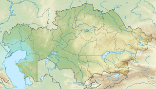
The following outline is provided as an overview of and topical guide to Kazakhstan:
Kazakhstania, the Kazakh terranes, or the Kazakhstan Block, is a geological region in Central Asia which consists of the area roughly centered on Lake Balkhash, north and east of the Aral Sea, south of the Siberian craton and west of the Altai Mountains. The Junggar basin in Xinjiang, China is also part of Kazakhstania, though sometimes referred to as the Junggar Block. Because the Kazakh terranes merged during the Late Ordovician as part of the Central Asian Orogenic Belt they are also referred to as the Kazakh Orogen. These terranes are located in what is today Kazakhstan, north-eastern Uzbekistan, northern Kyrgyzstan, south-western China. Today Kazakhstania is surrounded by three large, former continents: to the north-east the Gornostaev Shear Zone separates it from Siberia with which it collided during the Carboniferous; to the north-west is Baltica which lay adjacent to the Kazakh Tourgai terrane but far away from Kazakhstania; to the south and east was Gondwana stretching from the South Pole to the Equator. Not far away from the dispersed Kazakh terranes were South China, North China, and Tarim, but how these continental blocks were positioned relative to Gondwana is not known.

Khuvkhoitun sometimes referred to as Gora Khuvkhoitun is a stratovolcano located on Russia's Kamchatka Peninsula. The mountain reaches 2,616 m in elevation above sea level.

Kurumdy Mountain is a mountain in the Pamir Mountains of Central Asia, in the eastern section of the Transalai Range. Kurumdy has an elevation of 6,614 metres above sea level and sits on the international border between Kyrgyzstan and Tajikistan and China.

Mönkh Saridag is the highest mountain in the Sayan Mountains of Asia. It is 3,491 metres (11,453 ft) tall and is on the international border between Mongolia and Russia. It is also the highest mountain in Buryatia and the highest mountain in Mongolia's Khövsgöl Province. On the southern side, the tree line is at 2000 meters, on the northern side at 2200 meters.
Below is the list of Kazakhstan related articles.
Barak Kol or Baraq Lake is a lake in Ulytau District, Karaganda Region, of central Kazakhstan between the mountains Gora Akdongul and Gora Baygetobe. Köl is the word for lake in Turkic languages, and Baraq was a khan of the Chagatai Khanate, a great-great-grandson of Genghis Khan.


