Karakum Desert
| No | Peak | Country | Elevation (m) | Prominence (m) | Col (m) |
|---|---|---|---|---|---|
| 1 | Gora Arlan | 1,880 | 1,748 | 132 | |
This is a list of the Ultra prominent peaks (with topographic prominence greater than 1,500 metres) in Central Asia. The list is divided topographically rather than politically. There are 75 in total; 21 in the Pamirs, 1 in the Karakum, 5 in the Alays, 24 in the Tian Shan and 24 in the Altai and Mongolia.
| No | Peak | Country | Elevation (m) | Prominence (m) | Col (m) |
|---|---|---|---|---|---|
| 1 | Gora Arlan | 1,880 | 1,748 | 132 | |


| No | Peak | Country | Elevation (m) | Prominence (m) | Col (m) |
|---|---|---|---|---|---|
| 1 | Kongur Tagh | 7,649 | 3,585 | 4064 | |
| 2 | Ismoil Somoni Peak | 7,495 | 3,402 | 4093 | |
| 3 | Chakragil | 6,760 | 2,934 | 3826 | |
| 4 | Ibn Sina Peak | 7,134 | 2,790 | 4344 | |
| 5 | Muztagh Ata | 7,509 | 2,698 | 4811 | |
| 6 | Karl Marx Peak | 6,723 | 2,693 | 4030 | |
| 7 | Independence Peak | 6,940 | 2,402 | 4538 | |
| 8 | Pik Sat | 5,900 | 2,302 | 3598 | |
| 9 | Gora Kurumdy | 6,614 | 2,278 | 4336 | |
| 10 | Kuh-i Belandtarin | 6,286 | 2,008 | 4278 | |
| 11 | Soviet Officers Peak | 6,233 | 1,982 | 4251 | |
| 12 | Patkhor Peak | 6,083 | 1,963 | 4120 | |
| 13 | Gora Radzhi-Bek | 5,735 | 1,940 | 3795 | |
| 14 | Gora Imeni Fuchika | 4,573 | 1,686 | 2887 | |
| 15 | Lyavirdyr | 6,361 | 1,676 | 4685 | |
| 16 | Peak Korzhenevskaya | 7,105 | 1,650 | 5455 | |
| 17 | Pik Agasis | 5,877 | 1,597 | 4280 | |
| 18 | HP Petra Pervogo Range | 4,745 | 1,571 | 3174 | |
| 19 | Qullai Arnavad | 5,992 | 1,570 | 4422 | |
| 20 | Point 5859 | 5,859 | 1,569 | 4290 | |
| 21 | Gora Bogchigir | 5,780 | 1,508 | 4272 | |
| No | Peak | Country | Elevation (m) | Prominence (m) | Col (m) |
|---|---|---|---|---|---|
| 1 | Chimtarga | 5,490 | 2,266 | 3224 | |
| 2 | Pik Skalisty | 5,621 | 2,095 | 3526 | |
| 3 | Pik MGU | 5,418 | 1,825 | 3593 | |
| 4 | Pik Tandykul | 5,544 | 1,677 | 3867 | |
| 5 | Ayrybaba | 3,138 | 1,639 | 1498 | |
| No | Peak | Country | Elevation (m) | Prominence (m) | Col (m) |
|---|---|---|---|---|---|
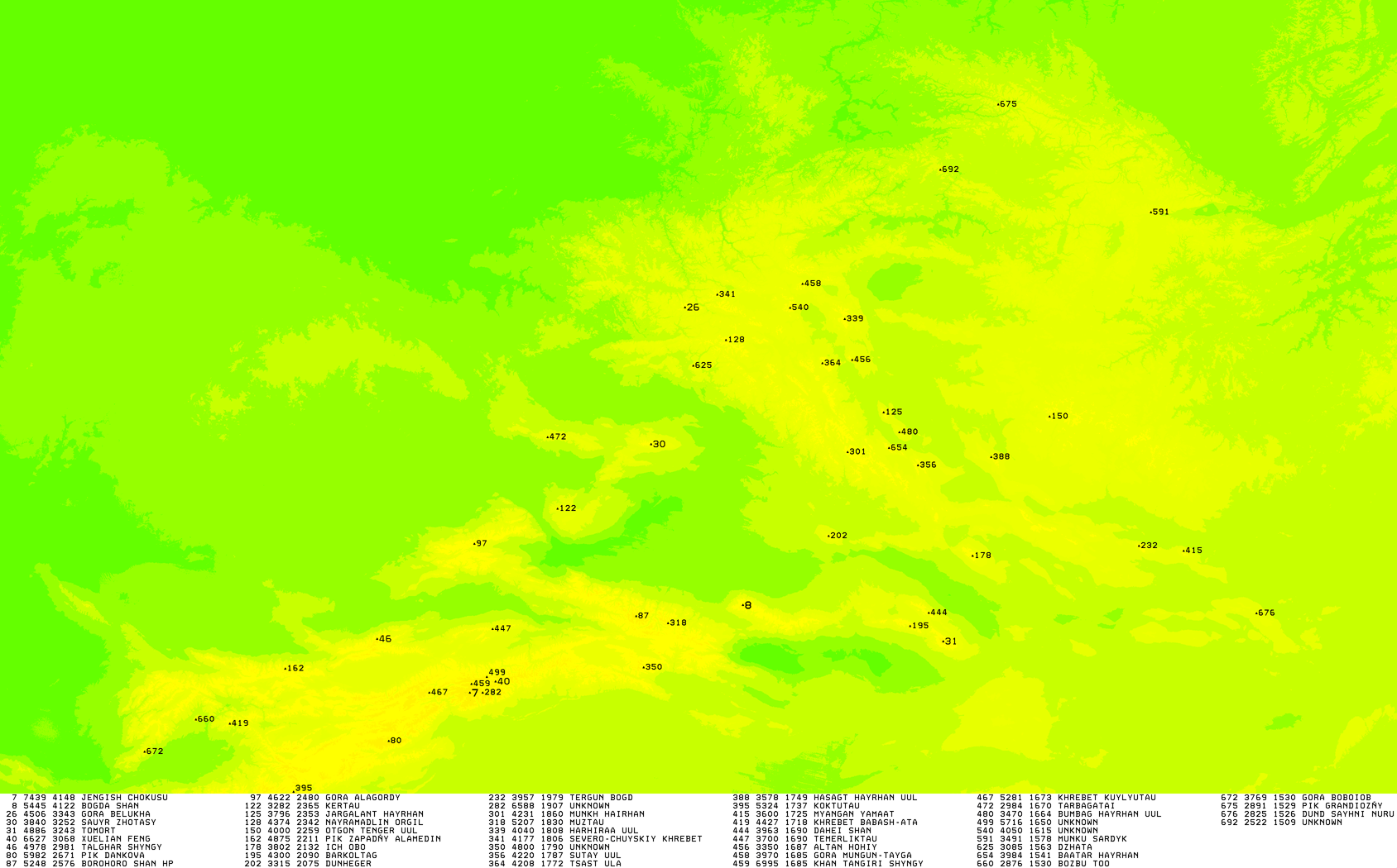
| 1 | Jengish Chokusu | 7,439 | 4,148 | 3291 | |
| 2 | Bogda Feng | 5,445 | 4,122 | 1323 | |
| 3 | Sauyr Zhotasy | 3,840 | 3,252 | 588 | |
| 4 | Tomort | 4,886 | 3,243 | 1643 | |
| 5 | Snow Lotus Peak | 6,627 | 3,068 | 3559 | |
| 6 | Pik Talgar | 4,979 | 2,982 | 1997 | |
| 7 | Pik Dankova | 5,982 | 2,675 | 3307 | |
| 8 | Heyuan Feng | 5,289 | 2,616 | 2673 | |
| 9 | Gora Alagordy | 4,622 | 2,480 | 2142 | |
| 10 | Kertau | 3,282 | 2,365 | 917 | |
| 11 | Semenov-Tian-Shansky Peak | 4,895 | 2,231 | 2664 | |
| 12 | Barkol Shan | 4,300 | 2,083 | 2217 | |
| 13 | Muzart | 6,571 | 1,822 | 4749 | |
| 14 | HP Borohoro Shan | 5,248 | 1,871 | 3377 | |
| 15 | Point 4800 | 4,800 | 1,796 | 3004 | |
| 16 | Koktutau | 5,324 | 1,737 | 3587 | |
| 17 | Temerliktau | 3,730 | 1,718 | 2012 | |
| 18 | Gora Babash-Ata | 4,428 | 1,708 | 2720 | |
| 19 | Yanamax | 6,357 | 1,702 | 4655 | |
| 20 | Dahei Shan | 3,963 | 1,692 | 2271 | |
| 21 | Khan Tengri | 7,010 | 1,685 | 5310 | |
| 22 | Gora Tastau | 2,993 | 1,679 | 1314 | |
| 23 | Soviet Constitution Peak | 5,281 | 1,673 | 3608 | |
| 24 | Point 5716 | 5,716 | 1,646 | 4070 | |
| 25 | Point 5318 | 5,318 | 1,563 | 3755 | |
| 25 | Bozbu Too | 2,875 | 1,529 | 1346 | |
| 26 | Gora Boboiob | 3,770 | 1,502 | 2268 | |

| No | Peak | Country | Elevation (m) | Prominence (m) | Col (m) |
|---|---|---|---|---|---|
| 1 | Belukha Mountain | 4,506 | 3,343 | 1163 | |
| 2 | Jargalant Hairhan | 3,796 | 2,353 | 1443 | |
| 3 | Khüiten Peak | 4,374 | 2,342 | 2023 | |
| 4 | Otgontenger | 4,000 | 2,259 | 1741 | |
| 5 | Aj Bogd | 3,802 | 2,132 | 1670 | |
| 6 | Dunheger | 3,315 | 2,075 | 1240 | |
| 7 | Ikh Bogd | 3,957 | 1,979 | 1978 | |
| 8 | Mönkh Hairhan | 4,231 | 1,860 | 2371 | |
| 9 | Harhiraa | 4,040 | 1,808 | 2232 | |
| 10 | Maasheybash | 4,177 | 1,806 | 2371 | |
| 11 | Sutai | 4,220 | 1,787 | 2433 | |
| 12 | Tsambagarav | 4,193 | 1,757 | 2436 | |
| 13 | Hasagt Hairhan | 3,578 | 1,749 | 1829 | |
| 14 | Baga Bogd | 3,600 | 1,725 | 1875 | |
| 15 | Altan Hohiy | 3,350 | 1,687 | 1663 | |
| 16 | Gora Mungun-Tayga | 3,970 | 1,685 | 2285 | |
| 17 | Bumbag Khairkhan | 3,470 | 1,664 | 1806 | |
| 18 | Türgen | 4,029 | 1,594 | 2435 | |
| 19 | Mönkh Saridag | 3,491 | 1,578 | 1913 | |
| 20 | Dzhata | 3,085 | 1,560 | 1525 | |
| 21 | Baatar Khairkhan | 3,984 | 1,541 | 2443 | |
| 22 | Pik Grandioznyy | 2,891 | 1,529 | 1362 | |
| 23 | Dund Saihny Nuruu | 2,825 | 1,526 | 1299 | |
| 24 | HP Khrebet Baldyrgannyg | 2,522 | 1,509 | 1013 | |

Central Asia is a subregion of Asia that stretches from the Caspian Sea in the west to China and Mongolia in the east, and from Afghanistan and Iran in the south to Russia in the north. The region consists of the former Soviet republics of Kazakhstan, Kyrgyzstan, Tajikistan, Turkmenistan, and Uzbekistan. It is also colloquially referred to as "The -Stans" as the countries all have names ending with the Persian suffix "-stan", meaning "land of".

Mongolia is a landlocked country in East Asia, bordered by Russia to the north and China to the south. It covers an area of 1,564,116 square kilometres, with a population of just 3.3 million, making it the world's most sparsely populated sovereign nation. Mongolia is the world's largest landlocked country that does not border a closed sea, and much of its area is covered by grassy steppe, with mountains to the north and west and the Gobi Desert to the south. Ulaanbaatar, the capital and largest city, is home to roughly half of the country's population.

Mongolia is a landlocked country in Central Asia and East Asia, located between China and Russia. The terrain is one of mountains and rolling plateaus, with a high degree of relief. The total land area of Mongolia is 1,564,116 square kilometres. Overall, the land slopes from the high Altai Mountains of the west and the north to plains and depressions in the east and the south. The Khüiten Peak in extreme western Mongolia on the Chinese border is the highest point. The lowest point is at 560 m (1,840 ft), is the Hoh Nuur or lake Huh. The country has an average elevation of 1,580 m (5,180 ft).

China is a country located in East Asia with an area of 9,596,960 km2 (3,705,410 sq mi). The exact land area can sometimes be challenged by border disputes, including those concerning Taiwan, Aksai Chin, the Trans-Karakoram Tract, the South China Sea Islands, the Senkaku Islands, and South Tibet. As sovereignty over Hong Kong and Macau were restored to China in 1997 and 1999, two special administrative regions were established under the One Country, Two Systems policy. The People's Republic of China is either the third or fourth largest country in the world, being either slightly larger or slightly smaller than the United States depending on how the area of the United States is measured.

The Karakoram is a mountain range in Kashmir spanning the borders of Pakistan, China, and India, with the northwest extremity of the range extending to Afghanistan and Tajikistan. Most of Karakorum mountain range falls under jurisdiction of Gilgit-Baltistan which is controlled by Pakistan. Its highest peak, K2, is located in Gilgit-Baltistan. It begins in the Wakhan Corridor (Afghanistan) in the west, encompasses the majority of Gilgit-Baltistan, and extends into Ladakh and Aksai Chin. It is the second highest mountain range in the world and part of the complex of ranges including the Pamir Mountains, the Hindu Kush and the Himalayan Mountains. The Karakoram has eighteen summits over 7,500 m (24,600 ft) height, with four of them exceeding 8,000 m (26,000 ft): K2, the second highest peak in the world at 8,611 m (28,251 ft), Gasherbrum I, Broad Peak and Gasherbrum II.
The Treaty of Kyakhta, along with the Treaty of Nerchinsk (1689), regulated the relations between Imperial Russia and the Qing Empire of China until the mid-19th century. It was signed by Tulišen and Count Sava Lukich Raguzinskii-Vladislavich at the border city of Kyakhta on 23 August 1727.

St. Kliment Ohridski Base is a Bulgarian Antarctic base on Livingston Island in the South Shetland Islands.

Operation Chahar, known in Chinese as the Nankou Campaign, occurred in August 1937, following the Battle of Beiping-Tianjin at the beginning of Second Sino-Japanese War.

The Eurasian Steppe, also simply called the Great Steppe or the steppes, is the vast steppe ecoregion of Eurasia in the temperate grasslands, savannas, and shrublands biome. It stretches through Hungary, Bulgaria, Romania, Moldova and Transnistria, Ukraine, Western Russia, Siberia, Kazakhstan, Xinjiang, Mongolia, and Manchuria, with one major exclave, the Pannonian steppe or Puszta, located mostly in Hungary.

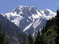
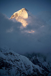
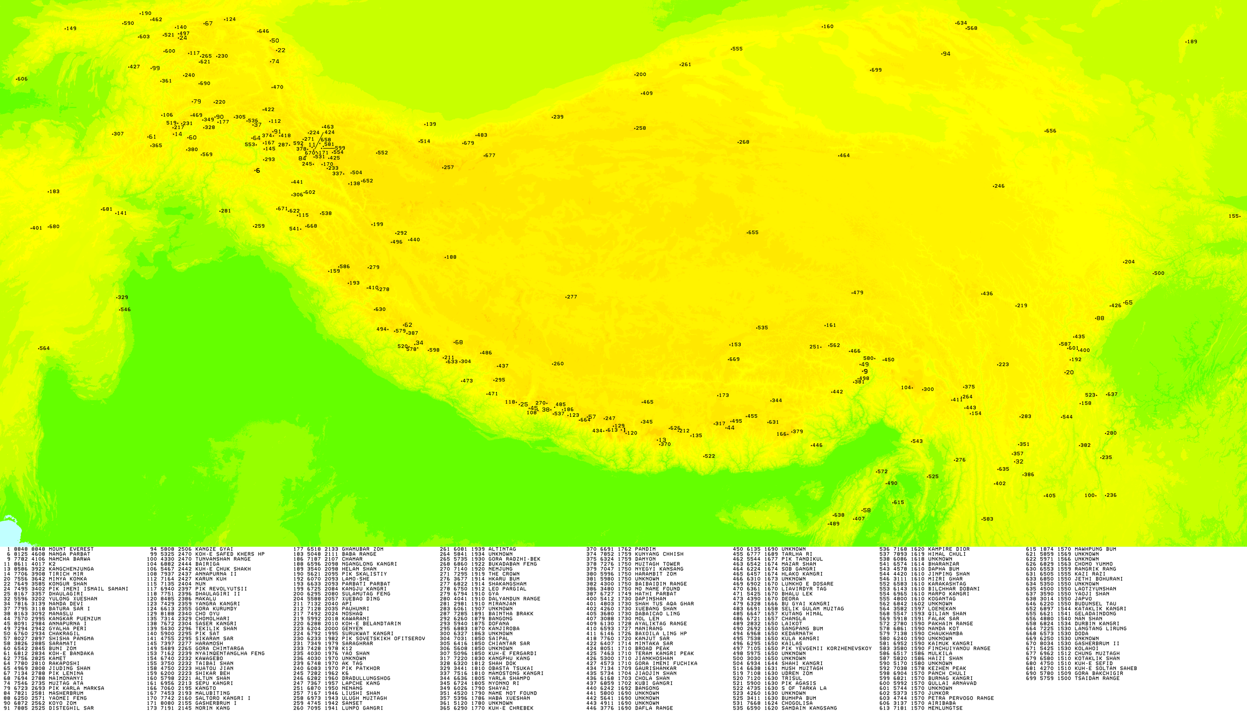
An ultra-prominent peak, or Ultra for short, is a mountain summit with a topographic prominence of 1,500 metres (4,900 ft) or more; it is also called a P1500. The prominence of a peak is the minimum height of climb to the summit on any route from a higher peak, or from sea level if there is no higher peak. There are approximately 1,524 such peaks on Earth. Some well-known peaks, such as the Matterhorn and Eiger, are not Ultras because they are connected to higher mountains by high cols and therefore do not achieve enough topographic prominence.

Pan-Mongolism is an irredentist idea that advocates cultural and political solidarity of Mongols. The proposed territory, called "Greater Mongolia", Also known as :which means "Whole Mongolia" usually includes the independent state of Mongolia, the Chinese regions of Inner Mongolia and Dzungaria, and the Russian republic of Buryatia. Sometimes the autonomous republic Tuva, the Altai Republic and parts of Zabaykalsky Krai and Irkutsk Oblast are included as well. As of 2006, all areas in Greater Mongolia except Mongolia have non-Mongol majorities.

Khüiten Peak, also known in China as Friendship Peak, is the highest peak with 4,356 m above sea level and a permanent snow cap in the Altai Range, the international border between China and Mongolia runs across its summit point. It is also the highest point of Mongolia and Altay Prefecture in Western China.
The Republic of China did not recognize Outer Mongolia until 1945; neither country exchanged diplomats between 1946 and 1949. At the end of the Chinese Civil War in 1949, Mongolia recognized the People's Republic of China and the Republic of China retreated to the island of Taiwan. The Republic of China continued to show Mongolia as part of its territory on official maps until 2002 when they recognized Mongolia as an independent country, and informal relations were established between the two sides.

The Mongolia national football team represents Mongolia in international football under the control of the Mongolian Football Federation (MFF). Founded in 1959, the federation was inactive between 1961 and 1997 and the men's national team did not feature in any international fixtures during that time. The federation was reorganised in 1997 and joined the AFC the same year. In 1998 the federation became a full member of FIFA, the international governing body for the sport. The MFF joined the EAFF as one of eight founding members in May 2002. Because of the harsh climate and a lack of suitable venues, the team has hosted few home matches in the past. However, in 2002 the MFF, with assistance from FIFA, began developing facilities in the country, including the creation of the 5,000-seat MFF Football Centre, which will allow the team to play more matches in Mongolia. About Mongolia's relatively low number of matches played, former national team player and coach Zorigtyn Battulga said, "Lack of games is a problem. No one will come to Mongolia in December and for us to fly to other countries is very expensive so it’s hard to arrange official matches."

Otgontenger is the highest peak in the Khangai Mountains in Mongolia. Its summit is currently calculated to reach an elevation of 4,008 meters above mean sea level. The mountain is located in Zavkhan Province and is the only peak in the Khangai range that is capped with a permanent glacier. The south face of Mount Otgontenger is the most extensive granite wall in Mongolia.

The Chinese–Russian border or the Sino-Russian border is the international border between China and the Asian portion of Russia. After the final demarcation carried out in the early 2000s, it measures 4,209.3 kilometres (2,615.5 mi), and is the world's sixth-longest international border.

Nora Nature Reserve is a Russian 'zapovednik' on the northeastern part of the Amur-Zeya lowland plain between the Nora River and the Selemdzha River. The reserve is known for its herd of Norsk roe deer, the largest migrating herd in the world, with 5,000-7,000 individuals migrating through every September. The terrain is half forested, and half wetland and bogs, in the meeting zone between Siberian, Okhotsk, and Mongolian plant and animal communities. The reserve is situated in the Selemdzhinsky District of Amur Oblast.