List of Ultras of Central America

Last updated

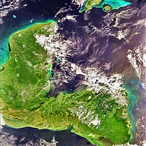
The following sortable table comprises the 23 ultra-prominent summits of Central America . Each of these peaks has at least 1500 meters (4921 feet) of topographic prominence. [1] This article defines Central America as the seven nations of Belize, Costa Rica, El Salvador, Guatemala, Honduras, Nicaragua, and Panamá.

Contents

The summit of a mountain or hill may be measured in three principal ways:

  1. The topographic elevation of a summit measures the height of the summit above a geodetic sea level. [2]
  2. The topographic prominence of a summit is a measure of how high the summit rises above its surroundings. [3] [2]
  3. The topographic isolation (or radius of dominance) of a summit measures how far the summit lies from its nearest point of equal elevation. [4]


Ultra-prominent summits

Map this section's coordinates using: OpenStreetMap  
Download coordinates as: KML

Of these 23 ultra-prominent summits of Central America, eight are located in Honduras, six in Guatemala, four in El Salvador, three in Costa Rica, two in Nicaragua, and one in Panamá. Cerro El Pital straddles the border between El Salvador and Honduras.

The 23 ultra-prominent summits of Central America

Rank Mountain Peak Nation Mountain Range Elevation Prominence Isolation Location
1 Volcán Tajumulco [5] [lower-alpha 1] [lower-alpha 2] Flag of Guatemala.svg  Guatemala Sierra de las Nubes 4220 m
13,845 ft
3990 m
13,091 ft
722 km
448 mi
15°02′35″N91°54′13″W / 15.0430°N 91.9037°W / 15.0430; -91.9037 (Volcán Tajumulco)
2 Chirripó Grande [6] [lower-alpha 3] [lower-alpha 4]
(Cerro Chirripó)
Flag of Costa Rica.svg  Costa Rica Cordillera de Talamanca 3819 m
12,530 ft
3755 m
12,320 ft
878 km
546 mi
9°29′03″N83°29′20″W / 9.4843°N 83.4889°W / 9.4843; -83.4889 (Chirripó Grande)
3 Montaña de Santa Bárbara [7] Flag of Honduras.svg  Honduras Santa Bárbara 2744 m
9,003 ft
2084 m
6,837 ft
74 km
46 mi
14°54′49″N88°06′52″W / 14.9137°N 88.1145°W / 14.9137; -88.1145 (Montaña de Santa Bárbara)
4 Cerro Las Minas [8] [lower-alpha 5] Flag of Honduras.svg  Honduras Sierra de las Nubes 2849 m
9,347 ft
2069 m
6,788 ft
132 km
82 mi
14°32′02″N88°40′49″W / 14.5340°N 88.6804°W / 14.5340; -88.6804 (Cerro Las Minas)
5 Volcán de Agua [9] Flag of Guatemala.svg  Guatemala Escuintla 3761 m
12,339 ft
1981 m
6,499 ft
14.86 km
9.23 mi
14°27′55″N90°44′34″W / 14.4654°N 90.7428°W / 14.4654; -90.7428 (Volcán de Agua)
6 Volcán Irazú [10] Flag of Costa Rica.svg  Costa Rica Cordillera Central, Costa Rica 3432 m
11,260 ft
1897 m
6,224 ft
47.8 km
29.7 mi
9°58′35″N83°51′12″W / 9.9764°N 83.8534°W / 9.9764; -83.8534 (Volcán Irazú)
7 Alto Cuchumatanes [11] [lower-alpha 6] Flag of Guatemala.svg  Guatemala Huehuetenango 3837 m
12,589 ft
1877 m
6,158 ft
65.2 km
40.5 mi
15°31′06″N91°32′40″W / 15.5182°N 91.5445°W / 15.5182; -91.5445 (Alto Cuchumatanes)
8 Montañas Peña Blanca [12] Flag of Guatemala.svg  Guatemala Sierra Madre de Chiapas 3518 m
11,542 ft
1858 m
6,096 ft
39.8 km
24.7 mi
15°29′59″N91°54′54″W / 15.4996°N 91.9151°W / 15.4996; -91.9151 (Montañas Peña Blanca)
9 Volcán Acatenango [13] [lower-alpha 7] Flag of Guatemala.svg  Guatemala Chimaltenango 3975 m
13,041 ft
1835 m
6,020 ft
125.9 km
78.2 mi
14°30′06″N90°52′32″W / 14.5016°N 90.8755°W / 14.5016; -90.8755 (Volcán Acatenango)
10 Volcán San Miguel [14] Flag of El Salvador.svg  El Salvador Sierra Madre de Chiapas 2131 m
6,991 ft
1831 m
6,007 ft
64.1 km
39.8 mi
13°26′05″N88°16′09″W / 13.4348°N 88.2691°W / 13.4348; -88.2691 (Volcán San Miguel)
11 Cerro Tacarcuna [15] [lower-alpha 8] Flag of Panama.svg  Panama Darién 1875 m
6,152 ft
1770 m
5,807 ft
174.4 km
108.3 mi
8°09′57″N77°17′45″W / 8.1659°N 77.2959°W / 8.1659; -77.2959 (Cerro Tacarcuna)
12 Volcán Atitlán [16] Flag of Guatemala.svg  Guatemala Sierra Madre de Chiapas 3537 m
11,604 ft
1754 m
5,755 ft
33.2 km
20.6 mi
14°35′00″N91°11′11″W / 14.5834°N 91.1864°W / 14.5834; -91.1864 (Volcán Atitlán)
13 Pico Bonito [17] [lower-alpha 9] Flag of Honduras.svg  Honduras Cordillera Nombre de Dios 2450 m
8,038 ft
1710 m
5,610 ft
151 km
93.8 mi
15°33′27″N86°52′32″W / 15.5575°N 86.8756°W / 15.5575; -86.8756 (Pico Bonito)
14 Montaña San Ildefonso [18] Flag of Honduras.svg  Honduras Cortés 2242 m
7,356 ft
1702 m
5,584 ft
68.6 km
42.7 mi
15°31′00″N88°14′00″W / 15.5167°N 88.2333°W / 15.5167; -88.2333 (Montaña San Ildefonso)
15 Volcán San Cristóbal [19] Flag of Nicaragua.svg  Nicaragua Cordillera Los Maribios 1745 m
5,725 ft
1665 m
5,463 ft
134.5 km
83.6 mi
12°42′09″N87°00′21″W / 12.7026°N 87.0057°W / 12.7026; -87.0057 (Volcán San Cristóbal)
16 Volcán de Santa Ana [20] Flag of El Salvador.svg  El Salvador Sierra Madre de Chiapas 2362 m
7,749 ft
1602 m
5,256 ft
69.1 km
42.9 mi
13°51′21″N89°37′44″W / 13.8557°N 89.6288°W / 13.8557; -89.6288 (Volcán de Santa Ana)
17 Volcán Concepción [21] Flag of Nicaragua.svg  Nicaragua Rivas 1610 m
5,282 ft
1579 m
5,180 ft
69.6 km
43.3 mi
11°32′17″N85°37′21″W / 11.5380°N 85.6226°W / 11.5380; -85.6226 (Volcán Concepción)
18 Pico Pijol [22] Flag of Honduras.svg  Honduras Yoro 2320 m
7,612 ft
1578 m
5,177 ft
65.1 km
40.4 mi
15°11′00″N87°34′00″W / 15.1833°N 87.5667°W / 15.1833; -87.5667 (Pico Pijol)
19 Volcán de San Vicente [23] Flag of El Salvador.svg  El Salvador Sierra Madre de Chiapas 2182 m
7,159 ft
1562 m
5,125 ft
90.3 km
56.1 mi
13°35′47″N88°50′15″W / 13.5965°N 88.8376°W / 13.5965; -88.8376 (Volcán de San Vicente)
20 Cerro El Pital [24] [lower-alpha 10] Flag of El Salvador.svg  El Salvador
Flag of Honduras.svg  Honduras
Sierra de las Nubes 2730 m
8,957 ft
1530 m
5,020 ft
51.1 km
31.8 mi
14°23′04″N89°07′45″W / 14.3844°N 89.1292°W / 14.3844; -89.1292 (Cerro El Pital)
21 Volcán Miravalles [25] Flag of Costa Rica.svg  Costa Rica Cordillera de Guanacaste 2028 m
6,654 ft
1528 m
5,013 ft
99.4 km
61.8 mi
10°44′49″N85°09′02″W / 10.7469°N 85.1505°W / 10.7469; -85.1505 (Volcán Miravalles)
22 Montaña los Comayagua [26] Flag of Honduras.svg  Honduras Comayagua 2407 m
7,897 ft
1507 m
4,944 ft
80.1 km
49.7 mi
14°30′00″N87°30′00″W / 14.5000°N 87.5000°W / 14.5000; -87.5000 (Montaña los Comayagua)
23 Sierra de Agalta high point [27] Flag of Honduras.svg  Honduras Sierra de Agalta 2335 m
7,661 ft
1505 m
4,938 ft
122.6 km
76.1 mi
14°57′27″N85°54′59″W / 14.9576°N 85.9165°W / 14.9576; -85.9165 (Sierra de Agalta high point)

See also

Notes

  1. The summit of Volcán Tajumulco is the highest point of the Sierra de las Nubes, the Republic of Guatemala, and all of Central America.
  2. Volcán Tajumulco is the southernmost and easternmost 4000-meter (13,123-foot) summit of greater North America.
  3. The summit of Chirripó Grande is the highest point of the Republic of Costa Rica.
  4. Chirripó Grande is the southernmost and easternmost summit of its elevation in Central America and greater North America.
  5. The summit of Cerro Las Minas is the highest point of the Republic of Honduras.
  6. Alto Cuchumatanes is the northernmost 3000-meter (9843-foot) summit of Central America.
  7. Volcán Acatenango is the southernmost and easternmost summit of its elevation in Central America and greater North America.
  8. Cerro Tacarcuna is the southernmost ultra-prominent summit of Central America and greater North America.
  9. Pico Bonito is the northernmost 2000-meter (6562-foot) summit of Central America.
  10. Cerro El Pital on the international border with Honduras is the highest point of the Republic of El Salvador.

Related Research Articles

<span class="mw-page-title-main">Mount Chirripó</span> Highest mountain in Costa Rica

Mount Chirripó is the highest mountain in Costa Rica, with an elevation of 3,821 meters. It is part of the Cordillera de Talamanca, and the range's highest point. It is located in Chirripó National Park and is noted for its ecological wealth. The mountain was named "Chirripo", meaning "land of eternal waters", by indigenous Costa Ricans because there are many lakes and streams around the mountain. The high peaks in Chirripó National Park and La Amistad International Park host important areas of Talamancan montane forest and Costa Rican Páramo with high endemism and extremely high biodiversity. The peaks of these mountains constitute sky islands for many species of plants and animals. Snow has not fallen on the peak in the past 100 years or so, according to the University of Costa Rica, but hail is sometimes reported.

References

  1. This article defines a significant summit as a summit with at least 100 meters (328.1 feet) of topographic prominence, and a major summit as a summit with at least 500 meters (1640 feet) of topographic prominence. An ultra-prominent summit is a summit with at least 1500 meters (4921 feet) of topographic prominence.
  2. 1 2 If the elevation or prominence of a summit is calculated as a range of values, the arithmetic mean is shown.
  3. The topographic prominence of a summit is the topographic elevation difference between the summit and its highest or key col to a higher summit. The summit may be near its key col or quite far away. The key col for Denali in Alaska is the Isthmus of Rivas in Nicaragua, 7642 kilometers (4749 miles) away.
  4. The topographic isolation of a summit is the great-circle distance to its nearest point of equal elevation.
  5. "Volcán Tajumulco". Peakbagger.com. Retrieved 5 May 2016.
  6. "Chirripó Grande". Peakbagger.com. Retrieved 5 May 2016.
  7. "Montaña de Santa Bárbara". Peakbagger.com. Retrieved 5 May 2016.
  8. "Cerro Las Minas". Peakbagger.com. Retrieved 5 May 2016.
  9. "Volcán de Agua". Peakbagger.com. Retrieved 5 May 2016.
  10. "Volcán Irazú". Peakbagger.com. Retrieved 5 May 2016.
  11. "Alto Cuchumatanes". Peakbagger.com. Retrieved 5 May 2016.
  12. "Montañas Peña Blanca". Peakbagger.com. Retrieved 5 May 2016.
  13. "Volcán Acatenango". Peakbagger.com. Retrieved 5 May 2016.
  14. "Volcán San Miguel". Peakbagger.com. Retrieved 5 May 2016.
  15. "Cerro Tacarcuna". Peakbagger.com. Retrieved 5 May 2016.
  16. "Volcán Atitlán". Peakbagger.com. Retrieved 5 May 2016.
  17. "Pico Bonito". Peakbagger.com. Retrieved 5 May 2016.
  18. "Montaña San Ildefonso". Peakbagger.com. Retrieved 5 May 2016.
  19. "Volcán San Cristóbal". Peakbagger.com. Retrieved 5 May 2016.
  20. "Volcán de Santa Ana". Peakbagger.com. Retrieved 5 May 2016.
  21. "Volcán Concepción". Peakbagger.com. Retrieved 5 May 2016.
  22. "Pico Pijol". Peakbagger.com. Retrieved 5 May 2016.
  23. "Volcán de San Vicente". Peakbagger.com. Retrieved 5 May 2016.
  24. "Cerro El Pital". Peakbagger.com. Retrieved 5 May 2016.
  25. "Volcán Miravalles". Peakbagger.com. Retrieved 5 May 2016.
  26. "Montaña los Comayagua". Peakbagger.com. Retrieved 5 May 2016.
  27. "Sierra de Agalta high point". Peakbagger.com. Retrieved 5 May 2016.

Coordinates: 15°02′35″N91°54′13″W / 15.0430°N 91.9037°W / 15.0430; -91.9037 (Volcán Tajumulco)