Central America is a subregion of North America. Its political boundaries are defined as bordering Mexico to the north, Colombia to the south, the Caribbean Sea to the east, and the Pacific Ocean to the west. Central America is usually defined as consisting of seven countries: Belize, Costa Rica, El Salvador, Guatemala, Honduras, Nicaragua, and Panama. Within Central America is the Mesoamerican biodiversity hotspot, which extends from northern Guatemala to central Panama. Due to the presence of several active geologic faults and the Central America Volcanic Arc, there is a high amount of seismic activity in the region, such as volcanic eruptions and earthquakes, which has resulted in death, injury, and property damage.

Temperate broadleaf and mixed forest is a temperate climate terrestrial habitat type defined by the World Wide Fund for Nature, with broadleaf tree ecoregions, and with conifer and broadleaf tree mixed coniferous forest ecoregions.

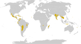
The tropical and subtropical dry broadleaf forest is a habitat type defined by the World Wide Fund for Nature and is located at tropical and subtropical latitudes. Though these forests occur in climates that are warm year-round, and may receive several hundred millimeters of rain per year, they have long dry seasons that last several months and vary with geographic location. These seasonal droughts have great impact on all living things in the forest.

Santa Rosa National Park, is a national park, in Guanacaste Province, northwestern Costa Rica, it was created in 1966 by decree 3694.

The Eastern Mediterranean conifer-sclerophyllous-forests, also known as the Eastern Mediterranean conifer-forests, is an ecoregion in the eastern Mediterranean Basin. It covers portions of Turkey, Syria, Iraq, Lebanon, Israel, Palestinian territories, Jordan, and Saudi Arabia.

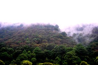
The Talamancan montane forests ecoregion, in the tropical moist broadleaf forest biome, are in montane Costa Rica and western Panama in Central America.

The Petén–Veracruz moist forests is an ecoregion of the tropical and subtropical moist broadleaf forest biome found in Belize, Guatemala, and Mexico.

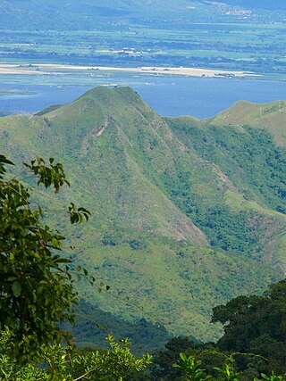
The Cordillera de la Costa montane forests is a montane ecoregion of the tropical and subtropical moist broadleaf forests biome, in the Venezuelan Coastal Range on the Caribbean Sea in northern Venezuela.

The Central American pine–oak forests is a tropical and subtropical coniferous forests ecoregion in the mountains of northern Central America and Chiapas state in southern Mexico.
The Central America bioregion is a biogeographic region comprising southern Mexico and Central America.

The Isthmian–Atlantic moist forests (NT0129) are a Central American tropical moist broadleaf forest ecoregion located on the lowland slopes on the Caribbean Sea side of Nicaragua and Costa Rica and the Gulf and Pacific Ocean sides of Panama. The forest species are a mix of North American and South American, as this region only became a land bridge in the past 3 million years.

The Yucatán moist forests are an ecoregion of the tropical and subtropical moist broadleaf forests biome, as defined by the World Wildlife Fund.

The Central American montane forests are an ecoregion of the tropical and subtropical moist broadleaf forests biome, as defined by the World Wildlife Fund, located in mountains of Central America.

The Chiapas Depression dry forests form one of the ecoregions that belong to the tropical and subtropical dry broadleaf forests biome, as defined by the World Wildlife Fund, in northwestern Central America.

The Ecuadorian dry forests (NT0214) is an ecoregion near the Pacific coast of the Ecuador. The habitat has been occupied by people for centuries and has been severely damaged by deforestation, overgrazing and hillside erosion due to unsustainable agriculture. Only 1% of the original forest remains. The patches of forest, mostly secondary growth, are fragmented. They are home to many endemic species at risk of extinction.

The Eastern Panamanian montane forests (NT0122) is an ecoregion in the east of Panama and the extreme northwest of Colombia. It contains diverse flora and fauna, with considerable endemism. The ecoregion is largely intact due to its inaccessibility, although the opening of an extension of the Pan-American Highway has introduced threats from human activity.

The Veracruz montane forests is a tropical moist broadleaf forest ecoregion in eastern Mexico. It includes a belt of montane tropical forest on the eastern slope of the southern Sierra Madre Oriental and eastern Trans-Mexican Volcanic Belt ranges. These forests lie between the lowland Veracruz moist forests and the pine-oak forests of the higher mountains.

The Sierra Madre de Chiapas moist forests is a tropical moist broadleaf forest ecoregion in southern Mexico and southern Guatemala, extending into the northwestern corner of El Salvador.

The Central American Atlantic moist forests ecoregion covers the lowland coastal forests of Honduras, southeast Guatemala, and the eastern forests of Nicaragua. Half of the ecoregion is closed-canopy tropical broadleaf evergreen forest, with tree heights reaching 50 meters. This ecoregion has the largest single fragment of natural forest in Central America, with a size of 14,629 square kilometres (5,648 sq mi). The total area is 89,979 square kilometres (34,741 sq mi).

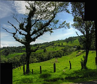
The Costa Rican seasonal moist forests ecoregion covers the Pacific Slope of the volcanic mountain range of northwestern Costa Rica and the extreme south of Nicaragua. The area has a distinct dry season during which the characteristic deciduous trees drop their leaves. The forests themselves have been highly degraded in the past by human conversion to agriculture and settlement. The Costa Rican capital city of San Jose is in the middle of this ecoregion.


