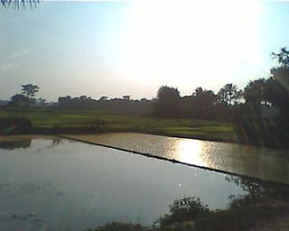
Araria is a city and a municipality that is the headquarters of Araria district in the Indian state of Bihar. Araria is situated in the northern part of Bihar.

Bihar Sharif is the headquarters of Nalanda district and the fifth-largest sub-metropolitan area in the eastern Indian state of Bihar. Its name is a combination of two words: Bihar, derived from vihara, also the name of the state; and Sharif. The city is a hub of education and trade in southern Bihar, and the economy centers around agriculture supplemented by tourism, the education sector and household manufacturing. The ruins of the ancient Nalanda Mahavihara, a UNESCO World Heritage Site, are located near the city.
The Ranvir Sena is a militia functioning as a landlord group, mainly based in the state of Bihar, India. The group was formed by Bhumihar landlords in 1994, with the aim to counter the influence of various left-wing militants, Naxalite groups and the Communist Party of India (Marxist–Leninist) Liberation (CPI-ML) in central Bihar. The Ranvir Sena has been connected to a number of massacres including the massacre at Laxmanpur Bathe. It has, on several occasions, been accused of human rights abuses. The Bihar state government banned the Ranvir Sena in July 1995, but the group continue to remain active. The group has frequently publicly claimed responsibility for its crimes with impunity.
Bhumihars, also locally called Bhuinhar and Babhan, are a Hindu caste mainly found in Bihar, the Purvanchal region of Uttar Pradesh, Jharkhand, the Bundelkhand region of Madhya Pradesh, and Nepal.

Baro Vatra is a village in Gopalganj District, Bangladesh, part of Muksudpur Upazila. The village covers an area of 3.43 km2, and is bordered by the villages of Nanikhir, Nawkhanda, Pathorgatha and Banagram. Baro Vatra's main canal is the Nawkhanda Khall or Nanikhir Khall. The Bil Rout Canal at Jalirpar joins with the main canal, flowing into the river Padma.
Mow is a village in the Gaya district of Bihar, India, on the Gcleaaya-Kurtha Road. It is about 5 km from the city of Tekari and around 35 km from Gaya City.
Nathowal is a village in the Ludhiana district in Punjab, India also known as ‘Faujian da Pind’.
Pakistan is a village located in Purnia district, Bihar, India. It is named after the country of Pakistan in memory of its Muslim residents who migrated to erstwhile East Pakistan after the Partition of India in August 1947. Although the village's district shared a common land border with what was East Pakistan at the time of Partition, its present-day Purnia district does not border Bangladesh. The village today does not have any Muslims or mosques and is mainly populated by Hindu tribals.
Shahbazpur, also known as Khurd-Dhanpura, is a village located in Araria district of the Indian state of Bihar. This village is located near the border of India and Nepal.
Jalalpur is a village in Gaya district, Bihar, India. Jalalpur Village is located in Paluhar panchayat of Tekari block. This village has total 100+ families residing. The population was 2,441 as of the 2011 Indian census. It is only 0.5–1 km from Tekari, a city also in Gaya district.
Babalad or Muttyna Babalad is a village in the southern state of Karnataka, India. It is located in Bijapur taluk of Bijapur district, Karnataka. It is nearly 25 km from the district headquarters, Bijapur. It's one of several small villages near Bijapur.
Sahdullahpur is a village in Bihar in the Vaishali district. It is about five kilometers from the nearest town, Lalganj. The name of its panchayat is the name of the village Sahdullahpur. The village is not so big according to the geographical area. It is expected to be about 650 acres of land acquired by the village. Its north border is shared by Hussaina and Amritpur and its southern border is shared by Jaitipur and Sarariya. The village has its own post office with the pin code 844121.
Kumai is a village in Kumai Bhadon Panchayat in Gaurabauram Block of Darbhanga district in the Indian state of Bihar.

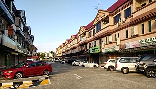
Kampong Kiulap or commonly known as Kiulap, is a village in Brunei-Muara District, Brunei, as well as a neighbourhood and commercial area in the capital Bandar Seri Begawan. It has an area of 176.53 hectares ; the population was 3,400 in 2016. It is one of the villages within Mukim Gadong 'B'. The postcode is BE1518.
Lawapur Narayan is a Village situated in Vaishali District, Bihar, India.
Rajputs in Bihar are members of the Rajput community living in the eastern Indian state Bihar. They are popularly known as Babu Saheb, a term that is mainly used in Bihar, the Purvanchal region of Uttar Pradesh, and Jharkhand. They traditionally formed part of the feudal elite in Bihari society. Rajputs were pressed with the Zamindari abolition and Bhoodan movement in post-independence India; along with other Forward Castes, they lost their significant position in Bihar's agrarian society, leading to the rise of Other Backward Classes (OBCs).

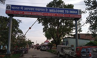
Shrikhandi Bhittha or Bhitthamore is an Indian village in the Mithila region of Bihar, situated near the Indo-Nepal border, on the banks of the perennial Ratnawati (Raato) river.


