Gornji Zagon

Last updated
Gornji Zagon
Gornji Zagon
Croatia location map.svg
Red pog.svg
Gornji Zagon
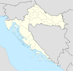
Location of Gornji Zagon in Croatia
Coordinates: 45°10′46″N14°49′38″E / 45.179435°N 14.827151°E / 45.179435; 14.827151
Country Flag of Croatia.svg  Croatia
County Flag of Primorje-Gorski Kotar County.png  Primorje-Gorski Kotar
City Novi Vinodolski
Area
[1]
  Total
27.9 km2 (10.8 sq mi)
Population
 (2021) [2]
  Total
16
  Density0.57/km2 (1.5/sq mi)
Time zone UTC+1 (CET)
  Summer (DST) UTC+2 (CEST)
Postal code [3]
51250 Novi Vinodolski

Gornji Zagon is a settlement in the City of Novi Vinodolski in Croatia. [4] In 2021, its population was 16. [2]

Demographics

Gornji Zagon: Population trends 1857–2021
population
384
467
397
426
431
402
411
487
428
444
324
109
24
11
9
8
16
18571869188018901900191019211931194819531961197119811991200120112021

References

  1. Register of spatial units of the State Geodetic Administration of the Republic of Croatia. Wikidata   Q119585703.
  2. 1 2 "Population by Age and Sex, by Settlements" (xlsx). Census of Population, Households and Dwellings in 2021. Zagreb: Croatian Bureau of Statistics. 2022.
  3. List of Croatian settlements and delivery post offices. Wikidata   Q125763583.
  4. "Zakon o područjima županija, gradova i općina u Republici Hrvatskoj". Narodne novine (in Croatian). Archived from the original on 2023-06-07.