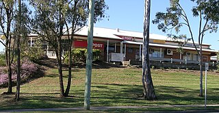
Jimboomba is a town and locality in the City of Logan, Queensland, Australia. In the 2021 census, the locality of Jimboomba had a population of 7,423 people.
Hukuntsi is a village in Kgalagadi District (Kalahari) in Botswana.

Yanchep is an outer coastal suburb of Perth, Western Australia, 56 kilometres (35 mi) north of the Perth CBD. It is a part of the City of Wanneroo local government area. Originally a small crayfishing settlement, it was developed by entrepreneur Alan Bond in the 1970s and 80s for the 1987 America's Cup. The area covers the urban centre of Yanchep as well as Yanchep National Park in its entirety.

Forest Lake is an outer south-western suburb of the City of Brisbane, Queensland, Australia. In the 2021 census, Forest Lake had a population of 22,676 people.
Ncojane or Nojane is a town in the Kalahari desert of Ghanzi District, western Botswana. It is located 20 kilometres from the border with Namibia, and it has a primary School called Ncojane Primary School and secondary school called Marakanelo Community Junior Secondary School and a clinic. The population was 1,439 in 2001 census.
Kunzar, or Kunzer, is a town in the union territory of Jammu and Kashmir located in the District Baramulla. It is 30 km from Srinagar and approximately 32 km from Baramulla town.
Mapoka is a small village in the North-East District of Botswana. Its neighboring villages are Nlapkhwane, Moroka, and Masukwane. The 2001 population and housing census put its population at 1,540.

Lupane ( luːpɑːnɛ) District is located in the Matabeleland North Province of Zimbabwe, and it is also the Provincial Capital. The District is situated at an elevation of 976 m with a population of 107,000 inhabitants by 2022. Lupane Town is the main center of the district located 172 km from Bulawayo along the A8 Victoria Falls Road. The Government Provincial Administrative offices are located at the Town Centre. A new university near the Town has been established under the name Lupane State University, which caters for the region and beyond. The word Lupane is thought to be a Kalanga or Lozwi word.

Kien Svay is a district (srok) of Kandal Province, Cambodia. The district is subdivided into 12 communes (khum): Banteay Daek, Chheu Teal, Dei Edth, Kampong Svay, Kbal Kaoh, Kokir, Kokir Thum, Phum Thum, Preaek Aeng, Preaek Thmei, Samraong Thum, Veal Sbov, and 46 villages (phum).

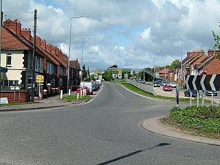
Dordon is a village and civil parish in the North Warwickshire district of the county of Warwickshire in England and close to the border with Staffordshire. The village is located on the A5 national route and is contiguous with the larger village of Polesworth. Other nearby places include Tamworth, Atherstone, Grendon, Wood End Village, Baddesley Ensor and Nuneaton. In 2001 the population for the parish of Dordon was 3,225, reducing slightly to 3,215 at the 2011 census.

Deganga is a community development block that forms an administrative division in North 24 Parganas district in the Indian state of West Bengal.

Nakashipara is a community development block that forms an administrative division in Krishnanagar Sadar subdivision of Nadia district in the Indian state of West Bengal.
Senete is a village in Central District of Botswana. It is located close to the border with Zimbabwe, and has both primary and secondary schools and a health clinic. Senete has a rich cultural heritage where the Bakalanga tribe are also found. The burying people in the hill caves by the Masokandolo people. Senete village is situated twenty kilometres from Tutume village and about 120 km from Francistown. The population was 2,523 in 2001 census.
Nswazwi is a small village in the Central District of Botswana. Located close to the border with Zimbabwe, it is named after the great chief John Nswazwi of Bakalanga people. The population was 1,741 at the 2001 census.
Mosu is a village in Central District of Botswana. The village is located to the south of Sua Pan – the eastern half of Makgadikgadi Pan – and it has a primary school and a junior secondary school namely Mosu Primary School and Makgadikgadi Junior Secondary School respectively. The population was 1,792 in 2011 census. Mosu is also the gateway to Makgadikgadi plains. Village is located on the foot of a hilly landform, exposing the village's terrain to massive soil erosion.
Kalamare is a village in Central District of Botswana. It is located 35 km north-west of Mahalapye. The village has primary called Kalamare Primary School and Kalamare Junior Secondary School and a health clinic. The population was 2,241 in 2001 census.

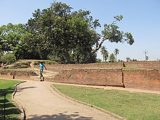
Berdavan is a village on the Kolb River in the Noyemberyan Municipality of the Tavush Province of Armenia. The village is located about 2 km north of the town of Noyemberyan, and near the villages of Dovekh, Koghb and Zorakan. Berdavan Fortress is located on a nearby hilltop.

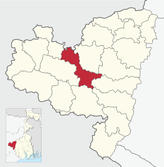
Purulia I is a community development block that forms an administrative division in the Purulia Sadar subdivision of the Purulia district in the Indian state of West Bengal.

East End is a rural locality in the Gladstone Region, Queensland, Australia. In the 2021 census, East End had a population of 88 people.

Akingam is a village in South Kashmir in the Anantnag district, in the Indian union territory of Jammu and Kashmir. It is at a distance of approximately 14.2 kilometres (8.8 mi) from the Lal Chowk along a route passing through the tourist resorts of Achabal and Kokernag. In revenue records, the village of Akingam is still called Maqan Shiva Bhagwati. The adjacent villages are Mohripura, Hiller, Badasgam, Hardpora and Badoora.


