
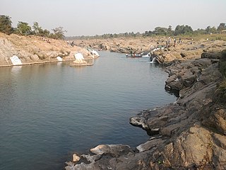
Nawada is a city and a municipality in Bihar, India. It is also the headquarters of the Nawada district. It is the headquarters of the subdivision of the same name, lying on both sides of the Khuri River( also known as Sakri river in some parts) at 24º 53’ N and 85º 33’ E. The name evolved from Nau-wada, meaning the new town. On 26th January 1973, Nawada was formed as a separate district from Gaya.

Nawada district is one of the thirty-eight districts of the Indian state of Bihar. Nawada is its administrative headquarters. The district is the easternmost district of the Magadh division, one of the nine administrative divisions of Bihar. The area of the modern district was historically part of the Magadha, Shunga and Gupta empires. Koderma and Giridih districts of the state of Jharkhand lie on the southern border of the district; it also shares borders with the Gaya, Nalanda, Sheikhpura, and Jamui districts of Bihar.

Koderma district is one of the twenty-four districts of Jharkhand state, India, and Koderma is the administrative headquarters of this district.
Kodarma is a city and a notified area in Koderma district in the Indian state of Jharkhand. The district is bound on the north by the Nawada district of Bihar, on the south by Hazaribagh district of Jharkhand, on the east by Giridih district of Jharkhand and on the west by the Gaya district of Bihar.

Naugachia is a town and a notified area in Bhagalpur district in the Indian state of Bihar. It is a block and a division of the Bhagalpur district and also a police district.
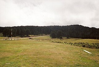
Warisaliganj is a town and a Nagar Panchayat in Nawada district in the Indian state of Bihar.

Bokaro Thermal is a census town in Bermo block in Bermo subdivision of Bokaro district in the state of Jharkhand, India. Often colloquially referred to as 'BTPS', as the Bokaro Thermal Power Station is located in this area.
Khatangi is a prominent village in Bihar, India. It is situated in Sonbhadra-Bansi-Surajpur Block in Arwal district of the State of Bihar. It is located at 96.1 km distance from Arwal and at 114 km distance from the state capital Patna. It is a very old village with a population of about 5,000 people. The literacy rate is 45.56%, comprising a female literacy rate of 27.3% and a male literacy rate of 62.98%. The people here are very friendly and hospitable. The economy of this village is agro-based and agriculture remains the main source of income.
Ramgarh district is one of the 24 districts in the Indian state of Jharkhand. It was also a military district during the British Regime, referred to then as Ramgahr district.
Raghopur is a community development block in Vaishali district of Bihar. Situated between two streams of the Ganges river, it is a river island. It is connected to Patna by Pipa pul.

Jalalpur is a small village in Gaya district, Bihar, India. Jalalpur Village is located in Daryapur panchayat of Mohra block of Gaya district, Bihar. This village has total 415 families residing. It has population of 2441 as per government records. It is only 2–3 km from Wazirganj ,a city and block in Gaya district.
Delhua is a village, situated about 20 kilometers away from Nawada city in Bihar state. It comes to Sarakanda Panchayat of Govindpur Block. The distance of this market from Govindpur is about 3 kilometres. On the one hand, there are long chains of Sakri river and mountains on the other. The population here is around 2000. The majority of the population here is dependent on agriculture. The soil here is very fertile. There is also the cultivation of vegetables and pulses along with rice and wheat. Here the fields are small, hence there is traditional farming. The main market of this village is Govindpur. People used this market for shopping and as well as selling. Nowadays, a big Haat (bazaar) taken place on every Tuesday at the other side of Sakri river and it is called Mangal Haat located on Katruchak mod. In this Haat, many farmers of Delhua sell vegetables and human needs.
Jihuli is a village in the East Champaran district of Bihar, India.
Pakri Barawan is a town in the Nawada District of the Indian state of Bihar.
Satgawan is a community development block that forms an administrative division of Koderma district, Jharkhand state, India.
Chandwara is a community development block that forms an administrative division of Koderma district, Jharkhand state, India.
Naromurar is a Village in Warisaliganj Tehsil, located 10 km far from National Highway 31 and 8 km from State Highway 59, making it the only village of the area well connected to both Nawada and Nalanda districts of Bihar.
Literally the word Nar means water and Murar means Lord Krishna who appeared as the 8th avatara of Lord Vishnu in Dvapara Yuga as mentioned in Garuda Purana, that is the word Naromurar means the house of lord Vishnu -Kshirsagar.
Naromurar is a village of great traditions. It is one of the ancient villages of India having a four hundred year older Thakur Wadi dedicated to Maryada Purushottam Ram and Lord Shiva.
Along with the Rajkiyakrit Madhya Vidyalay having established in 1920 AD, 27 years before the freedom of India, a Janta Pustakalay the Public Library is also started in the year of 1956 AD which was inaugurated by the Education Minister of Bihar during the time of Krishna Singh.
Amhara is a town and a Gram Panchayat in Bihta block of Patna district in the state of Bihar, India. Amhara lies in east of the Sone river and south of Bihta. The village is well connected to major cities with state highways.Hey budy, This is also my birthplace. It is absolutely osmm village. I agree with ur all statements regarding this village like power supply, river bla bla blah...... But u didn't mention about the actual condition of roads and schools. In schools, their is a lack good teachers now....Nd the roads were completely distroyed. Besides these two things, everything is fine in this village....
Birpur is a village in vaishali district, Bihar which is situated at the river island called Raghopur Diyara Island. It is one of the largest village in Raghopur community block. People of this village are mostly dependent on agriculture.People in this area has long tradition of joining armed forces. Its population is approximately 20,000 and peoples of this village are living their life in peaceful manner. Birpur is named upon Raja Bir Singh, a migrant from Jodhpur in the 17th century. Most of the Villagers work outside and bring revenue to this place which helps flourish the local community and enhance purchasing power. Birpur comes under Raghopur community block and a police station is Jurawanpur. It is one of the largest village in the Raghopur block in terms of area and population. its pin code is 844508. One post office is there which is located at one its tola(blocks in village) called SatGhar. literacy rate of this village is very low around 33%. Higher education facility is not available in the village and also there is no any good hospitals only small private clinic exists here, which is organised by non-professional or we can call it as a jhola chhap doctor means one who doesn't have any degree. Vajjika and Maithili are the languages which people speaks. It is spread over in the area of 20 km.
Kutri Village is located in the Warisaliganj Block of Nawada district in Bihar, India. It is a historical village among 80 villages of Warisaliganj Block of Nawada district. According to government records, Kutri village has 842 houses spread over a geographical area of 368 hectares. It is situated 5 km away from the Warisaliganj Block and 22 km away from Nawada. As of 2009, Kutri village was designated a gram panchayat.