Granada is a province of southern Spain, in the eastern part of the autonomous community of Andalusia. It is bordered by the provinces of Albacete, Murcia, Almería, Jaén, Córdoba, Málaga, and the Mediterranean Sea. Its capital city is also called Granada.
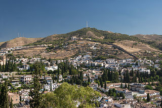
Sacromonte, sometimes also called Sacramonte, is a traditional neighbourhood in the eastern area of the city of Granada in Andalusia, Spain. It is one of the six neighbourhoods that make up the urban district of Albayzín and borders the neighbourhoods of Albayzín, San Pedro, Realejo-San Matías, El Fargue and Haza Grande.

Guadix is a city and municipality in southern Spain, in the province of Granada.
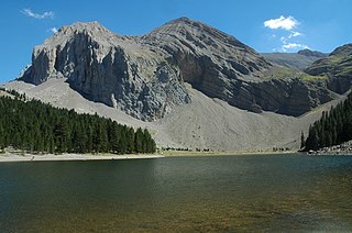
Sobrarbe is one of the comarcas of Aragon, Spain. It is located in the northern part of the province of Huesca, part of the autonomous community of Aragon in Spain. Many of its people speak the Aragonese language locally known as fabla.

Huéscar is a municipality of the province of Granada, Spain.
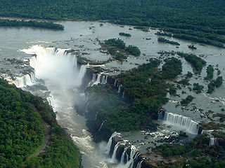
Geotourism is tourism associated with geological attractions and destinations. Geotourism deals with the abiotic natural and built environments. Geotourism was first defined in England by Thomas Alfred Hose in 1995.

Granada Atlético Club de Fútbol was a Spanish football team based in Granada, in the autonomous community of Andalusia. Founded in 2004, it played its last season in Tercera División - Group 9, holding home games at Estadio Nuevo Los Cármenes, with a capacity of 16,200 seats.
Abu'l-Walid Ismail I ibn Faraj was the fifth Nasrid ruler of the Emirate of Granada on the Iberian Peninsula from 1314 to 1325. A grandson of Muhammad II on the side of his mother Fatima, he was the first of the lineage of sultans now known as the al-dawla al-isma'iliyya al-nasriyya. Historians characterise him as an effective ruler who improved the emirate's position with military victories during his reign.

The Intrabaetic Basin is a discontinuous series of valleys in the Baetic System of Andalusia, Spain.

Galera is a municipality in the comarca of Huéscar, province of Granada, autonomous community of Andalusia, Spain. It is situated in a sparsely populated area roughly 150 kilometres (93 mi) from the provincial capital, Granada.

Beas de Guadix is a municipality in the province of Granada, Spain. As of 2010, it has a population of 396 inhabitants.

The Burren and Cliffs of Moher Geopark is an internationally designated area of geological interest in The Burren region of County Clare, Ireland. It is the third Geopark to be designated in Ireland, and is recognised at both European and global levels.
Geoheritage is the geological aspect of natural and cultural heritage. A geosite is a particular geological heritage asset. It is a heritage category comparable to other forms of natural heritage, such as biodiversity.

The Azores Geopark is a network of 121 geographically-dispersed sites of geographic heritage and marine areas that covers the nine volcanic islands of the archipelago of the Azores. This network is managed by the Azores Geopark Association, a non-profit association, with its headquarters in Horta on the island of Faial, established 19 May 2010. It is part of the European Geoparks Network and the UNESCO Global Geoparks Network. The Association's mission is to ensure the geological conservation, environmental education and sustainable development, while promoting the well-being of the population and a respect for the environment.
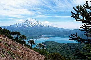
Kütralkura is a geopark in southern Chile's Araucanía Region. The geopark has an area of 8100 km2 and lies mostly in the Andes. It spans four communes: Curacautín, Lonquimay, Melipeuco and Vilcún. All of Conguillio National Park and Llaima, one of Chile's most active volcanoes, lie within the geopark.

Barranco León is an archaeological site in Orce, Andalusia, Spain with an age range between 1.2 and 1.4 million of years. It is noted for having yielded evidence of hominin occupation, including the milk tooth of a boy or girl of 10 years. After the tooth had been dated, its original owner was hailed as having left the earliest anatomical evidence for humans in Western Europe.

The Comarca Minera Geopark is located in the center-south of the Mexican state of Hidalgo. It extends over nine municipalities: Atotonilco el Grande, Epazoyucan, Huasca de Ocampo, Mineral del Chico, Mineral de la Reforma, Mineral del Monte, Omitlán de Juárez, Pachuca de Soto and Singuilucan. These municipalities are articulated by a network of 31 geosites, elected because they express the geological history of the territory and highlight the relationship between mining and metallurgy, and the historical spaces and cultural development of the region. In addition, they are important for science and education and, mostly, have a significant landscape value.

Castellón Alto is an Argaric culture archaeological site located in Galera, Granada and dated between 1900 and 1600 BE during the Bronze Age.

The current configuration of the province of Granada is the result of a long process of territorial organization that reached its culmination in 1833, by means of the decree of provincialization promulgated by Javier de Burgos, Ministry of Development of the government of the regent Maria Christina of Bourbon. Until that date, what now constitutes the province of Granada was integrated within the limits of the so-called Kingdom of Granada.

