
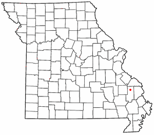
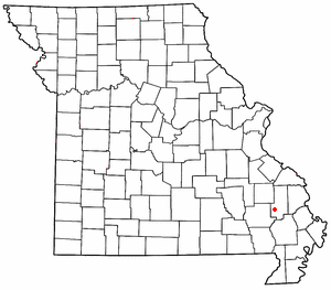
Grassy is an unincorporated community in Filmore Township in western Bollinger County, Missouri, United States. [1]
Grassy is an unincorporated community in Filmore Township in western Bollinger County, Missouri, United States. [1]
It is eight miles west of Marble Hill on Route 34. [2]
Grassy is part of the Cape Girardeau – Jackson, MO-IL Metropolitan Statistical Area. [3]
Located just outside Grassy are three campgrounds along the Castor River: Arrowhead Campgrounds, [4] Castor River Park, [5] and Twin Bridges Park.
Grassy was named for the nearby Grassy Creek on which the community is located. The name of the creek derives from the lush sage grass that grows along the banks and in the bed of the stream. [6]
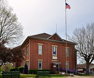
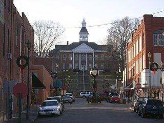
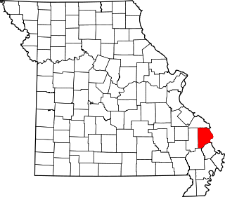
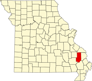
Bollinger County is a county located in the southeastern part of the U.S. state of Missouri. As of the 2020 census, the county's population was 10,567. The county seat, largest and only city, is Marble Hill. The largely rural county is supported by agriculture and construction. The county was officially organized in March, 1851 from portions of Wayne, Cape Girardeau and Stoddard Counties, and named in honor of George Frederick Bollinger, an early settler.

Zalma, once known as "Bollinger's Mill", is an unincorporated community and census-designated place (CDP) on the banks of the winding Castor River at a point where the river makes a horseshoe bend in southern Bollinger County in southeast Missouri, United States. When the railroad moved to town, the name Bollinger's Mill was changed to Zalma, after railroad worker Zalma Block. Zalma is also said to come from a Native American word meaning "the end." As of the 2020 U.S. Census, Zalma had a population of 73.

Oak Ridge is a village in the southern part of Apple Creek Township in Cape Girardeau County, Missouri, United States. The population was 237 at the 2020 census. It is part of the Cape Girardeau–Jackson, MO-IL Metropolitan Statistical Area.
Cape Girardeau is a city in Cape Girardeau and Scott Counties in the U.S. state of Missouri. At the 2020 census, the population was 39,540. The city is one of two principal cities of the Cape Girardeau-Jackson, MO-IL Metropolitan Statistical Area, which encompasses Alexander County, Illinois, Bollinger County, Missouri and Cape Girardeau County, Missouri and has a population of 97,517. The city is the economic center of Southeast Missouri and also the home of Southeast Missouri State University. It is located approximately 100 miles (161 km) southeast of St. Louis and 150 miles (241 km) north of Memphis.
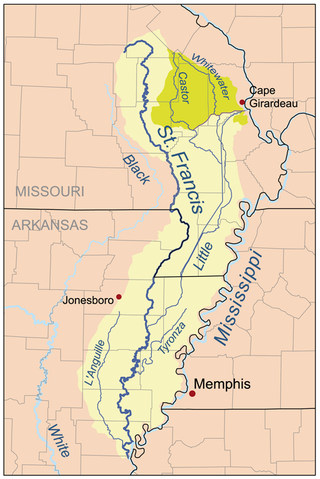
The Castor River is divided into the Upper Castor River and the Lower Castor River by the Headwater Diversion Channel.
Patton is an unincorporated community in the southeastern part of Union Township in northern Bollinger County in Southeast Missouri, United States. It is located on State Highway 51, approximately one mile south of the intersection with Route 72 along Little Whitewater Creek and 15 miles north of Marble Hill. The ZIP Code for Patton is 63662.

Burfordville is an unincorporated community in western Cape Girardeau County, Missouri, United States, on the banks of the Whitewater River. It is located five miles west of Jackson on Route 34. Bufordville is part of the Cape Girardeau–Jackson, MO-IL Metropolitan Statistical Area.
Gipsy is an unincorporated community in the northwestern part of Wayne Township in the western part of Bollinger County, Missouri, United States. It is located on Missouri Supplemental Route E, fourteen miles southwest of Marble Hill on Lick Log Creek.

Sturdivant is an unincorporated community in the southern part of Wayne Township in extreme southern Bollinger County, Missouri, United States. It is located approximately sixteen miles north of Dexter along State Highway V. The zip code is 63782. It is part of the Cape Girardeau–Jackson, MO-IL Metropolitan Statistical Area.
The Cape Girardeau–Jackson Metropolitan Statistical Area, as defined by the United States Census Bureau, is an area consisting of two counties in southeastern Missouri and one in southern Illinois, anchored by the cities of Cape Girardeau and Jackson. It was upgraded from a Micropolitan Statistical Area (μSA) to a Metropolitan Statistical Area (MSA) by the Office of Management and Budget on November 20, 2008.

Filmore Township is one of eight townships in Bollinger County, Missouri, USA. As of the 2000 U.S. Census, its population was 508. As of the 2010 U.S. Census, the population had decreased to 488. Filmore Township covers an area of 60.71 square miles (157.2 km2).
Scopus is an unincorporated community in central Bollinger County in Southeast Missouri, United States. It is located approximately nine miles northeast of Marble Hill at the intersection of Highway B and Highway M.
Shawneetown is an unincorporated community in Shawnee Township in northern Cape Girardeau County, Missouri, United States. It is located twenty miles north of Cape Girardeau and is part of the Cape Girardeau–Jackson, MO-IL Metropolitan Statistical Area.
Egypt Mills is an unincorporated community in Randol Township in eastern Cape Girardeau County, Missouri, United States. It is located approximately 12 miles east of Jackson.
Castor is an unincorporated community in the northwestern part of Filmore Township in Bollinger County, Missouri, United States. Castor is situated on the Castor River and is located approximately 16 miles west of Marble Hill.
Hahn is an unincorporated community in the part of Wayne Township in Bollinger County, Missouri, United States. The community was established in 1895 and was named for Daniel Hahn, who settled in 1805 on the creek which also bears his name. The Hahns were one of the early families who settled in the area. A post office was in operation between 1895–1954.
Hurricane is an unincorporated community in the eastern part of Crooked Creek Township in Bollinger County, Missouri, United States. The community is located near Hurricane Creek, a nearby stream. after which it was named. The name derives from the creek's unusual swiftness and violence after heavy rains, which makes passage across the creek impossible or dangerous. The violence of this swiftness and speed is likened to a storm or hurricane. A post office was in operation between the years 1894–1942.
Mayfield is an unincorporated community in the central part of Scopus Township in Bollinger County, Missouri, United States, approximately 4.5 miles west of the Cape Girardeau County line.
Neely's Landing or Neelys Landing is an unincorporated community in Shawnee Township in northern Cape Girardeau County, Missouri, United States. It is located seventeen miles north of Cape Girardeau and is part of the Cape Girardeau–Jackson, MO-IL Metropolitan Statistical Area.
Panther Creek is a stream in eastern Bollinger and western Cape Girardeau counties in the U.S. state of Missouri. It is a tributary of Whitewater River which it enters approximately two miles south of Millersville.
Municipalities and communities of Bollinger County, Missouri, United States | ||
|---|---|---|
| City |  | |
| Villages | ||
| Townships | ||
| CDP | ||
| Other communities | ||
| Abandoned villages | ||
37°15′39″N90°07′25″W / 37.26083°N 90.12361°W
| | This Bollinger County, Missouri state location article is a stub. You can help Wikipedia by expanding it. |