Patton, Missouri

Last updated

MOMap-doton-Patton.png

Patton is an unincorporated community in the southeastern part of Union Township in northern Bollinger County in Southeast Missouri, United States. It is located on State Highway 51, approximately one mile south of the intersection with Route 72 (referred to as Patton Junction) along Little Whitewater Creek and 15 miles north of Marble Hill. The ZIP Code for Patton is 63662. [1]

Contents

Patton is part of the Cape Girardeau Jackson, MO-IL Metropolitan Statistical Area.

Name

In the early pioneer days, Patton had a dancing place at which the people danced long after the fiddlers were exhausted by patting hands. The expression "keep a pattin'" was used so often that the place was named Patton. [2]

History

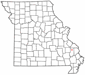
A post office was established in 1874 and named for the Patton family, of whom J.J. and Harvey Patton were prominent family members. [3]

Education

The Meadow Heights R-II School District, located on Route 72 just outside Patton, encompasses most of northern Bollinger County. According to the Missouri Department of Elementary and Secondary Education, there was a total of 593 students and 55 certified staff members enrolled in the district during the 2008–2009 school year. The school colors are red and black and its mascot is the panther. Athletics at the school consists of boys' and girls' basketball, girls' volleyball, cheerleading, boys' baseball, girls' softball, track and field, and cross country. During the 2005–2006 season, the boys' basketball team set a national record for the number of three-pointers (36) in a single high school basketball game. [4]

Miscellaneous

37°30′08″N90°00′48″W / 37.50222°N 90.01333°W / 37.50222; -90.01333

Notes

  1. "Patton ZIP Code". zipdatamaps.com. 2022. Retrieved November 18, 2022.
  2. State Historical Society of Missouri: Bollinger County Place Names, 1928-1945 http://shs.umsystem.edu/manuscripts/ramsay/ramsay_bollinger.html
  3. State Historical Society of Missouri: Bollinger County Place Names, 1928-1945 http://shs.umsystem.edu/manuscripts/ramsay/ramsay_bollinger.html
  4. prepnation.com http://www.prepnation.com/poll/poll.cfm?poll=2&year=2005&week=12


Related Research Articles

<span class="mw-page-title-main">Gipsy, Missouri</span> Unincorporated community in the American state of Missouri

Gipsy is an unincorporated community in the northwestern part of Wayne Township in the western part of Bollinger County, Missouri, United States. It is located on Missouri Supplemental Route E, fourteen miles southwest of Marble Hill on Lick Log Creek.

<span class="mw-page-title-main">Grassy, Missouri</span> Unincorporated community in the American state of Missouri

Grassy is an unincorporated community in Filmore Township in western Bollinger County, Missouri, United States.

<span class="mw-page-title-main">Filmore Township, Bollinger County, Missouri</span> Township in the US state of Missouri

Filmore Township is one of eight townships in Bollinger County, Missouri, USA. As of the 2000 U.S. Census, its population was 508. As of the 2010 U.S. Census, the population had decreased to 488. Filmore Township covers an area of 60.71 square miles (157.2 km2).

Scopus is an unincorporated community in central Bollinger County in Southeast Missouri, United States. It is located approximately nine miles northeast of Marble Hill at the intersection of Highway B and Highway M.

<span class="mw-page-title-main">Alliance, Missouri</span> Unincorporated community in Missouri, United States

Alliance is an unincorporated community in the northwestern part of Whitewater Township in Bollinger County, Missouri, United States.

<span class="mw-page-title-main">Bessville, Missouri</span> Unincorporated community in the American state of Missouri

Bessville is an unincorporated community in the southern part of Crooked Creek Township in eastern Bollinger County, Missouri, United States. The community lies on the east bank of Crooked Creek and at the end of Missouri Route OO. It is located approximately seven miles northwest of Marble Hill and 5.5 miles southeast of Marquand in adjacent Madison County.

<span class="mw-page-title-main">Buchanan, Missouri</span> Unincorporated community in Missouri, United States

Buchanan is an unincorporated community in the southern part of Filmore Township in Bollinger County, Missouri, United States. The community lies approximately 18 miles southwest of Marble Hill and was named after James Buchanan, the fifteenth president of the United States, who served in office from 1857 to 1861. A post office was established in 1857 and remained in operation until 1940.

<span class="mw-page-title-main">Castor, Missouri</span> Unincorporated community in Missouri, United States

Castor is an unincorporated community in the northwestern part of Filmore Township in Bollinger County, Missouri, United States. Castor is situated on the Castor River and is located approximately 16 miles west of Marble Hill.

<span class="mw-page-title-main">Dongola, Missouri</span> Unincorporated community in the American state of Missouri

Dongola is an unincorporated community in the southern part of Liberty Township in Bollinger County, Missouri, United States. The community is located nine miles south of Marble Hill on Missouri Route 51.

<span class="mw-page-title-main">Drum, Missouri</span> Unincorporated community in the American state of Missouri

Drum is an unincorporated community in the eastern part of Liberty Township in Bollinger County, Missouri, United States. The community was named for the Drum family, who were prominent pioneers. A post office operated between the years 1893–1916.

<span class="mw-page-title-main">Glennon, Missouri</span> Unincorporated community in Missouri, United States

Glennon is an unincorporated community in the eastern part of Liberty Township in Bollinger County, Missouri, United States.

<span class="mw-page-title-main">Greenbrier, Missouri</span> Unincorporated community in Missouri, United States

Greenbrier is an unincorporated community in the southeastern part of Wayne Township in Bollinger County, Missouri, United States. The name Greenbrier been attributed as being due to the vegetation growing in the area, particularly blackberry and other green briers. The community was situated along the branch railroad which connected Brownwood in Stoddard County to Zalma. A post office was in operation between the years 1889–1957.

<span class="mw-page-title-main">Hahn, Missouri</span> Unincorporated community in the American state of Missouri

Hahn is an unincorporated community in the part of Wayne Township in Bollinger County, Missouri, United States. The community was established in 1895 and was named for Daniel Hahn, who settled in 1805 on the creek which also bears his name. The Hahns were one of the early families who settled in the area. A post office was in operation between 1895–1954.

<span class="mw-page-title-main">Hurricane, Bollinger County, Missouri</span> Unincorporated community in Missouri, United States

Hurricane is an unincorporated community in the eastern part of Crooked Creek Township in Bollinger County, Missouri, United States. The community is located near Hurricane Creek, a nearby stream. after which it was named. The name derives from the creek's unusual swiftness and violence after heavy rains, which makes passage across the creek impossible or dangerous. The violence of this swiftness and speed is likened to a storm or hurricane. A post office was in operation between the years 1894–1942.

<span class="mw-page-title-main">Lixville, Missouri</span> Unincorporated community in Missouri, United States

Lixville is an unincorporated community in the northeastern part of Whitewater Township in the northeast part of Bollinger County, Missouri, United States. Lixville lies seven miles northeast of Alliance. An early pioneer to settle in the area of Lixville was a German immigrant named Henry Lix. The community was officially established in 1897 and was named for the first post master, Louis W. Lix. A post office was in operation between the years 1895–1945.

<span class="mw-page-title-main">Lodge, Missouri</span> Unincorporated community in Missouri, United States

Lodge is an unincorporated community in the western part of Lorance Township in Bollinger County, Missouri, United States. A post office was in service between 1880 and 1942.

<span class="mw-page-title-main">Mayfield, Missouri</span> Unincorporated community in the American state of Missouri

Mayfield is an unincorporated community in the central part of Scopus Township in Bollinger County, Missouri, United States, approximately 4.5 miles west of the Cape Girardeau County line.

<span class="mw-page-title-main">Scheperville, Missouri</span> Unincorporated community in Missouri, United States

Scheperville is an unincorporated community in the central part of Liberty Township in Bollinger County, Missouri, United States. A post office was in operation between 1882–1902.

<span class="mw-page-title-main">Shrum, Missouri</span> Unincorporated community in the American state of Missouri

Shrum is an unincorporated community in the southeastern part of Crooked Creek Township in Bollinger County, Missouri, United States. Shrum, which lies 5 1/2 miles east of Bessville, was established in 1900, and the community was named for a local landowner, Nicholas Shrum. The community's post office was in operation between the years of 1898–1937.

<span class="mw-page-title-main">Tallent, Missouri</span> Unincorporated community in the American state of Missouri

Tallent is an unincorporated community in the northern part of Crooked Creek Township in Bollinger County, Missouri, United States. Tallent lies 4 1/2 miles southwest of Patton, and was named for Reverend George W. Tallent, who was a local minister and school commissioner. A post office was established here in 1902, and operated until 1935.