Great St Bernard Lake

Last updated
Great St Bernard Lake
Lac du Great St Bernard Pass, 2010 August.JPG
Looking south to Italian hospice
Reliefkarte Wallis blank.png
Red pog.svg
Great St Bernard Lake
Italy Aosta Valley location map.svg
Red pog.svg
Great St Bernard Lake
Switzerland relief location map.jpg
Red pog.svg
Great St Bernard Lake
Italy relief location map.jpg
Red pog.svg
Great St Bernard Lake
Alps location map.png
Red pog.svg
Great St Bernard Lake
Location Valais, Aosta Valley
Coordinates 45°52′07″N7°10′02″E / 45.86861°N 7.16722°E / 45.86861; 7.16722 Coordinates: 45°52′07″N7°10′02″E / 45.86861°N 7.16722°E / 45.86861; 7.16722
Primary outflows Torrent du Grand St-Bernard
Basin  countriesSwitzerland, Italy
Surface elevation2,447 m (8,028 ft)
Great St Bernard Lake

Great St Bernard Lake
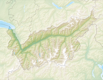
 (French : Lac du Grand St-Bernard, Italian : Lago del Gran San Bernardo) is a mountain lake of the Pennine Alps, located south-west of Great St Bernard Pass. It is divided between Switzerland (canton of Valais) and Italy (region of Aosta Valley), although it lies south of the Alps, within the Dora Baltea basin.

The lake is located at a height of 2,447 metres above sea level and has a maximum length of 350 metres.

Related Research Articles

Geography of Switzerland Geographical features of Switzerland

The geography of Switzerland encompasses the geographical features of Switzerland, a mountainous and landlocked country located in Western and Central Europe. Switzerland's natural landscape is marked by its numerous lakes and mountains. It is surrounded by 5 countries: Austria and Liechtenstein to the east, France to the west, Italy to the south and Germany to the north. Switzerland has a maximum north–south length of 220 kilometres (140 mi) and an east–west length of about 350 kilometres (220 mi).

Swiss Alps Portion of the Alps that lies within Switzerland

The Alpine region of Switzerland, conventionally referred to as the Swiss Alps, represents a major natural feature of the country and is, along with the Swiss Plateau and the Swiss portion of the Jura Mountains, one of its three main physiographic regions. The Swiss Alps extend over both the Western Alps and the Eastern Alps, encompassing an area sometimes called Central Alps. While the northern ranges from the Bernese Alps to the Appenzell Alps are entirely in Switzerland, the southern ranges from the Mont Blanc massif to the Bernina massif are shared with other countries such as France, Italy, Austria and Liechtenstein.

Pennine Alps Mountain range in the western Alps within Switzerland and Italy

The Pennine Alps, also known as the Valais Alps, are a mountain range in the western part of the Alps. They are located in Switzerland (Valais) and Italy.

Bernese Alps Part of the Alps mountain range in Switzerland

The Bernese Alps are a mountain range of the Alps, located in western Switzerland. Although the name suggests that they are located in the Berner Oberland region of the canton of Bern, portions of the Bernese Alps are in the adjacent cantons of Valais, Fribourg and Vaud, the latter being usually named Fribourg Alps and Vaud Alps respectively. The highest mountain in the range, the Finsteraarhorn, is also the highest point in the canton of Bern.

Main chain of the Alps Central line of mountains that forms the divide of the Alps

The main chain of the Alps, also called the Alpine divide is the central line of mountains that forms the drainage divide of the range. Main chains of mountain ranges are traditionally designated in this way, and generally include the highest peaks of a range. The Alps are something of an unusual case in that several significant groups of mountains are separated from the main chain by sizable distances. Among these groups are the Dauphine Alps, the Eastern and Western Graians, the entire Bernese Alps, the Tödi, Albula and Silvretta groups, the Jura Mountains, Ortler, and Adamello ranges, and the Dolomites of South Tyrol, as well as the lower Alps of Vorarlberg, Bavaria, and Salzburg.

This article lists the principal mountain passes and tunnels in the Alps, and gives a history of transport across the Alps.

South Tyrol Autonomous province of Italy

South Tyrol is an autonomous province in northern Italy, one of the two that make up the autonomous region of Trentino-Alto Adige/Südtirol. The province is the northernmost of Italy, the second largest, with an area of 7,400 square kilometres (2,857 sq mi) and has a total population of about 534,000 inhabitants as of 2021. Its capital and largest city is Bolzano.

Valais Canton of Switzerland

Valais, or Wallis, more formally the Canton of Valais, is one of the 26 cantons forming the Swiss Confederation. It is composed of thirteen districts and its capital and largest city is Sion. The flag of the canton is made of thirteen stars representing the districts, on a white-red background.

Great St Bernard Pass Road pass in Switzerland

The Great St Bernard Pass is the third highest road pass in Switzerland, at an elevation of 2,469 m (8,100 ft). It connects Martigny in the canton of Valais in Switzerland with Aosta in the region Aosta Valley in Italy. It is the lowest pass lying on the ridge between the two highest mountains of the Alps, Mont Blanc and Monte Rosa. It is located on the main watershed that separates the basin of the Rhône from that of the Po.

Aosta Comune in Aosta Valley, Italy

Aosta is the principal city of Aosta Valley, a bilingual region in the Italian Alps, 110 km (68 mi) north-northwest of Turin. It is situated near the Italian entrance of the Mont Blanc Tunnel, at the confluence of the Buthier and the Dora Baltea, and at the junction of the Great and Little St Bernard Pass routes.

Little St Bernard Pass Mountain pass in the Alps on the France–Italy border

The Little St Bernard Pass is a mountain pass in the Alps on the France–Italy border. Its saddle is at 2188 metres above sea level. It is located between Savoie, France, and Aosta Valley, Italy, to the south of the Mont Blanc Massif, exactly on the main alpine watershed. There is also a Great St. Bernard Pass, famous for giving the St Bernard breed its name, and a San Bernardino Pass.

Dufourspitze Highest mountain in Switzerland

The Dufourspitze is the highest peak of Monte Rosa, an ice-covered mountain massif in the Alps. Dufourspitze is the highest mountain peak of both Switzerland and the Pennine Alps and is also the second-highest mountain of the Alps and Western Europe, after Mont Blanc. It is located between Switzerland and Italy.

Geography of the Alps Description of the landforms of the Alps mountain range

The Alps cover a large area. This article describes the delimitation of the Alps as a whole and of subdivisions of the range, follows the course of the main chain of the Alps and discusses the lakes and glaciers found in the region.

The Veragri were a Gallic tribe dwelling around present-day Martigny, in the Pennine Alps, during the Iron Age and the Roman period.

Mont Vélan Mountain in Switzerland/Italy

Mont Vélan is a mountain of the Pennine Alps, located on the border between Switzerland and Italy. At 3,727, metres Mont Vélan is the highest summit lying between the Great St Bernard Pass and Grand Combin. Two large glaciers cover its northern flanks: Glacier de Tseudet (west) and Glacier de Valsoray (east). The Glacier de Proz, lying on the west side, was traversed during the first ascent.

Grand Golliat Mountain in Switzerland

The Grand Golliat is a mountain of the Pennine Alps, located between the Petit Col Ferret and the Great St. Bernard Pass. At 3,238 metres above sea level, its summit straddles the border between Switzerland and Italy, separating the Swiss canton of Valais from the Italian region of Aosta Valley. The name Golliat comes from "gouilles" or small lakes located on the Italian side of the mountain.

<i>Mittelgebirge</i> Type of low mountain range or hill country common in Central Europe

A Mittelgebirge is a type of relatively low mountain range or highland area typical of the geography of central Europe, especially central and southern Germany; it refers to something between rolling low hill country or Hügelland and a proper mountain range like the High Alps.

SOIUSA

SOIUSA is a proposal for a new classification system of the Alps from the geographic and toponomastic point of view. It was designed by Sergio Marazzi, Italian researcher and author of the Orographic Atlas of the Alps SOIUSA. His book was presented with the patronage of the Italian Alpine Club on 23 Jan 2006, but has yet to receive any formal acceptance.

Grande Rochère Mountain in Italy

The Grande Rochère is a mountain of the Italian Pennine Alps, located north of Morgex in the Aosta Valley. Reaching a height of 3,326 metres above sea level, it is the culminating point of the group lying between the Col Ferret and the Great St. Bernard Pass.

Mont Mort is a mountain of the Pennine Alps, located on the border between Switzerland and Italy. It is located on the main chain of the Alps, just south-east of the Great St Bernard Pass.

References

Commons-logo.svg Media related to Great St Bernard Lake at Wikimedia Commons