The Mavora Lakes are located in the South Island of New Zealand.
The Routeburn Track is a world-renowned, 32 km tramping (hiking) track found in the South Island of New Zealand. The track is usually completed by starting on the Queenstown side of the Southern Alps, at the northern end of Lake Wakatipu, and finishing on the Te Anau side, at the Divide, several kilometres from the Homer Tunnel to Milford Sound.

The Matukituki River is found in the Southern Alps of New Zealand's South Island. Both the West Branch and the East Branch originate from the Main Divide mountain ranges near Mount Aspiring and their largely glacier-fed waters flow for approximately 20 kilometres (12 mi) each before joining near Camerons Flat. After this confluence, the Matukituki River leaves the boundaries of Mount Aspiring National Park and continues for another 30 kilometres (19 mi) until it drains into Lake Wanaka at the lake's southwestern edge.

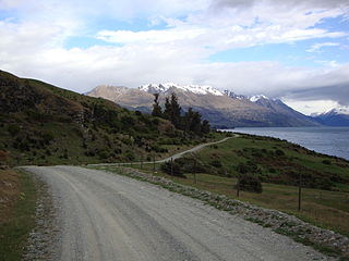
Glenorchy is a small settlement at the northern end of Lake Wakatipu in the South Island region of Otago, New Zealand. It is approximately 45 km (28 mi) by road or boat from Queenstown, the nearest large town. There are two pubs, a café and a range of small shops in the town catering mainly to tourists but also to the small resident population. There is also a small airstrip which caters to small planes.

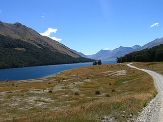
The Dart River, Te Awa Wakatipu in Māori language, flows through rugged forested country in the southwestern South Island of New Zealand. Partly in Mount Aspiring National Park, it flows south-west and then south for 60 kilometres (37 mi) from its headwaters in the Southern Alps and the Dart Glacier, eventually flowing into the northern end of Lake Wakatipu near Glenorchy. It was named in the 1860s by a runholder, William Gilbert Rees, who chose the name for the river's swift flow.

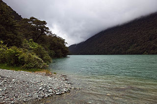
The Hollyford River / Whakatipu Kā Tuka is in the southwest of the South Island of New Zealand. It runs for 72 kilometres (45 mi) through Fiordland, its sources being close to the Homer Tunnel and in Gertrude Valley in the southern Darren Mountains.

The Hollyford Track is a tramping track in New Zealand. Located at the northern edge of Fiordland, in the southwestern South Island, it is unusual among Fiordland's major tracks in that it is largely flat and accessible year-round. It follows the Hollyford River which in turn follows the course of the Hollyford Valley.

The Kepler Track is a 60 km (37 mi) circular tramping track which travels through the landscape of the South Island of New Zealand and is situated near the town of Te Anau. The track passes through many landscapes of the Fiordland National Park such as rocky mountain ridges, tall mossy forests, lake shores, deep gorges, rare wetlands and rivers. Like the mountains it traverses, the track is named after Johannes Kepler. The track is one of the New Zealand Great Walks and is administered by New Zealand Department of Conservation (DOC).
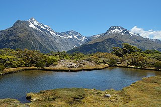
Lake Gunn is a lake in the South Island of New Zealand, located at 44°53′S168°05′E.
The Grebe River is a river in Fiordland, New Zealand. It arises north-west of Lake Monowai in an area once part of the lake but cut off by an enormous landslide about 13,000 years ago. The river now flows north, between the Townley Mountains to the west, and the Hunter Mountains to the east, and into Lake Manapouri's South Arm. Its major tributaries are Jaquiery Stream, Florence Stream, Emerald Stream, and Percy Stream, all from the west.

The Rees River is a headwater tributary of the Clutha/Mata-Au that drains eastward of the main divide of the Southern Alps of New Zealand. Located at the head of Lake Wakatipu, the Rees River runs 41 km and drains an area of 406 km2 and discharges into Lake Wakatipu at Glenorchy. Bound by the Richardson (Whakari) Mountains to the east and the Forbes Mountains to the west, its headwaters exceed 2000 m.a.s.l. and are partially snow covered. The upper parts of the Rees River occupies a formerly glaciated valley that was fed by the Tyndall Glacier, which now drains into the adjacent Dart Valley. Below Rees Saddle the river valley is constrained by a series of steep alluvial fans that are fed from tributary basins. The lithology of the Rees catchment is highly erodible schist of the Aspiring lithologic association. The underlying schist is highly fissive due to its fine-grain, segregated quart-feldspar-mica composition. The Rees valley is covered in indigenous tussock grasses and forest and is a popular location for recreational fly fishing, pack rafting and hiking, including the 4–5 day hike on the Dart-Rees Track. However, the steep topography, easily erodible lithology, proximity to the alpine fault, and intense rainfalls contribute to potential geohazard risks in the region. A debris flow swept away a hiker during a river crossing in an unnamed tributary in the Upper Rees Valley near Cleft Peak in January 2002.
The Around the Mountains Cycle Trail has been funded as one of the projects of the New Zealand Cycle Trail. The 175 kilometres (109 mi) track begins and ends in the Queenstown Lakes District, though for most of its length it is in the Southland District.
The Wapiti River is a river in the Southland Region of New Zealand. It rises in the northern extremity of the Stuart Mountains in Fiordland National Park, the top of its watershed being part of the main divide. Two branches feed Lake Sutherland, the outflow of which flows southwest to Lake Thomson. A further 2.2 kilometres (1.4 mi) reach of the river heads east to Lake Hankinson, which is separated from the North West Arm of the Middle Fiord of Lake Te Anau by a final 0.6-kilometre (0.4 mi) stretch of the river.
Lake Fergus is a lake in the South Island of New Zealand, located at 44°50′42″S168°6′40″E.

The Wild Animal Control Act 1977 is a current Act of Parliament in New Zealand. It is administered by the Department of Conservation.

The Routeburn River, also known as the Route Burn, is a river in New Zealand. It is a short stony river that flows for some 15 kilometres into the Dart River in the South Island. The Routeburn River flows alongside a section of the Routeburn Track. The upper reaches of the river are found in the Routeburn North Branch and leave the Routeburn Track around the Routeburn Flat Hut area.
The Humboldt Mountains or Humboldt Range are one of the many ranges which make up the Southern Alps in the South Island of New Zealand. They lie to the northwest of Lake Wakatipu in the Otago Region. Parts of the range lie within Fiordland National Park, and they form the southern extremity of Mount Aspiring National Park. The range was named by early explorer James McKerrow, and like many geographic features worldwide, it was named in honour of notable scientist Alexander von Humboldt.

Lake Tennyson is a glacial high-country lake in Canterbury, New Zealand. The first European settler to see the lake was Frederick Weld in 1853, who also named it. The headwaters of the Clarence River are just to the north, and the river flows through Lake Tennyson.


