Related Research Articles

Lake Ontario is one of the five Great Lakes of North America. It is bounded on the north, west, and southwest by the Canadian province of Ontario, and on the south and east by the U.S. state of New York. The Canada–United States border spans the centre of the lake.

The Thousand Islands constitute a North American archipelago of 1,864 islands that straddles the Canada–US border in the Saint Lawrence River as it emerges from the northeast corner of Lake Ontario. They stretch for about 50 miles (80 km) downstream from Kingston, Ontario. The Canadian islands are in the province of Ontario and the U.S. islands in the state of New York.

Thousand Islands National Park, formerly known as the St. Lawrence Islands National Park, is a Canadian National Park located on the 1000 Islands Parkway in the Thousand Islands Region of the Saint Lawrence River. The islands are actually the worn-down tops of ancient mountains. This region, the Frontenac Axis, connects the Canadian Shield from Algonquin Park in Ontario to the Adirondack Mountains in New York.

The Thousand Islands – Frontenac Arch region or the Frontenac Axis is an exposed strip of Precambrian rock in Canada and the United States that links the Canadian Shield from Algonquin Park with the Adirondack Mountain region in New York, an extension of the Laurentian mountains of Québec. The Algonquin to Adirondacks region, which includes the Frontenac Axis or Arch, is a critical linkage for biodiversity and resilience, and one with important conservation potential. The axis separates the St. Lawrence Lowlands and the Great Lakes Lowlands. It has many distinctive plant and animal species. It is one of four ecoregions of the Mixedwood Plains.
Cape Vincent is a town in Jefferson County, New York, United States. The population was 2,777 at the 2010 census.

The Maribyrnong River is a perennial river of the Port Phillip catchment, located in the north–western suburbs of Melbourne, in the Australian state of Victoria.
Cootes Paradise is a property of the Royal Botanical Gardens at the western end of Lake Ontario, and a remnant of the larger 3700 acre Dundas Marsh Crown Game Preserve established by the Province of Ontario in 1927. It is a 600 hectare environmental protection and education area, dominated by a 4.5km long rivermouth wetland, representing the lake's western terminus. It is found on the west side of Hamilton Harbour and is located in the municipality of Hamilton, Ontario, Canada.
Kikomun Creek Provincial Park is a provincial park in British Columbia, Canada.

The Kororoit Creek is a watercourse of the Port Phillip catchment, rising in the outer north western suburbs of Melbourne, in the Australian state of Victoria.

The Fort de La Présentation, a mission fort, was built in 1749 and so named by the French Sulpician priest, Abbé Picquet. It was also sometimes known as Fort La Galette. It was built at the confluence of the Oswegatchie River and the St Lawrence River in present-day New York. The French wanted to strengthen their alliance with the powerful Iroquois, as well as convert them to Catholicism. With increasing tensions with Great Britain, they were concerned about their thinly populated Canadian colony. By 1755 the settlement included 3,000 Iroquois residents loyal to France, in part because of the fur trade, as well as their hostility to encroachment by British colonists in their other territories. By comparison, Montréal had only 4,000 residents.

Front of Yonge is a township found in the United Counties of Leeds and Grenville in Ontario, Canada. It is the location of the Thousand Islands National Park and Brown's Bay Provincial Park, as well as a number of private campgrounds, the Jones Creek walking trail system, and the 1000 Islands Waterfront Trail’s walking/bike path which runs from just beyond the township’s eastern boundary to neighbouring towns. The predominance of the Canadian Shield produces scenic and diverse landscapes which include exposed rock formations and heavy tree cover, as well as wide fields and beaches.

Chantry Island is a small island in Lake Huron, south of the mouth of the Saugeen River and approximately a kilometre off the shores of the town of Southampton, Ontario. It is approximately 19 hectares in size and is a migratory bird sanctuary. Since the sanctuary territory extends 183 metres into the water surrounding the island, the total official area is listed as 63 hectares.

The Rachel Carson National Wildlife Refuge is a 9,125-acre (37 km2) National Wildlife Refuge made up of several parcels of land along 50 miles (80 km) of Maine's southern coast. Created in 1966, it is named for environmentalist and author Rachel Carson, whose book Silent Spring raised public awareness of the effects of DDT on migratory songbirds, and of other environmental issues.

Tholkappia Poonga or Adyar Eco Park is an ecological park set up by the Government of Tamil Nadu in the Adyar estuary area of Chennai, India. According to the government, the project, conceived based on the master plan for the restoration of the vegetation of the freshwater ecosystems of the Coromandel Coast, especially the fragile ecosystem of the Adyar estuary and creek, was expected to cost around ₹ 1,000 million which will include the beautification of 358 acres of land. The park's ecosystem consists of tropical dense evergreen forest, predominantly comprising trees and shrubs that have thick dark green foliage throughout the year, with over 160 woody species, and comprises six vegetative elements such as trees, shrubs, lianas, epiphytes, herbs and tuberous species. The park was opened to public by Chief Minister M. Karunanidhi on 22 January 2011 and named after the renowned Tamil scholar Tholkappiar. About 65 percent of the park is covered by water and artefacts and signages. In the first 2 months of its inauguration, nearly 4,000 children from several schools in the city and the nearby Kancheepuram and Tiruvallur districts have visited the park to learn about wetland conservation, eco-restoration and water management. While the first phase of the ecopark covered about 4.16 acres of CRZ-III area, the entire area covered under the second phase falls under this category.

Mohawk Island is a small island in the northeast of Lake Erie, in Haldimand County, Ontario, Canada. It is composed of limestone with almost no vegetation, and is close to the water level. It was formerly known as Gull Island and contains the ruins of the Gull Island Lighthouse which was built in 1848 to guide ships into the Welland Canal at Port Maitland. In 1933, the lighthouse was automated to no longer require a human keeper and lost significance in 1934 due to the realignment of the canal at Port Colborne. It was decommissioned in 1969 when the mechanism was destroyed by a fire. The lighthouse is located close to the shore of Rock Point Provincial Park.

Mount Loretto Unique Area is an open space reserve and nature preserve administered by the New York State Department of Environmental Conservation on the South Shore of Staten Island, New York City. The area's total size is 241 acres (98 ha), of which 49 acres (20 ha) is underwater.

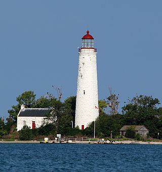
Tar Island is an island near the town of Rockport in the Canadian waters of the St. Lawrence River, and a part of the Thousand Islands, a freshwater archipelago.

The fauna of Louisiana is characterized by the region's low swamplands, bayous, creeks, woodlands, coastal marshlands and beaches, and barrier islands covering an estimated 20,000 square miles, corresponding to 40 percent of Louisiana's total land area. Southern Louisiana contains up to fifty percent of the wetlands found in the Continental United States, and are made up of countless bayous and creeks.
The Chantry Island Lighthouse, officially known as Chantry Island Lightstation Tower, is a lightstation on Chantry Island, off the coast of Southampton, Ontario in Lake Huron. It was constructed in the years 1855 through to 1859, by John Brown of Thorold, Ontario, under the authority of the Province of Canada and is recognized as one of the six Imperial Towers. Virtually identical, they were completed in 1858-1859 on Lake Huron and Georgian Bay and are among the few lighthouses on the Great Lakes made of cut limestone and granite.

Kobuleti Strict Nature Reserve is a protected area in Kobuleti Municipality, Adjara region of Georgia along the Black Sea coast in the northern part of the resort town Kobuleti. Kobuleti Protected Areas were established in 1998 to preserve unique wetland ecosystems recognized by the Ramsar Convention. Because of these wetland ecosystems, ancient forests, and the high biodiversity found within the reserve, it was inscribed on the UNESCO World Heritage List as part of the Colchic Rainforests and Wetlands in 2021.
References
- ↑ Google Maps. Accessed 18 November 2008.
- ↑ White, James. Place-names in the Thousand Islands, St. Lawrence River Archived 2007-09-26 at the Wayback Machine . Geographic Board of Canada, University of Calgary. Accessed 18 November 2008.
- 1 2 3 Mallorytown Landing & Grenadier Island Archived 2010-03-13 at the Wayback Machine . Accessed November 18, 2008.
- ↑ Canada's Islands and the Military Archived 2008-05-28 at the Wayback Machine . Accessed 18 November 2008.
- ↑ "St. Lawrence Islands National Park of Canada - Looking Back..." Retrieved 10 February 2010.
- ↑ Brooker's Creek on Grenadier Island. Parks Canada. Accessed 18 November 2008.
- ↑ Grenadier Island Country Club. Accessed 18 November 2008.
- ↑ Sessional Papers, various dates.