Mount Smythe is a mountain in Jasper National Park, Alberta, Canada.

Berrian Mountain is a mountain summit in the Front Range of the Rocky Mountains of North America. The 9,151-foot (2,789 m) peak is located 0.9 miles (1.5 km) north-northeast of the community of Aspen Park in Jefferson County, Colorado, United States.

Mount Frissell, 2,454 feet (748 m), which straddles the border of southwest Massachusetts and northwest Connecticut, is a prominent peak of the Taconic Range.
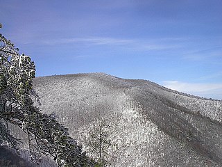
The Big Frog Wilderness was designated in 1984 and currently consists of 8,082 acres (32.71 km2). Approximately 89 acres (360,000 m2) are located in Georgia in the Chattahoochee National Forest and approximately 7,993 acres (32 km2) are located in Tennessee in the Cherokee National Forest. The Wilderness is managed by the United States Forest Service in Tennessee and is part of the National Wilderness Preservation System.

The South Jasper Ranges are mountain ranges of the Rocky Mountains in Alberta and British Columbia, Canada.

Crowsnest Range is a mountain range of the Rocky Mountains in southwestern Alberta and southeastern British Columbia, Canada.
Table Top Mountain is a mountain located in Essex County in the U.S. State of New York. Table Top Mtn. is flanked to the north by Phelps Mountain, and to the south by Mount Marcy. Table Top has three summits; the southernmost is the highest, followed by the middle peak at 4,308 ft (1,313 m) and the north peak at 4,216 ft (1,285 m).
Nye Mountain is a mountain located in Essex County, New York, named after William B. Nye (c.1815–1893), an Adirondack mountain guide. Nye Mountain is part of the Street Range of the Adirondack Mountains; it is flanked to the southwest by Street Mountain.
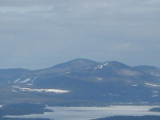
Gunstock Mountain is the second highest peak in the Belknap Mountains of central New Hampshire with an elevation greater than 2240 feet. It is located 1 mile (1.6 km) north of Belknap Mountain, the highest point in the range. It is home to the Gunstock Mountain Resort ski area. The ski resort has been written up in national ski magazines for its views of Lake Winnipesaukee.

Twin Mountain is a mountain located in Greene County, New York. Twin gets its name from its two summits; the lower, 3,590-ft (1,090 m) peak is about .5 miles (0.8 km) to the southeast of the higher. The mountain is part of the Devil's Path range of the Catskill Mountains. To the northwest, Twin Mtn. is separated from Sugarloaf Mountain by Pecoy Notch; to the southeast, Twin Mtn. is separated from Indian Head Mountain by Jimmy Dolan Notch.
Rounds Mountain, 2,257 feet (688 m), is a prominent peak in the Taconic Mountains of western Massachusetts and adjacent New York. The west side of the mountain and summit are located in New York; the east side is located within Massachusetts. The summit a bald; the slopes are wooded with northern hardwood tree species. It is notable for its views of the Hudson River Valley to the west and the Green River and Kinderhook Creek valleys of Hancock, Massachusetts to the east. The 35 mi (56 km) Taconic Crest Trail traverses the mountain. Much of the upper slopes and summit are within protected conservation land.
Holy Mount, 1,968 feet (600 m), is a prominent peak in the Taconic Mountains of western Massachusetts, formerly used as the location of religious ceremonies by a nearby Shaker community.

Mica Peak is the name of two separate mountain summits in the United States located approximately 5.49 miles (9 km) apart; one in Spokane County, Washington and the other in Kootenai County, Idaho. The two peaks are located along the same ridge, which separates the Spokane Valley and Rathdrum Prairie from the Palouse. The mountains have an elevation difference of only 31 ft (9.4 m) and are the southernmost peaks of the Selkirk Mountains.

Kodikuthimala also known as the Ooty of Malappuram is a hill station in the Malappuram district of Kerala in India. Located in Vettathur and Thazhekode villages, at a height of 540 m above sea level, this is the highest geographic peak in Amminikkadan hills.

Vanderwhacker Mountain is a 3,389-foot-tall (1,033 m) mountain in the Adirondack Mountains region of New York. It is located northeast of Indian Lake and southeast of Newcomb in Essex County. The Vanderwhacker Mountain Fire Observation Station is located on top of the mountain. In May 1911, the Conservation Commission built a wooden fire observation tower on the mountain which was replaced in 1918, with a 35-foot-tall (11 m) metal tower. The tower stopped fire watching operations at the end of the 1988 season.
Boreas Mountain is a 3,780-foot-tall (1,150 m) mountain in the Adirondack Mountains region of New York. It is located west-northwest of North Hudson in Essex County. In 1919, the Conservation Commission built a 47-foot-tall (14 m) steel fire lookout tower on the mountain. Due to increased use of aerial detection, the tower became obsolete and was closed at the end of the 1971 fire lookout season and later removed.
Petersburg Mountain is a mountain located in the Catskill Mountains of New York southeast of Cobleskill. Warnerville Hill is located northwest, and Donats Mountain is located northwest of Petersburg Mountain. In 1940, a 67-foot-6-inch-tall (20.57 m) steel fire lookout tower was built on the mountain. The tower was closed at the end of the 1971 season, and later transferred to Schoharie County for use as a radio tower. The tower site is closed to the public.

The Sonceboz-Sombeval–Moutier railway is a single-track standard gauge railway line of the Swiss Federal Railways (SBB).

Grenchenberg tunnel, Mont-de-Granges tunnel or Grenchenbergtunnel is a railway tunnel built between 1911 and 1915 connecting the town of Grenchen (SO) to Moutier.

