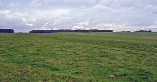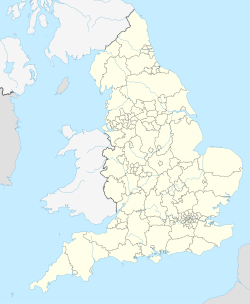
Woodhenge is a Neolithic Class II henge and timber circle monument within the Stonehenge World Heritage Site in Wiltshire, England. It is 2 miles (3.2 km) northeast of Stonehenge, in Durrington parish, just north of the town of Amesbury.

Dorchester is the county town of Dorset, England. It is situated between Poole and Bridport on the A35 trunk route. A historic market town, Dorchester is on the banks of the River Frome to the south of the Dorset Downs and north of the South Dorset Ridgeway that separates the area from Weymouth, 7 miles (11 km) to the south. The civil parish includes the experimental community of Poundbury and the suburb of Fordington.

A henge loosely describes one of three related types of Neolithic earthwork. The essential characteristic of all three is that they feature a ring-shaped bank and ditch, with the ditch inside the bank. Because the internal ditches would have served defensive purposes poorly, henges are not considered to have been defensive constructions. The three henge types are as follows, with the figure in brackets being the approximate diameter of the central flat area:
- Henge. The word henge refers to a particular type of earthwork of the Neolithic period, typically consisting of a roughly circular or oval-shaped bank with an internal ditch surrounding a central flat area of more than 20 m (66 ft) in diameter. There is typically little if any evidence of occupation in a henge, although they may contain ritual structures such as stone circles, timber circles and coves. Henge monument is sometimes used as a synonym for henge. Henges sometimes, but by no means always, featured stone or timber circles, and circle henge is sometimes used to describe these structures. The three largest stone circles in Britain are each within a henge. Examples of henges without significant internal monuments are the three henges of Thornborough Henges. Although having given its name to the word henge, Stonehenge is atypical in that the ditch is outside the main earthwork bank.
- Hengiform monument. Like an ordinary henge, except the central flat area is between 5 and 20 m (16–66 ft) in diameter, they comprise a modest earthwork with a fairly wide outer bank. The terms mini-henge or Dorchester henge are sometimes used as synonyms for hengiform monument. An example is the Neolithic site at Wormy Hillock Henge.
- Henge enclosure. A Neolithic ring earthwork with the ditch inside the bank, with the central flat area having abundant evidence of occupation and usually being more than 300 m (980 ft) in diameter. Some true henges are as large as this, but lack evidence of domestic occupation. Super-henge or superhenge is sometimes used as a synonym for a henge enclosure. However, sometimes the term is used to indicate size alone rather than use, e.g. "Marden henge ... is the least understood of the four British 'superhenges' ".

Avebury is a Neolithic henge monument containing three stone circles, around the village of Avebury in Wiltshire, in south-west England. One of the best-known prehistoric sites in Britain, it contains the largest megalithic stone circle in the world. It is both a tourist attraction and a place of religious importance to contemporary pagans.

Cursuses are monumental Neolithic structures resembling ditches or trenches in the islands of Great Britain and Ireland. Relics found within them indicate that they were built between 3400 and 3000 BC, making them among the oldest monumental structures on the islands. The name 'cursus' was suggested in 1723 by William Stukeley, the antiquarian, who compared the Stonehenge cursus to a Roman chariot-racing track, or circus.

Durrington Walls is the site of a large Neolithic settlement and later henge enclosure located in the Stonehenge World Heritage Site in England. It lies 2 miles (3.2 km) north-east of Stonehenge in the parish of Durrington, just north of Amesbury in Wiltshire. The henge is the second-largest Late Neolithic palisaded enclosure known in the United Kingdom, after Hindwell in Wales.

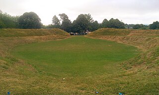
Maumbury Rings is a Neolithic henge in the south of Dorchester town in Dorset, England. It is a large circular earthwork, 85 metres in diameter, with a single bank and an entrance to the north east. It was modified during the Roman period when it was adapted for use as an amphitheatre, and the site was remodelled again during the English Civil War when it was used as an artillery fort guarding the southern approach to Dorchester. The monument is now a public open space, and used for open-air concerts, festivals and re-enactments.

Flagstones is a late Neolithic interrupted ditch enclosure on the outskirts of Dorchester, Dorset, England. It derives its name from having been discovered beneath the site of the demolished Flagstones House. Half of it was excavated in the 1980s when the Dorchester by-pass was built; the rest of it still exists under the grounds of Max Gate, Thomas Hardy's house.

Mount Pleasant henge is a Neolithic henge enclosure in the English county of Dorset. It lies southeast of Dorchester in the civil parish of West Stafford. It still partially survives as an earthwork.

Badbury Rings is an Iron Age hill fort and Scheduled Monument in east Dorset, England. It was in the territory of the Durotriges. In the Roman era a temple was located immediately west of the fort, and there was a Romano-British town known as Vindocladia a short distance to the south-west.

Durnovaria is a suggested spelling for the Latin form of the name of the Roman town of Dorchester in the modern English county of Dorset, amended from the actually observed Durnonovaria. Upon the assumption that the name was originally Brythonic, it is suggested that the first element in the name, *durno- may mean "fist" like and the second may be related to Old Irish fáir ~ fóir denoting a confined area or den. A simpler amendment would lead to *Duronovaria, making this place one of up to 18 ancient British names that contain Duro- and mostly occur at river crossings, while -novaria has two possible ancient parallels in Britain associated with river junctions. That analysis would perfectly fit the geographical situation of Dorchester.

Balfarg is a prehistoric monument complex in Glenrothes, Fife, Scotland. It is protected as a scheduled monument. With the development of Glenrothes new town in the latter half of the 20th Century an adjacent residential area was developed around the complex carrying the same name.

Poundbury Hill is the site of a scheduled Prehistoric and Roman archaeological remains and includes evidence of a Neolithic settlement, a substantial Bronze Age occupation site and an Iron Age hillfort. There are also late Iron Age burials and a section of Roman aqueduct. On the eastern side is an earlier Romano-British farmstead; and an extensive later cemetery, belonging to the Roman town Durnovaria.

The Bull Ring is a Class II henge that was built in the late Neolithic period near Dove Holes in Derbyshire, England.
The Stonehenge Riverside Project was a major Arts and Humanities Research Council-funded archaeological research study of the development of the Stonehenge landscape in Neolithic and Bronze Age Britain. In particular, the project examined the relationship between the stones and surrounding monuments and features, including the River Avon, Durrington Walls, the Cursus, the Avenue, Woodhenge, burial mounds, and nearby standing stones. The project involved a substantial amount of fieldwork and ran from 2003 to 2009. It found that Stonehenge was built 500 years earlier than previously thought. The monument is believed to have been built to unify the peoples of Britain. It also found a previously unknown stone circle, Bluestonehenge.

The Hampton Down Stone Circle is a stone circle located near to the village of Portesham in the south-western English county of Dorset. Archaeologists believe that it was likely erected during the Bronze Age. The Hampton Down ring is part of a tradition of stone circle construction that spread throughout much of Britain, Ireland, and Brittany during the Late Neolithic and Early Bronze Age, over a period between 3,300 and 900 BCE. The purpose of such monuments is unknown, although archaeologists speculate that they were likely religious sites, with the stones perhaps having supernatural associations for those who built the circles. However, it has been suggested that the site is not a stone circle at all, but is instead made up of kerbstones from a Bronze Age round barrow.

Coneybury Henge is a henge which is part of the Stonehenge Landscape in Wiltshire, England. The henge, which has been almost completely flattened, was only discovered in the 20th century. Geophysical surveys and excavation have uncovered many of its features, which include a northeast entrance, an internal circle of postholes, and fragments of bone and pottery.

The Keston Roman villa is an archaeological site in Keston in the London Borough of Bromley, England. The villa consisted of several buildings including a mausoleum. The latter is preserved above ground.
The Catholme ceremonial complex is an archaeological site of the Neolithic period in Staffordshire, England, near Barton-under-Needwood. It is a scheduled monument.

The Fordington mosaic, also known as the Fordington High Street mosaic, is a Roman floor mosaic from the 2nd century AD, found in Fordington, Dorchester in England, in what was once Durnovaria; it is now on display at the Dorset Museum. It depicts Oceanus, marine life, and the ocean.


