Grimsay (South East Benbecula)

Last updated

Grimsay
Scottish Gaelic nameGriomasaigh
Old Norse nameGrímsey
Meaning of name"Grim's island", from Norse
Location
Outer Hebrides UK relief location map.jpg
Red pog.svg
Grimsay
Grimsay shown within the Outer Hebrides
OS grid reference NF831473
Coordinates 57°25′N7°17′W / 57.41°N 7.28°W / 57.41; -7.28
Physical geography
Island group Uist and Barra
Area117 ha (0.45 sq mi) [1]
Area rank142 [2]
Highest elevation20 m (66 ft)
Administration
Sovereign state United Kingdom
Country Scotland
Council area Na h-Eileanan Siar
Demographics
Population20 [3]
Population rank65 [2]
Population density17 people/km2 [1] [3]
Lymphad3.svg
References [4] [5]
An unusual abandoned building on Grimsay Griomsaighruin.jpg
An unusual abandoned building on Grimsay

Grimsay, south east of Benbecula is a tidal island of the Outer Hebrides. It is connected to Benbecula by a causeway which carries the B891. In the 2001 census, Grimsay had a population of 19, [1] and 20 in 2011. [3]

An extension to the B891 now connects Grimsay to Eilean na Cille to the south east via a causeway. The road was built at a cost of £1,800 to service the pier at Peter's Port, which was constructed in 1896 at cost of £2,000 – although the anchorage is awkward and should not be used without local knowledge. [6]

Eilean na Cille, Triallabreac and Wiay east of Grimsay from the air, with Peter's Port at right Eilean na Cille.jpg
Eilean na Cille, Triallabreac and Wiay east of Grimsay from the air, with Peter's Port at right

Notes

  1. 1 2 3 Fleming, Alan D (28 November 2003). "Occasional Paper No 10: Statistics for Inhabited Islands". General Register Office for Scotland. Archived from the original on 25 May 2007. Retrieved 2 August 2007.
  2. 1 2 Area and population ranks: there are c.300 islands over 20ha in extent and 93 permanently inhabited islands were listed in the 2011 census.
  3. 1 2 3 National Records of Scotland (15 August 2013). "Appendix 2: Population and households on Scotland's Inhabited Islands" (PDF). Statistical Bulletin: 2011 Census: First Results on Population and Household Estimates for Scotland Release 1C (Part Two) (PDF) (Report). SG/2013/126. Retrieved 14 August 2020.
  4. Ordnance Survey. OS Maps Online (Map). 1:25,000. Leisure.
  5. Mac an Tàilleir, Iain (2003) Ainmean-àite/Placenames. (pdf) Pàrlamaid na h-Alba. Retrieved 26 August 2012.
  6. Haswell-Smith (2004) pp. 243, 250

Related Research Articles

<span class="mw-page-title-main">Benbecula</span> Island of the Outer Hebrides, Scotland

Benbecula is an island of the Outer Hebrides in the Atlantic Ocean off the west coast of Scotland. In the 2011 census, it had a resident population of 1,283 with a sizable percentage of Roman Catholics. It is in a zone administered by Comhairle nan Eilean Siar or the Western Isles Council. The island is about 12 kilometres from west to east and a similar distance from north to south. It lies between the islands of North Uist and South Uist and is connected to both by road causeways. Benbecula's main settlement and administrative centre is Balivanich.

Eriskay, from the Old Norse for "Eric's Isle", is an island and community council area of the Outer Hebrides in northern Scotland with a population of 143, as of the 2011 census. It lies between South Uist and Barra and is connected to South Uist by a causeway which was opened in 2001. In the same year Ceann a' Ghàraidh in Eriskay became the ferry terminal for travelling between South Uist and Barra. The Caledonian MacBrayne vehicular ferry travels between Eriskay and Ardmore in Barra. The crossing takes around 40 minutes.

Scalpay is an inhabited island in the Inner Hebrides of Scotland which has a population of 4.

Grimsay is a tidal island in the Outer Hebrides of Scotland.

<span class="mw-page-title-main">Uist</span>

"Uist" is a group of six islands and are part of the Outer Hebridean Archipelago, part of the Outer Hebrides of Scotland.

Berneray is an island and community in the Sound of Harris, Scotland. It is one of fifteen inhabited islands in the Outer Hebrides. It is famed for its rich and colourful history which has attracted much tourism. It lies within the South Lewis, Harris and North Uist National Scenic Area, one of 40 such areas in Scotland which are defined so as to identify areas of exceptional scenery and to ensure its protection from inappropriate development.

<span class="mw-page-title-main">Baleshare</span> Flat tidal island in the Outer Hebrides of Scotland

Baleshare is a flat tidal island in the Outer Hebrides of Scotland. Baleshare lies to the south-west of North Uist. Its economics and community were boosted by the building of a causeway in 1962. The 350-metre (380 yd) causeway was built by William Tawse Ltd. The island is extremely flat by Hebridean standards, rising to only 12 metres above sea level and known for its long sandy beach. It has a population of 49 living in two settlements: Samhla and Teananachar.

<span class="mw-page-title-main">Ronay</span>

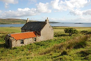
Ronay is an island in the Outer Hebrides of Scotland, which lies a short distance off the east coast of Grimsay.

Boreray is an island with a single croft, lying 2 kilometres (1.2 mi) north of North Uist in the Outer Hebrides of Scotland.

Killegray is an island in the Sound of Harris in the Outer Hebrides of Scotland.

<span class="mw-page-title-main">Flodaigh</span>

Flodaigh is a tidal island lying to the north of Benbecula and south of Grimsay in the Outer Hebrides, Scotland. It is connected to Benbecula by a causeway.

Ceann Ear is the largest island in the Monach or Heisgeir group off North Uist in north west Scotland. It is 203 hectares in size and connected by sandbanks to Ceann Iar via Sibhinis at low tide. It is said that it was at one time possible to walk all the way to Baleshare, and on to North Uist, 5 miles away at low tide. In the 16th century, a large tidal wave was said to have washed this away.

Na h-Eileanan Iasgaich comprise a small uninhabited archipelago in Loch Boisdale, in the south east of the island of South Uist, in the Outer Hebrides, Scotland. The individual islands are separated from one another at high tide, but connected to one another at low tide,. They are around 50 ha in extent and over 20m at their highest point. Their boundaries are ill-defined.

<span class="mw-page-title-main">Orosay</span>

Orosay is a small uninhabited tidal island in the Sound of Barra lying at the north end of Traigh Mhòr, the "big beach" on the north east coast of Barra. It is one of ten islands in the Sound of Barra, a Site of Community Importance for conservation in the Outer Hebrides of Scotland. It is about 30 hectares in extent and the highest point is 38 metres (125 ft).

<span class="mw-page-title-main">Fraoch-Eilean</span>

Fraoch-eilean is a small island with an uncertain population north of Benbecula in the Outer Hebrides of Scotland. It is about 55 hectares in extent and the highest point is 11 metres (36 ft). Its name derives from the Gaelic for "heather island".

Holm of Grimbister

Holm of Grimbister is an inhabited tidal islet in the Orkney archipelago of Scotland. Located in the Bay of Firth near Finstown it is connected to Mainland Orkney by a causeway.

<span class="mw-page-title-main">Eilean na Cille</span> Island of the Outer Hebrides connected to Grimsay (South) by a causeway

Eilean na Cille, south east of Benbecula is an island of the Outer Hebrides connected to Grimsay (South) by a causeway which carries the B891. The road was built to service the pier at Peter's Port, which was constructed in 1896 at cost of £2,000 – although the anchorage is awkward and should not be used without local knowledge.

<span class="mw-page-title-main">Flodday, Loch Maddy</span>

Flodday is an uninhabited island in Loch Maddy, North Uist in the Outer Hebrides of Scotland.

References

Coordinates: 57°24.3′N7°16.6′W / 57.4050°N 7.2767°W / 57.4050; -7.2767