Grojec | ||
---|---|---|
Palace in Grojec | ||
| ||
Coordinates: 49°58′58″N19°13′46″E / 49.98278°N 19.22944°E Coordinates: 49°58′58″N19°13′46″E / 49.98278°N 19.22944°E | ||
Country | ||
Voivodeship | Lesser Poland | |
County | Oświęcim County | |
Gmina | Gmina Oświęcim | |
First mentioned | 1285 | |
Population (2006) | ||
• Total | 2,923 | |
Time zone | CET (UTC+1) | |
• Summer (DST) | CEST (UTC+2) | |
Postal code | 32-615 | |
Area code(s) | +48 33 | |
Car plates | KOS |
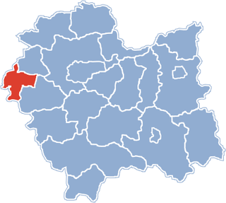
Grojec [ˈɡrɔjɛt͡s] is a historic village in Oświęcim County in Lesser Poland Voivodeship in Poland. [1] It lies approximately 8 kilometres (5 mi) south of Oświęcim and 52 km (32 mi) west of the regional capital Kraków.
Oświęcim County is a unit of territorial administration and local government (powiat) in Lesser Poland Voivodeship, southern Poland. It came into being on January 1, 1999, as a result of the Polish local government reforms passed in 1998. Its administrative seat and largest town is Oświęcim, which lies 51 kilometres (32 mi) west of the regional capital Kraków. The county contains four other towns: Kęty, 17 km (11 mi) south of Oświęcim, Brzeszcze, 9 km (6 mi) south-west of Oświęcim, Chełmek, 8 km (5 mi) north of Oświęcim, and Zator, 16 km (10 mi) east of Oświęcim.
Lesser Poland Voivodeship or Lesser Poland Province, also known as Małopolska Voivodeship or Małopolska Province, is a voivodeship (province), in southern Poland. It has an area of 15,108 square kilometres (5,833 sq mi), and a population of 3,267,731 (2006).
Kraków, also spelled Cracow or Krakow, is the second largest and one of the oldest cities in Poland. Situated on the Vistula River in the Lesser Poland region, the city dates back to the 7th century. Kraków was the official capital of Poland until 1596 and has traditionally been one of the leading centres of Polish academic, economic, cultural and artistic life. Cited as one of Europe's most beautiful cities, its Old Town was declared a UNESCO World Heritage Site.
The village was first mentioned as Grozey in 1285 in the document allowing komes Adam to establish a new village Sępnia (contemporary Poręba Wielka), which would lay close to Grojec. [2] It was later mentioned as Grodecz (1364), Grodicz (1442), Grodziecz (1537). The name indicates existence of a gord, of which traces can be found on a nearby hill.
Komes, also żupan in Polish - A title developed from the Latin comes in medieval Poland and was used for dignitary in the period of the Holy Roman Empire for administrative and military district commanders. The title faded from use before the establishment of the Polish-Lithuanian Commonwealth to be replaced by kasztelan.
Poręba Wielka is a village in the administrative district of Gmina Oświęcim, within Oświęcim County, Lesser Poland Voivodeship, in southern Poland. It lies approximately 7 kilometres (4 mi) south-east of Oświęcim and 48 km (30 mi) west of the regional capital Kraków.
A gord is a medieval Slavic fortified wooden settlement, sometimes known as a burgwall after the German term for such sites. Gords were built during the late Bronze and early Iron Ages by the Lusatian culture, and later in the 8th–7th centuries CE, in what is now Poland, the Czech Republic, Hungary, Slovakia, eastern Germany, Romania/Moldova, Belarus and western Ukraine. These settlements were usually founded on strategic sites such as hills, riverbanks, lake islands, or peninsulas.
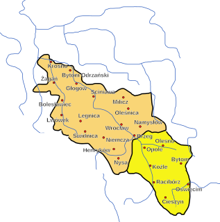
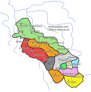
Politically it belonged initially to the Duchy of Racibórz and the Castellany of Oświęcim, which was in 1315 formed in the process of feudal fragmentation of Poland into the Duchy of Oświęcim, ruled by a local branch of Silesian Piast dynasty. In 1327 the duchy became a fee of the Kingdom of Bohemia. In 1457 Jan IV of Oświęcim agreed to sell the duchy to the Polish Crown, and in the accompanying document issued on 21 February the village was mentioned as Grodecz. [3]
The Duchy of Opole and Racibórz was one of the numerous Duchies of Silesia ruled by the Silesian branch of the royal Polish Piast dynasty. It was formed in 1202 from the union of the Upper Silesian duchies of Opole and the Racibórz, in a rare exception to the continuing feudal fragmentation of the original Duchy of Silesia.
A castellan is the title used in Medieval Europe for an appointed official, a governor of a castle and its surrounding territory referred to as the castellany. The title of governor is retained in the English Prison system, as a remnant of the medieval idea of the castellan as head of the local prison. The word stems from the Latin Castellanus, derived from castellum "castle". Sometimes also known as a constable of the castle district, the Constable of the Tower of London is, in fact, a form of castellan, with representative powers in the local or national assembly. A castellan was almost always male, but could occasionally be female, as when, in 1194, Beatrice inherited her father's castellany of Bourbourg upon the death of her brother, Roger.
The Duchy of Oświęcim, or the Duchy of Auschwitz, was one of many Duchies of Silesia, formed in the aftermath of the fragmentation of Poland.
The territory of the Duchy of Oświęcim was eventually incorporated into Poland in 1564 and formed Silesian County of Kraków Voivodeship. Upon the First Partition of Poland in 1772 it became part of the Austrian Kingdom of Galicia. After World War I and fall of Austria-Hungary it became part of Poland. It was annexed by Nazi Germany at the beginning of World War II, and afterwards it was restored to Poland.
Silesian County was an administrative unit (powiat) of both the Kingdom of Poland and the Polish–Lithuanian Commonwealth. With seats in the towns of Zator and Oświęcim, it was part of Kraków Voivodeship.
Kraków Voivodeship 1300–1795 – a unit of administrative division and local government in the Kingdom of Poland from the 14th century to the partitions of Poland in 1772–1795. Located in the southwestern corner of the country, it was part of the Little Poland province.
The First Partition of Poland took place in 1772 as the first of three partitions that ended the existence of the Polish–Lithuanian Commonwealth by 1795. Growth in the Russian Empire's power, threatening the Kingdom of Prussia and the Habsburg Monarchy, was the primary motive behind this first partition. Frederick the Great engineered the partition to prevent Austria, jealous of Russian successes against the Ottoman Empire, from going to war. The weakened Commonwealth's land, including what was already controlled by Russia, was apportioned among its more powerful neighbors—Austria, Russia and Prussia—so as to restore the regional balance of power in Central Europe among those three countries. With Poland unable to effectively defend itself, and with foreign troops already inside the country, the Polish parliament (Sejm) ratified the partition in 1773 during the Partition Sejm convened by the three powers.
Dankowice is a village in the administrative district of Gmina Wilamowice, within Bielsko County, Silesian Voivodeship, in southern Poland. It lies approximately 4 kilometres (2 mi) north-west of Wilamowice, 12 km (7 mi) north of Bielsko-Biała, and 37 km (23 mi) south of the regional capital Katowice.
Osiek is a village in Oświęcim County, Lesser Poland Voivodeship, in southern Poland. It is the seat of the gmina called Gmina Osiek. It lies approximately 12 kilometres (7 mi) south of Oświęcim and 50 km (31 mi) west of the regional capital Kraków.
Stara Wieś is a village in the administrative district of Gmina Wilamowice, within Bielsko County, Silesian Voivodeship, in southern Poland. It lies approximately 6 kilometres (4 mi) west of Wilamowice, 8 km (5 mi) north of Bielsko-Biała, and 40 km (25 mi) south of the regional capital Katowice. The village has a population of 1,978.
Przecieszyn is a village in the administrative district of Gmina Brzeszcze, within Oświęcim County, Lesser Poland Voivodeship, in southern Poland. It lies approximately 5 kilometres (3 mi) south-east of Brzeszcze, 10 km (6 mi) south of Oświęcim, and 56 km (35 mi) west of the regional capital Kraków.
Bulowice is a village in the administrative district of Gmina Kęty, within Oświęcim County, Lesser Poland Voivodeship, in southern Poland. It lies approximately 8 kilometres (5 mi) south of Kęty, 25 km (16 mi) south of Oświęcim, and 56 km (35 mi) south-west of the regional capital Kraków.
Łęki is a village in the administrative district of Gmina Kęty, within Oświęcim County, Lesser Poland Voivodeship, in southern Poland. It lies approximately 6 kilometres (4 mi) north of Kęty, 12 km (7 mi) south of Oświęcim, and 54 km (34 mi) west of the regional capital Kraków.
Malec is a village in the administrative district of Gmina Kęty, within Oświęcim County, Lesser Poland Voivodeship, in southern Poland. It lies approximately 5 kilometres (3 mi) north-east of Kęty, 13 km (8 mi) south of Oświęcim, and 52 km (32 mi) west of the regional capital Kraków.
Nowa Wieś is a village in the administrative district of Gmina Kęty, within Oświęcim County, Lesser Poland Voivodeship, in southern Poland. It lies approximately 1 kilometre (1 mi) north of Kęty, 16 km (10 mi) south of Oświęcim, and 55 km (34 mi) west of the regional capital Kraków.
Witkowice is a village in the administrative district of Gmina Kęty, within Oświęcim County, Lesser Poland Voivodeship, in southern Poland. It lies approximately 5 kilometres (3 mi) east of Kęty, 16 km (10 mi) south of Oświęcim, and 50 km (31 mi) west of the regional capital Kraków.
Głębowice is a village in the administrative district of Gmina Osiek, within Oświęcim County, Lesser Poland Voivodeship, in southern Poland. It lies approximately 5 kilometres (3 mi) east of Osiek, 14 km (9 mi) south-east of Oświęcim, and 46 km (29 mi) west of the regional capital Kraków.
Broszkowice is a village in the administrative district of Gmina Oświęcim, within Oświęcim County, Lesser Poland Voivodeship, in southern Poland. It lies approximately 1 kilometre (1 mi) north of Oświęcim and 51 km (32 mi) west of the regional capital Kraków.
Harmęże is a village in the administrative district of Gmina Oświęcim, within Oświęcim County, Lesser Poland Voivodeship, in southern Poland. It lies approximately 8 kilometres (5 mi) south-west of Oświęcim and 57 km (35 mi) west of the regional capital Kraków. The village has a population of 613.
Pławy is a village in the administrative district of Gmina Oświęcim, within Oświęcim County, Lesser Poland Voivodeship, in southern Poland. It lies approximately 7 kilometres (4 mi) west of Oświęcim and 57 km (35 mi) west of the regional capital Kraków.
Rajsko is a village in the administrative district of Gmina Oświęcim, within Oświęcim County, Lesser Poland Voivodeship, in southern Poland. It lies approximately 7 kilometres (4 mi) south-west of Oświęcim and 55 km (34 mi) west of the regional capital Kraków.
Włosienica is a village in the administrative district of Gmina Oświęcim, within Oświęcim County, Lesser Poland Voivodeship, in southern Poland. It lies approximately 8 kilometres (5 mi) south-east of Oświęcim and 45 km (28 mi) west of the regional capital Kraków.
Nidek is a village in the administrative district of Gmina Wieprz, within Wadowice County, Lesser Poland Voivodeship, in southern Poland. It lies approximately 4 kilometres (2 mi) north-west of Wieprz, 13 km (8 mi) west of Wadowice, and 47 km (29 mi) west of the regional capital Kraków.
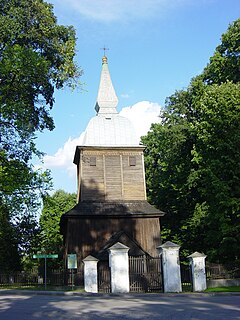
Polanka Wielka is a village in Oświęcim County, Lesser Poland Voivodeship, in southern Poland. It is the seat of the gmina called Gmina Polanka Wielka. It lies approximately 10 kilometres (6 mi) south-east of Oświęcim and 46 km (29 mi) west of the regional capital Kraków.
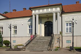
Bestwina is a village in Bielsko County, Silesian Voivodeship, in southern Poland. It is the seat of the gmina called Gmina Bestwina. It lies approximately 8 kilometres (5 mi) north of Bielsko-Biała and 40 km (25 mi) south of the regional capital Katowice.
Pisarzowice is a village in the administrative district of Gmina Wilamowice, within Bielsko County, Silesian Voivodeship, in southern Poland. It lies approximately 4 kilometres (2 mi) south of Wilamowice, 8 km (5 mi) north-east of Bielsko-Biała, and 42 km (26 mi) south of the regional capital Katowice. The village has a population of 4,673.
Wikimedia Commons has media related to Grojec (Gmina Oświęcim) . |
This Lesser Poland Voivodeship location article is a stub. You can help Wikipedia by expanding it. |