Yellandu is a town in Bhadradri Kothagudem district of the Indian state of Telangana. It is located in Yellandu mandal of Kothagudem revenue division.

Khammam district is a district in the eastern region of the Indian state of Telangana. The city of Khammam is the district headquarters. The district shares boundaries with Suryapet, Mahabubabad, Bhadradri districts and with Eluru and NTR districts.
Gudur is a town in Tirupati district of the Indian state of Andhra Pradesh. It is a municipality and the headquarters of Gudur mandal and Gudur revenue division.

Mahabubabad is a city and the district headquarters of Mahabubabad district in the Indian state of Telangana. It is on the west bank of the Munneru, which is one of the tributaries of the River Krishna. Mahabubabad is known for the Bayyaram Mines.
Pakhala Kothaguda is an agency mandal in Mulugu Constituency of Mahabubabad district of the Indian state of Telangana.
Bayyaram is a mandal in Mahabubabad district of Telangana.
Mulugu is a town in Mulugu district, Telangana. It is the headquarters of the district, which was formed in 2019 after Jayashankar Bhupalpally district was split. Prior to the reorganization of districts that created Jayashankar Bhupalpally district, Mulugu was a part of the Warangal district. It lies on National Highway 163.
Bayyaram Mines are iron ore mine located in Bayyaram in Mahabubabad district, Telangana, India. The mines also include Gudur Mandal in Warangal district.
Nellore mandal is one of the 46 mandals in Nellore district of the state of Andhra Pradesh, India. Its headquarters are located at Nellore. The mandal is bounded by Sangam, Butchireddipalem, Indukurpet, Kovur, Podlakur, Thotapalligudur, Venkatachalam and Muthukur mandals.
Gudur mandal is one of the 34 mandals in Tirupati district of the state of Andhra Pradesh, India. Its headquarters are located at Gudur. The mandal is situated on the coast of Bay of Bengal, bounded by Sydapuram, Manubolu, Balayapalle, Ojili and Chillakur mandals. It is a part of Gudur revenue division.
Kota mandal is one of the 34 mandals in Tirupati district of the state of Andhra Pradesh in India. Its headquarters are located at Kota. The mandal is bounded by Muthukur mandal, Chillakur, Ojili, Chittamur, Vakadu mandals and it also borders Nellore district.

Warangal district, formerly Warangal Rural district, is a district in the Indian state of Telangana. The district shares boundaries with Mahabubabad, Jangaon, Hanamkonda, Mulugu and Bhupalpally districts.

Mahabubabad district also known as Manukota district is a district in the Indian state of Telangana. The district was carved out from the erstwhile Warangal district following the re-organisation of districts in the state in October 2016. The district shares boundaries with Suryapet, Khammam, Bhadradri, Warangal, Mulugu and Jangaon districts.

Bhadradri Kothagudem is a district in the east of the Indian state of Telangana. Kothagudem is the district headquarters. It is the largest district in Telangana, with an area of 7483 km2. It borders the districts Khammam, Mahabubabad, Mulugu, Eluru and East Godavari, and shares a boundary with the bordering states Chhattisgarh and Andhra Pradesh. The district comprises 24 mandals and 2 revenue divisions, Kothagudem and Bhadrachalam.

Janagama(జనగామ) district is a district in the middle of the Indian state of Telangana. It was a part of the erstwhile Warangal district prior to the re-organisation of districts in the state. The district shares boundaries with Suryapet, Yadadri, Warangal, Hanamkonda, Siddipet and Mahabubabad districts.
Yelgoi is a village located in Telangana state Sangareddy district Manoor mandal. It is located 10 Km range from the Mandal headquarters manoor.
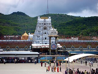
Tirupati district is one of the eight districts of Rayalaseema region in the Indian state of Andhra Pradesh. The district headquarters is located at Tirupati city. This district is known for its numerous historic temples, including the Hindu shrine of Tirumala Venkateswara Temple and Sri Kalahasteeswara temple. The district is also home to Satish Dhawan Space Centre, a rocket launch centre located in Sriharikota. The river Swarnamukhi flows through Tirupati, Srikalahasti, Naidupeta, Vakadu and join into the Bay of Bengal.
Gudur is a town in Tirupati district, Andhra Pradesh, India.

