Guelmim | |
|---|---|
    | |
 Guelmim Location in Morocco  Guelmim Guelmim (Africa) | |
| Coordinates: 28°59′N10°04′W / 28.983°N 10.067°W | |
| Country | |
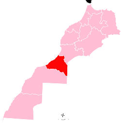
| Region | Guelmim-Oued Noun |
| Province | Guelmim |
| Population (2014) [1] | |
• Total | 118,318 |
| Time zone | UTC+1 (CET) |
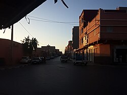
Guelmim [a] is a city in southern Morocco, often called the Gateway to the Desert. It is the capital of the Guelmim-Oued Noun region which includes southern Morocco (south of the Souss-Massa region) and the northeastern corner of Western Sahara. The population of the city was 187,808 as of the 2014 Moroccan census, [1] making it the largest city in the region. The N1 and N12 highways cross at Guelmim and link it to the nearby region of Souss-Massa.
Contents
Guelmim is located just north of Asrir, which was the site of an important trade-route city and the capital of the Saharan Berber tribes. It is home to a camel market. Most of the inhabitants speak either the Tachelhit language or the Hassaniya dialect of Sahrawi Arabs, as it is part of the Sahrawi-inhabited southern region of Morocco.