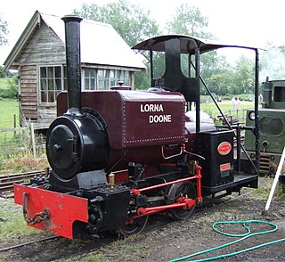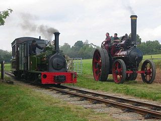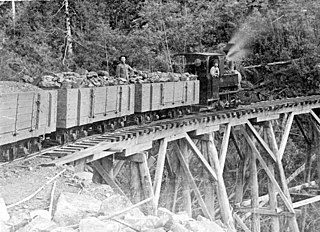
The Talyllyn Railway is a narrow gauge preserved railway in Wales running for 7.25 miles (11.67 km) from Tywyn on the Mid-Wales coast to Nant Gwernol near the village of Abergynolwyn. The line was opened in 1865 to carry slate from the quarries at Bryn Eglwys to Tywyn, and was the first narrow gauge railway in Britain authorised by Act of Parliament to carry passengers using steam haulage. Despite severe under-investment, the line remained open, and in 1951 it became the first railway in the world to be preserved as a heritage railway by volunteers.

Gauntlet track or interlaced track is an arrangement in which railway tracks run parallel on a single track bed and are interlaced such that only one pair of rails may be used at a time. Since this requires only slightly more width than a single track, all rails can be carried on the same crossties/sleepers. Trains run on the discrete pair of rails appropriate to their direction, track gauge or loading gauge.

The Amerton Railway is a 2 ft narrow gauge heritage railway in the English county of Staffordshire. It is owned by the Staffordshire Narrow Gauge Railway Society.

Perrygrove Railway runs through farmland and woods on the edge of the Forest of Dean. Passengers can ride on the train to use activities including a Treetop Adventure, a covered picnic and play area at Foxy Hollow, an Indoor Village with secret passages, and a den-building area in the woods.
The Opua Branch or Otiria-Opua Industrial Line, partially still operational as the Bay of Islands Vintage Railway, is a former section of the North Auckland Line in the Northland Region of New Zealand, between Otiria and the Bay of Islands township of Opua. The first section was constructed as a bush tramway in 1868 and converted to a railway in the next decade. Today the railway is partially used by the Bay of Islands Vintage Railway, which runs tourist services between Kawakawa and Taumarere. The line's centrepiece is the section where it runs down along the main street of Kawakawa.
The Oxford, Worcester and Wolverhampton Railway (OW&WR) was a railway company in England. It built a line from Wolvercot Junction near Oxford to Worcester, Stourbridge, Dudley and Wolverhampton, as well as some branches.

The former Victorian Railways, the state railway authority in Victoria, Australia, built a number of experimental 2 ft 6 in narrow-gauge lines around the beginning of the 20th century. Although all were closed by the early 1960s, parts of two have been reopened as heritage railways.
The Tyers Valley Tramway was a 2 ft 6 in narrow gauge timber tramway built by the Forests Commission of Victoria to exploit timber resources on the slopes of Mount Baw Baw, Victoria. At Collins Siding the tramway linked with the Victorian Railways narrow gauge line from Moe to Walhalla, and was built to the same 2 ft 6 in gauge.

The East Kent Light Railway was part of the Colonel Stephens group of cheaply built rural light railways in England. Holman Fred Stephens was engineer from its inception, subsequently becoming director and manager. The line ran from Shepherdswell to Wingham Station with a branch from Eastry through Poison Cross to Richborough Port. Built primarily to serve colliery traffic, the line was built with many spurs and branches to serve the mostly unsuccessful mines of the Kent coalfield, with cancelled plans to construct several others. The success of Tilmanstone colliery allowed the main line of the railway to continue operation until 1986, when the remainder of the line became a heritage railway.

The Statfold Barn Railway is a narrow gauge railway of 2 ft gauge near Tamworth, Staffordshire and partially in Warwickshire, England, also displaying locomotives of other gauges including 4 ft 8 1⁄2 instandard gauge, 18 in and 2 ft 6 in, and other vehicles. It is privately owned by Mr Graham Lee, former chairman of LH Group Services Ltd – which in 2005 bought what remained of the Hunslet Engine Company.
The Deeside Tramway was a gravity and horse-worked, 2 ft 6 in narrow gauge industrial railway connecting the slate workings on the Dee valley with the main road at Glyndyfrdwy and later the Great Western Railway's Ruabon-Dolgellau railway. It was one of the last tramways in regular use to use wooden rails covered in iron sheaths.
Richboro Port railway station was constructed by the East Kent Light Railway, as part of its branch to Richborough Port, which never opened to passengers. Authorisation to operate a passenger service over the branch was never requested by the East Kent as it considered that the Port had first to develop before expenses could be outlaid on improving the branch's bridges over the Southern Railway and River Stour, which His Majesty's Railway Inspectorate would no doubt have required before giving its consent. The station was named Richboro Port, dropping the "ugh" off the end of Richborough, as witnessed by the nameboard on the station and contemporary maps.

The Hay Railway (HR) was an early Welsh narrow gauge horse-drawn tramway that connected Eardisley with Watton Wharf on the Brecknock and Abergavenny Canal.

The Crystal Brook-Broken Hill railway line is a 371 kilometre line running from Crystal Brook to Broken Hill on the Australian Rail Track Corporation network.

High Peak Junction, near Cromford, Derbyshire, England, is the name now used to describe the site where the former Cromford and High Peak Railway (C&HPR), whose workshops were located here, meets the Cromford Canal. It lies within Derwent Valley Mills World Heritage Site, designated in 2001, and today marks the southern end of the High Peak Trail, a 17 miles (27 km) trail for walkers, cyclists and horse riders. The Derwent Valley Heritage Way also passes this point, and popular walks lead from here along the towpath in both directions.

The Bicslade Tramroad was a wagonway built by the Severn and Wye Railway (S&WR) in the Forest of Dean, Gloucestershire, England. The first section of the line was opened in 1812 as a branch of the S&WR plateway from Lydney to Lydbrook, which had opened in 1810. It was expanded over time to serve the collieries and quarries in the Bixslade valley ; the last stretch, to Bixhead Quarry, opened in 1855. Stone traffic ceased in 1944 and coal followed in 1946.

The Coalport branch line was a standard gauge London and North Western Railway branch line in Shropshire, England, which ran between Hadley Junction near Oakengates on the Stafford to Shrewsbury line and a terminus at Coalport East railway station on the north bank of the River Severn at Coalport.

The Sandfly Colliery Tramway was a 20 km (12 mi), 2 ft narrow gauge tramway linking the Kaoota Mine to Margate, Tasmania. Constructed in 1905–06, the Tramway climbed 457 m (1,499 ft) above sea level and crossed ten bridges. After coal mining ceased the tramway was used to transport logs, fruit and passengers. The line was lifted and abandoned in 1922 after bushfires destroyed several bridges along the line. Currently, 6 km (3.7 mi) of the old track is used as cycling/walking tracks, while the remainder of the old line is on private property.
Fenn's Bank railway station was a station in Bronington, Wrexham, Wales. The station was opened on 4 May 1863 and closed on 18 January 1965.
The Eaton Branch Railway was a standard gauge industrial railway built to serve ironstone quarries around the village of Eaton in Leicestershire. It operate from 1884 until 1965.


