
Cape Longing is a rocky cape on the east coast of Graham Land, Antarctica, forming the south end of a large ice-covered promontory which marks the west side of the south entrance to Prince Gustav Channel. It was discovered by the Swedish Antarctic Expedition under Otto Nordenskiöld in 1902, and so named by him because from the position of his winter hut on Snow Hill Island the cape lay in the direction of his "land of longing" which he was anxious to explore.

Finsterwalder Glacier is a glacier on the northwest side of Hemimont Plateau, 2 nautical miles wide and 10 nautical miles long, flowing southwest from the central plateau of Graham Land, Antarctica, toward the head of Lallemand Fjord. Its mouth lies between the mouths of Haefeli Glacier and Klebelsberg Glacier, the three glaciers merging with Sharp Glacier where the latter enters the fjord. It was first surveyed from the plateau in 1946–47 by the Falkland Islands Dependencies Survey, and named by them for Sebastian Finsterwalder and his son, Richard Finsterwalder, German glaciologists.
Barlas Channel is a channel, 8 nautical miles (15 km) long and 2 nautical miles (4 km) wide, in the northern part of Laubeuf Fjord, extending southwest from The Gullet and separating Day Island from Adelaide Island. It was first roughly surveyed in 1936 by the British Graham Land Expedition under John Rymill, and resurveyed in 1948 by the Falkland Islands Dependencies Survey, who named it for William Barlas.
Bertram Glacier is a glacier, 15 nautical miles (28 km) long and 18 nautical miles (33 km) wide at its mouth, which flows west from the Dyer Plateau of Palmer Land into George VI Sound between Wade Point and Gurney Point.
Chamberlin Glacier is a glacier on the east side of Hemimont Plateau which flows northeast into Whirlwind Inlet about 4 nautical miles (7 km) southeast of Matthes Glacier, on the east coast of Graham Land. It was discovered by Sir Hubert Wilkins on a flight of December 20, 1928, and in 1940 was photographed from the air by the United States Antarctic Service. It was charted in 1947 by the Falkland Islands Dependencies Survey, who named it for American glaciologist and geomorphologist Thomas C. Chamberlin, educator and professor of geology at the Universities of Wisconsin and Chicago.
Swine Hill is the southernmost of two rugged, rocky knolls, 550 nautical miles (1000 km), standing 10 nautical miles (18 km) west-northwest of the summit of Mount Bagshawe on the west coast of Palmer Land and overlooking Gadarene Lake and George VI Sound. The feature was first seen and photographed from the air on November 23, 1935 by Lincoln Ellsworth, and was mapped from these photographs by W.L.G. Joerg. It was roughly surveyed in 1936 by the British Graham Land Expedition (BGLE) under Rymill, and resurveyed in 1948 by the Falkland Islands Dependencies Survey (FIDS) who erected a cairn on the summit. Named by FIDS for its association with Gadarene Lake and the incident of the Gadarene swine.
Dalgliesh Bay is a bay, 1 nautical mile (2 km) wide and indenting 3 nautical miles (6 km), lying between Lainez Point and Bongrain Point on the west side of Pourquoi Pas Island, off the west coast of Graham Land. It was first roughly surveyed in 1936 by the British Graham Land Expedition under John Rymill. It was resurveyed in 1948 by the Falkland Islands Dependencies Survey (FIDS) and named for David G. Dalgliesh, FIDS medical officer at Stonington Island in 1948–49, who accompanied the 1948 sledge survey party to this area.
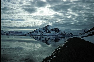
Day Island is an island, 7 nautical miles (13 km) long and 3 nautical miles (6 km) wide, lying immediately south of The Gullet and 2 nautical miles (4 km) north of Wyatt Island in the northern part of Laubeuf Fjord, off the west coast of Graham Land. It was first surveyed in 1936 by the British Graham Land Expedition under John Rymill, who used the provisional name Middle Island for this feature. The island was resurveyed in 1948 by the Falkland Islands Dependencies Survey and renamed by them for Vice Admiral Sir Archibald Day, Hydrographer of the Navy.
Delaite Island is an island 1 nautical mile (2 km) long, lying 3 nautical miles (6 km) northeast of Emma Island in the north-central portion of Wilhelmina Bay, off the west coast of Graham Land. It was discovered by the Belgian Antarctic Expedition, 1897–99, under Gerlache, and named by him for J. Delaite, a supporter of the expedition.
Jones Channel is an ice-filled channel, 8 nautical miles (15 km) long and 1 to 2 nautical miles wide, lying between Blaiklock Island and the south part of Arrowsmith Peninsula and connecting Bourgeois Fjord with the head of Bigourdan Fjord, off the west coast of Graham Land. It was occupied by the Jones Ice Shelf, since the latters disintegration in 2003 it is free of ice.
Perutz Glacier is a glacier, 10 nautical miles (18 km) long and 2 nautical miles (3.7 km) wide, which flows west-northwest from Hemimont Plateau into Bourgeois Fjord, close east of Thomson Head, on the west coast of Graham Land, Antarctica. The mouth of the glacier was first surveyed in 1936 by the British Graham Land Expedition (BGLE) under Rymill. The entire glacier was surveyed in 1946-47 and 1948-49 by the Falkland Islands Dependencies Survey (FIDS), and named by them for Max F. Perutz of the Cavendish Laboratory, Cambridge, who has made important studies on the mechanism of glacier flow.
Forbes Glacier is a glacier which flows from Hemimont Plateau west into the northeast corner of Square Bay, on the west coast of Graham Land, Antarctica. It is 10 nautical miles (19 km) long, 4 nautical miles (7 km) wide in its central part, and narrows to 2 nautical miles (4 km) at its mouth. The lower reaches of the glacier were first surveyed in 1936 by the British Graham Land Expedition under John Rymill. The survey was completed in 1946–48 by the Falkland Islands Dependencies Survey who named the glacier for James David Forbes, a Scottish physicist who was noted for his pioneer works on glaciology.
Forel Glacier is a glacier 1.5 nautical miles (3 km) wide and 4 nautical miles (7 km) long, flowing southwest into Blind Bay, on the west coast of Graham Land, Antarctica. It was first roughly surveyed in 1936 by the British Graham Land Expedition under John Rymill. Its lower reaches were surveyed in 1949 by the Falkland Islands Dependencies Survey, and the glacier named by them for François-Alphonse Forel, a noted Swiss glacier physicist and author, and first President of the International Commission of Glaciers in 1894.

Hale Glacier is a glacier about 6 nautical miles (11 km) long, located just east of Mount Simpson on Thurston Island, Antarctica, and flowing southwest to the Abbot Ice Shelf in Peacock Sound. It was delineated from air photos taken by U.S. Navy Squadron VX-6 in January 1960, and was named by the Advisory Committee on Antarctic Names (US-ACAN) for Lieutenant Bill J. Hale, U.S. Navy, a helicopter pilot aboard USS Burton Island who made exploratory flights to Thurston Island in February 1960.
Meiklejohn Glacier is a glacier, 12 nautical miles (22 km) long and 4 nautical miles (7 km) wide, flowing southwest from the Dyer Plateau of Palmer Land, Antarctica, to George VI Sound, immediately south of Moore Point. In its lower reaches the south side of this glacier merges with Millett Glacier. It was first surveyed in 1936 by the British Graham Land Expedition (BGLE) under John Rymill, and was named by the UK Antarctic Place-Names Committee in 1954 for Ian F. Meiklejohn, a radio operator of the BGLE.
Heim Glacier is a glacier 8 nautical miles (15 km) long in the southeast part of Arrowsmith Peninsula, which flows south to merge with the ice in Jones Channel on the west coast of Graham Land, Antarctica. With Antevs Glacier to the north, it forms a transverse depression extending to the southwest part of Lallemand Fjord. Heim Glacier was first sighted from the air in 1936 by the British Graham Land Expedition under John Rymill. Its lower reaches were surveyed in 1949 by the Falkland Islands Dependencies Survey, and the glacier named by them for Albert Heim, a Swiss glaciologist and the author in 1885 of Handbuch der Gletscherkunde.
Hinks Channel is an arc-shaped channel in the northern part of Laubeuf Fjord, 2 nautical miles (4 km) wide and 11 nautical miles (20 km) long, which extends from The Gullet and separates Day Island on the west from Arrowsmith Peninsula and Wyatt Island on the east, off the west coast of Graham Land, Antarctica. It was first roughly surveyed in 1936 by the British Graham Land Expedition under Rymill, and was resurveyed in 1948 by the Falkland Islands Dependencies Survey who named it for Arthur R. Hinks.
Tickle Channel is a narrow channel in the south part of Hanusse Bay, from 1 to 3 nautical miles (6 km) wide and 5 nautical miles (9 km) long, extending northward from The Gullet and separating Hansen Island from the east extremity of Adelaide Island. First seen from the air by the British Graham Land Expedition (BGLE) on a flight in February 1936. Surveyed from the ground in 1948 by the Falkland Islands Dependencies Survey (FIDS), who applied this descriptive name. In Newfoundland and Labrador a tickle is a narrow water passage as between two islands.
Ridge Island is a ridge-shaped island, 6 nautical miles (11 km) long and 1.5 nautical miles (2.8 km) wide lying 3 nautical miles (6 km) east of Pourquoi Pas Island in the center of Bourgeois Fjord, off the west coast of Graham Land. Discovered and named by the British Graham Land Expedition (BGLE), 1934–37, under Rymill.

