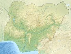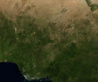
Nigeria is a country in West Africa. It shares land borders with the Republic of Benin to the west, Chad and Cameroon to the east, and Niger to the north. Its coast lies on the Gulf of Guinea in the south and it borders Lake Chad to the northeast. Notable geographical features in Nigeria include the Adamawa Plateau, Mambilla Plateau, Jos Plateau, Obudu Plateau, the Niger River, Benue River, and Niger Delta.
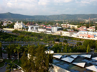
Abuja is the capital and eighth most populous city of Nigeria. Situated in the middle of the country within the Federal Capital Territory (FCT), it is a planned city built mainly in the 1980s based on a master plan by International Planning Associates (IPA), a consortium of three American planning and architecture firms made up of Wallace, Roberts, McHarg & Todd as the lead, Archi systems International, and Planning Research Corporation. The Central Business District of Abuja was designed by Japanese architect Kenzo Tange. It replaced Lagos, the country's most populous city, as the capital on 12 December 1991.
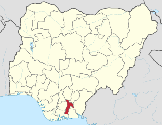
Abia State is a state in the South-East geopolitical zone of Nigeria. The state is bordered to the northwest by Anambra State and to the northeast by the states of Enugu and Ebonyi, Imo State to the west, Cross River State to the east, Akwa Ibom State to the southeast, and Rivers State to the south. Abia is the only Southeastern state that has boundaries with the other four Southeastern states in Nigeria. It takes its name from the acronym for four of the state's most populated regions: Aba, Bende, Isuikwuato, and Afikpo. The state capital is Umuahia while the largest city and commercial centre is Aba.

Benue River, previously known as the Chadda River or Tchadda, is the major tributary of the Niger River. The size of its catchment basin is 319,000 km2. Almost its entire length of approximately 1,400 kilometres (870 mi) is navigable during the summer months. As a result, it is an important transportation route in the regions through which it flows. The name Benue comes from 'Ber-nor, meaning 'river or lake of hippopotamus in the Tiv language,{{ref >= benue Wikipedia]] The River Benue looking south east from Jimeta.]]
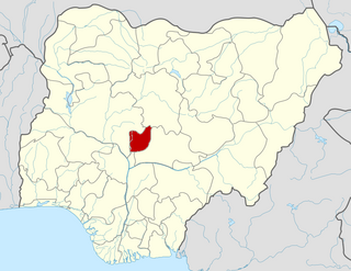
The Federal Capital Territory (FCT) is a federal territory in central Nigeria. Abuja, the capital city of Nigeria, is located in this territory. The FCT was formed in 1976 from parts of the states of old Kaduna, Kwara, Niger, and Plateau states, with the bulk of land mass carved out of Niger state. The Federal Capital Territory is within the North Central region of the country. Unlike other states of Nigeria, which are headed by elected Governors, it is administered by the Federal Capital Territory Administration, headed by a minister, who is appointed by the president.

Niger is a state in the North Central region of Nigeria. It is the largest state in the country by area. The state capital is Minna. Other major cities are Bida, Kontagora and Suleja. Niger state was formed in 1976 when the then North-Western State was divided into Niger State and Sokoto State. It is home state of two former Nigerian military heads of state— Ibrahim Babangida and Abdulsalami Abubakar. The Nupe,Adara, Gbagyi, Kamuku, Kambari, Gungawa, Hun-Saare, Hausa and Koro form the majority of numerous indigenous tribes of Niger State.
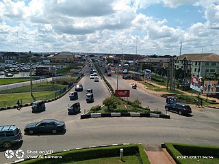
Asaba is the capital of Delta State, Nigeria. A rapidly growing city, it is located at the western bank of the Niger River, in the Oshimili South Local Government Area. Asaba had a population of 149,603 as at the 2006 census, and a fast growing metropolitan population of over half a million people.

Bayelsa state is a state in the South South region of Nigeria, located in the core of the Niger Delta. Bayelsa State was created in 1996 and was carved out from Rivers State, making it one of the newest states in the federation. The capital, Yenagoa, is susceptible to high risk of annual flooding. It shares a boundary with Rivers State to the east and Delta State to the north across the Niger River for 17 km and the Forçados River for 198 km, with the waters of the Atlantic Ocean dominating its southern borders. It has a total area of 10,773 square kilometres (4,159 sq mi). The state comprises eight local government areas: Ekeremor, Kolokuma/Opokuma, Yenagoa, Nembe, Ogbia, Sagbama, Brass and Southern Ijaw. The state is the smallest in Nigeria by population as of the 2006 census. Being in the Niger Delta, Bayelsa State has a riverine and estuarine setting, with bodies of water within the state preventing the development of significant road infrastructure.
Suleja is a city in Niger State, Nigeria, just north of Abuja, capital of the Nigeria. It is sometimes confused with the nearby city of Abuja, due to its proximity, and the fact that it was originally called Abuja before the Nigerian government adopted the name from the then Emir Sulayman Bal for its new federal capital in 1976.
Bida is a Local Government Area in Niger State, Nigeria and a city on the A124 highway which occupies most of the area.
Kagarko is a Local Government Area in southern Kaduna State of Nigeria. Its headquarters are in the town of Kagarko. It has an area of 2,356 km2 and a population of 239,058 at the 2006 census. The Local Government Council is chaired by Nasara Rabo. The postal code is 802.

Gurara is a Local Government Area in Niger State, Nigeria, adjoining the Federal Capital Territory. Its headquarters are in the town of Gawu. Major inhabitants are the Gwari people. The Gurara Waterfalls is found here.

Potiskum is a local government area and city in Yobe State, Nigeria. It's the largest, most populous and fastest growing city in Yobe State. Of the native languages in Yobe State, Potiskum is home to several major groups which include the Karai-Karai, Bolewa and Ngizim and Hausa-Fulani. It is on the A3 highway at 11°43′N11°04′E. It has an area of 559 square kilometres (216 sq mi).

Bwari is a local government area in the Federal Capital Territory in Nigeria. The original inhabitants of the town are the Gbagyi speaking people. The paramount ruler is the Esu who is otherwise known as Sa-bwaya. However, with the establishment of FCT in Abuja so many changes occurred; such changes include the turbaning of late Musa Ijakoro as District Head of Bwari in 1976, and his elevation as Sarki of Bwari to the position of a second class status in 1997 by the Ministry of the Federal Capital Territory under the then minister, General Jeremiah Useni.
Niger East senatorial district, known as Zone B within Niger State in Nigeria covers 9 local governments which include:
- Bosso local government area
- Chanchaga local government area
- Munya local government area
- Paiko local government area
- Rafi local government area
- Shiroro local government area
- Suleja local government area
- Tafa local government area
- Gurara local government area.

Southern Kaduna is an area of the Nok Culture region inhabited by various related ethnic groups who do not identify as Hausa, living south of Zaria, Kaduna State. It is located in the Middle Belt region of Nigeria. According to the Southern Kaduna People's Union (SOKAPU), Southern Kaduna consists of 12 Local Government Areas out of 23 in Kaduna State.
Patigi Beach or Pategi Beach is a beach and tourist destination that is located along the River Niger in Pategi, Kwara State, in the middle belt of Nigeria.
Rifkatu Adamu Chidawa is the Commissioner for Tourism and Culture, Niger State, Nigeria.
The 2023 Niger State gubernatorial election will take place on 18 March 2023, to elect the Governor of Niger State, concurrent with elections to the Niger State House of Assembly as well as twenty-seven other gubernatorial elections and elections to all other state houses of assembly. The election—which was postponed from its original 11 March date—will be held three weeks after the presidential election and National Assembly elections. Incumbent APC Governor Abubakar Sani Bello is term-limited and cannot seek re-election to a third term.
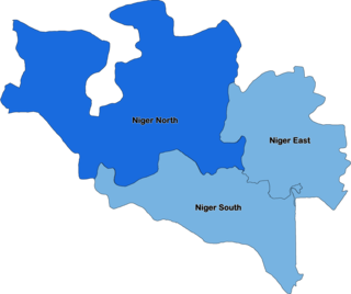
The 2023 Nigerian Senate elections in Niger State will be held on 25 February 2023, to elect the 3 federal Senators from Niger State, one from each of the state's three senatorial districts. The elections will coincide with the 2023 presidential election, as well as other elections to the Senate and elections to the House of Representatives; with state elections being held two weeks later. Primaries were held between 4 April and 9 June 2022.


