![]() | This article has multiple issues. Please help improve it or discuss these issues on the talk page . (Learn how and when to remove these template messages)
(Learn how and when to remove this template message) Contents |
Guruvannapeta | |
---|---|
town | |
Coordinates: 17°51′00″N78°41′00″E / 17.85000°N 78.68333°E Coordinates: 17°51′00″N78°41′00″E / 17.85000°N 78.68333°E | |
Country | ![]() |
State | Telangana |
Languages | |
• Official | Telugu |
Time zone | IST (UTC+5:30) |
Vehicle registration | TS |
Website | telangana |
Guruvannapeta is a village situated in Cheriyal mandal and an MLA (Member of Legislative Assembly) constituency in the Warangal district in the state of Telangana, India. [1]
Cheriyal is a village and a mandal in Siddipet district in the state of Telangana in India.
A tehsil is an administrative division in some countries of South Asia. It is an area of land with a city or town that serves as its administrative centre, with possible additional towns, and usually a number of villages. The terms in India have replaced earlier geographical terms, such as pargana, pergunnah and thannah, used under Delhi Sultanate and the British Raj.
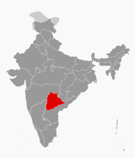
Telangana is a state in India situated on the centre-south stretch of the Indian peninsula on the high Deccan Plateau. It is the twelfth largest state and the twelfth-most populated state in India with a geographical area of 112,077 km2 (43,273 sq mi) and 35,193,978 residents as per 2011 census. On 2 June 2014, the area was separated from the northwestern part of Andhra Pradesh as the newly formed 29th state with Hyderabad as its historic permanent capital. Its other major cities include Warangal, Nizamabad, Khammam and Karimnagar. Telangana is bordered by the states of Maharashtra to the north, Chhattisgarh to the east, Karnataka to the west, and Andhra Pradesh to the east and south. The terrain of Telangana region consists mostly of hills, mountain ranges, and thick dense forests distribution of 27,292 sq. km. As of 2019, the state of Telangana is divided into 33 districts.
Guruvannapeta is spread across 5,659 acres (22.90 km2) of land. There are approximately 600 houses. As per 1991 census, Guruvannapeta consists of 5,320 population.
Agriculture is the primary source of income. There are no special minerals found in this region.
Guruvannapeta has 1 primary school and 1 high school.
Dharmasagar is a Town and a mandal in Warangal (urban) district in Telangana, India. Dharmasagar is well connected with towns like Kazipet, and Hanamakonda by road. It is 14.4 km far from its District Main Town Warangal and 122 km far from its State Capital Hyderabad.
Warangal Urban District is located in the northern region of the Indian state of Telangana. The district headquarters are located at Warangal.
Jangaon is a town and the district headquarters of Jangaon district in the Indian state of Telangana. It is also the mandal and divisional headquarters of Jangaon mandal and Jangaon revenue division respectively. It is about 85 kilometres (53 mi) from the state capital Hyderabad. It lies on the National Highway 163.
Duggondi is a village and a mandal in Warangal (rural) district in the state of Telangana in India.
Geesukonda is a village and a mandal in Warangal (rural) district in the state of Telangana in India.
Chennaraopet is a village and a mandal in Warangal district in the state of Telangana in India.
Atmakur is a village and mandal in Warangal (rural) district from the state of Telangana in India.
Zilla Parishat High School (ZPHS) is the name of many Government Secondary Schools in India and most particularly in the states of Andhra Pradesh and Telangana. These schools are established, supervised, and funded by the Zilla Parishad. ZP High Schools provide education for students from grades 6-10 of the Secondary School Certificate.
Veliminedu is a village of around 10,000 population in Chityal (Nalgonda) mandal within Nalgonda district in Telangana, India. This village is not to be confused with another village by the same name Veliminedu near Ibrahim Patnam in Ranga Reddy district. The Chityal also is not to be confused with another mandal Chityal (Warangal) by the same name in Warangal district.
Punnelu is a village in Wardhannapet mandal, Warangal district, Andhra Pradesh state in India.
Thorrur is a revenue division, Mandal and a muncipality in Mahabubabad district of Telangana, India. It is located on Jayaprakash Narayana road between Warangal and Khammam. It is at about 50 km from Warangal, 62 km from Suryapet and 70 km from Khammam. It is a rapidly growing town due to its location.
Kadipikonda is a Municipal corporation of 35th Division in Warangal District, Telangana state, India. It is located near the Kazipet railway junction. Landmarks :
Kolkonda is a Village in Devaruppula Mandal in Warangal District of Telangana, India. It is located 51 km South of District headquarters Warangal. 15 km from Devaruppula.
Thimmapur may refer to:
Warangal (urban) mandal is one of the 11 mandals in Warangal (urban) district of the Indian state of Telangana. It is under the administration of Warangal revenue division and has its headquarters at Warangal. The mandal is bounded by Hanamkonda and Hasanparthy mandals.
Warangal Rural district is a district in the Indian state of Telangana. The district headquarters are located at Geesugonda. It was a part of the Warangal district prior to the re-organisation of districts in the state.
Mahabubabad is a district in the Indian state of Telangana. It was a part of the Warangal district prior to the re-organisation of districts in the state in October 2016.The district shares boundaries with Suryapet, Khammam, Bhadradri Kothagudem,Jayashankar Bhupalpalle,Warangal Rural, Jangaon districts.
Mulugu district is a district in the Indian state of Telangana. The district headquarters are located at Bhupalpally. It was a part of the Warangal district prior to the re-organisation of districts in the state.
Jangaon district is a district in the Indian state of Telangana. It was a part of the Warangal district and Nalgonda district prior to the re-organisation of districts in the state. .The district shares boundaries with Suryapet, Yadadri, Warangal (rural) district, Warangal urban, Siddipet and Mahabubabad districts.
This article about a location in Warangal (urban) district, Telangana is a stub. You can help Wikipedia by expanding it. |