Guthani | |
|---|---|
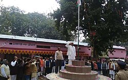 Flag hoisting in Guthani block | |
 Guthani Location in Bihar, India | |
| Coordinates: 26°09′49″N84°02′11″E / 26.1636°N 84.0364°E | |
| Country | India |
| State | Bihar |
| District | Siwan |
| Subdivision | Siwan |
| Headquarters | Guthani block and circle office |
| Government | |
| • Type | Community development |
| • Body | Guthani Block and Circle |
| Area | |
• Total | 91.70 km2 (35.41 sq mi) |
| Elevation | 73 m (240 ft) |
| Population (2011) | |
• Total | 128,155 |
| • Density | 1,398/km2 (3,620/sq mi) |
| Language | |
| • Official | English,Hindi [1] |
| • Additional official | Urdu [1] |
| • Regional | Bhojpuri |
| Time zone | UTC+5:30 (IST) |
| PIN | 841435 |
| Telephone code | 06157 |
| Vehicle registration | BR-29 |
| Sex ratio | 1000:994 male/female |
| Lok Sabha constituency | Siwan |
| Vidhan Sabha constituency | Darauli |
Guthani is a community development block and a revenue circle in Siwan district of the Indian state of Bihar, lying on the banks of river Chhoti Gandak. It is one of 13 blocks of Siwan Subdivision. The headquarters of the block is at Guthani town (Nagar Panchayat Guthani). The block is divided into ten gram panchayats (rural area) and one city council, Nagar Panchayat Guthani (urban area).
Contents
The total area of the block is 91.70 square kilometres (35.41 mi2) and the total population of the block as of the 2011 census of India is 128,155. [2]