The Nzérékoré Region is a region in the southern part of Guinea. Its capital and largest city is Nzérékoré. It is one of the eight regions of Guinea. It is bordered by the countries of Sierra Leone, Liberia, and Ivory Coast, and the Guinean regions of Kankan and Faranah.

The Faranah Region is located in east-central Guinea. It is bordered by the countries of Sierra Leone and Mali and the Guinean regions of Kankan, Mamou, Nzérékoré, and Labé.

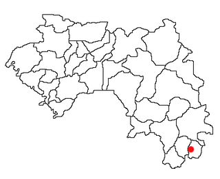
Yomou is a prefecture located in the Nzérékoré Region of Guinea. The capital and principal town of the prefecture is Yomou. The prefecture covers an area of 3,920 km.² and has an estimated population of 114,371.

Mamou is a prefecture located in the Mamou Region of Guinea. The capital is Mamou. The prefecture covers an area of 8,000 km.² and has an estimated population of 222,000.

Lélouma is a prefecture located in the Labé Region of Guinea. The capital is Lélouma. The prefecture covers an area of 2,140 km.² In census of 2014, it had population of 163,000.

Boffa is a prefecture located in the Boké Region of Guinea. The capital is Boffa. The prefecture covers an area of 5,050 km2 (1,950 sq mi) and has a population of 212,583.

The Kindia Region is located in western Guinea. It is bordered by the country of Sierra Leone and the Guinean regions of Conakry, Labé, Mamou, and Boké.

The Labé Region is located in north-central Guinea. It is bordered by the countries of Senegal and Mali and the Guinean regions of Faranah, Kindia, Mamou, and Boké.

Beyla is a town and urban sub-prefecture located in southeastern Guinea. It is the capital of Beyla Prefecture and the main town of the Konyan region.
Gbessoba is a town and sub-prefecture in the Beyla Prefecture in the Nzérékoré Region of south-eastern Guinea.
Dogomet is a town and sub-prefecture in the Dabola Prefecture in the Faranah Region of Guinea. As of 2014 it had a population of 29,040 people.
Sandéniah is a town and sub-prefecture in the Faranah Prefecture in the Faranah Region of Guinea. As of 2014 it had a population of 17,454 people.
Ouéndé-Kénéma is a town and sub-prefecture in the Guéckédou Prefecture in the Nzérékoré Region of south-western Guinea.
Souguéta is a town and sub-prefecture in the Kindia Prefecture in the Kindia Region of western Guinea.
Fermessadou-Pombo is a town and sub-prefecture in the Kissidougou Prefecture in the Faranah Region of Guinea. As of 2014 it had a population of 19,489 people.
Pilimini is a town and sub-prefecture in the Koubia Prefecture in the Labé Region of northern Guinea.
Kouankan is a town and sub-prefecture in the Macenta Prefecture in the Nzérékoré Region of south-eastern Guinea
Balaki is a town and sub-prefecture in the Mali Prefecture in the Labé Region of northern Guinea.
Ouré-Kaba is a town and sub-prefecture in the Mamou Prefecture in the Mamou Region of Guinea.
Kiniébakoura is a town and sub-prefecture in the Siguiri Prefecture in the Kankan Region of northern Guinea.