Hajjah, Palestine

Last updated

Contents

Hajjah
Arabic transcription(s)
   Arabic حجة
   Latin Hajjah (official)
Haja (unofficial)
Palestine location map wide.png
Red pog.svg
Hajjah
Location of Hajjah within Palestine
Coordinates: 32°12′17″N35°07′50″E / 32.20472°N 35.13056°E / 32.20472; 35.13056
Palestine grid 162/179
State State of Palestine
Governorate Qalqilya
Government
  Type Village council
Elevation
[1]
409 m (1,342 ft)
Population
 (2017) [2]
  Total
2,659
Name meaningKuryet Hajja, The town of Hajja, from personal name, or pathway [3]

Hajjah (Arabic : حجة) is a Palestinian village in the northern West Bank, located eighteen kilometers west of Nablus in the Qalqilya Governorate of the State of Palestine. According to the Palestinian Central Bureau of Statistics, the town had a population of 2,659 inhabitants in 2017. [2]

Location

Hajja is located 15.9 kilometers (9.9 mi) east of Qalqiliya. It is bordered by Kafr Qaddum and Immatin to the east, Al Funduq and Jinsafut to the south, Kafr ‘Abbush, Kafr Laqif and Baqat al Hatab to the west, and Kur to the north. [1]

History and archaeology

Potsherds from the Iron Age, Byzantine and Early Muslim periods have been found at Hajja. [4] [5] [6]

Jewish scholars claim that during the Iron Age, Hajjah hosted inhabitants from the Israelite Tribe of Menashe. [4]

Hellenistic to Byzantine period

Magen identified Hajja with Kfar Hagai (כפר חגי), an ancient Samaritan village from the Hellenistic period. A votive inscription of the third or second century BCE from Mount Gerizim, the holiest site in Samaritanism and then the site of a major temple, reads "That which Ḥaggai son of Qimi from Kfar Ḥaggai offered". [7] [8]

In later Samaritan sources, the village is referred to as "Kiryat Hagga (קרית חגה), the current Arabic name being a direct rendition. [9] [10] It was mentioned as the birthplace of Baba Rabba, who built several synagogues in the area, including in the village of Hagga. The Tolidah , a Samaritan historical work, mentions a man named Geber Ben-Karmi of Kiryat Hagga. [4] Mikvehs found in the village indicate that Samaritans inhabited the village during the Byzantine and Early Islamic periods. [4]

Mamluk period

During the reign of the Mamluk sultan An-Nasir Muhammad, in AH 722/1322 CE, a mosque was constructed in the village. A minaret was added to it in AH 735/1334-35 CE. These building were done in the name of Muhammed bin Musa bin Ahmed, a local imam, whose grave stone is also by the mosque, dating his death to AH 749/1348 CE. [11]

Ottoman period

Hajja was incorporated into the Ottoman Empire in 1517 with all of Palestine, and in 1596 it appeared in the tax registers as being in the nahiya of Bani Sa'b of the liwa of Nablus. It had a population of 96 households, all Muslims. The villagers paid a fixed tax rate of 33.3% on various agricultural products, such as wheat, barley, summer crops, olive trees, goats and/or beehives, in addition to "occasional revenues", a press for olive oil or grape syrup, and a tax for people of the Nablus region; a total of 19,200 akçe. All of the revenues went to a waqf. [12]

In 1838, Robinson noted Kuryet Hajja as a village in Beni Sa'ab district, west of Nablus, [13] while in 1870 Victor Guérin noted it from Fara'ata. [14]

In 1870-71 (AH 1288), an Ottoman census listed the village in the nahiya (sub-district) of Bani Sa'b. [15]

In 1882 the PEF's Survey of Western Palestine (SWP) noted about Kuryet Hajja: "A good-sized village on high ground, supplied by wells. It has a rock-cut tomb on the west, and appears to be an ancient place." [16]

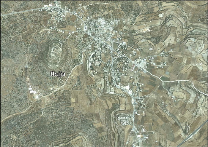
The village's en-Naby Rabbah shrine, atop a tell. This site was declared a nature reserve in 1986.

British Mandate

In the 1922 census of Palestine conducted by the British Mandate authorities, Qariyet Hajjeh had a population of 642 inhabitants, all Muslims, [17] increasing in the 1931 census to 731 Muslims, with 206 houses. [18]

In the 1945 statistics, the population was 960 Muslims, [19] with 13,119 dunams of land, according to an official land and population survey. [20] Of this, 4 dunams were for citrus and bananas, 1,226 dunams were for plantations or irrigated land, 5,045 were for cereals, [21] while 36 dunams were built-up land. [22]

Jordanian period

In the wake of the 1948 Arab–Israeli War, and after the 1949 Armistice Agreements, Hajjah came under Jordanian rule.

The Jordanian census of 1961 found 1,093 inhabitants. [23]

1967-present

Since the Six-Day War in 1967, Hajjah has been under Israeli occupation.

After the 1995 accords, 37.2% of village land was assigned as Area B land, while the remaining 62.8% is assigned Area C. [24]

Israel has confiscated 216 dunums of land from Hajja to establish two Israeli settlements, Karne Shomron and Neve Oramin, with the remainder of the land for these two settlements taken from Jinsafut, Kafr Laqif and Deir Istiya). Israel has also confiscated land from Hajja to build bypass roads and the Israeli West Bank barrier. [24]

Demographics

Hajjah is considered the initial center of the Bani Sa'b tribe. Historically, it has absorbed Bedouins from the Arab al-Jabarat group. [25] The current residents of Hajjah trace their ancestry to Egypt, Yemen and Jaffa. They are united in several clans ("hamulas"), including the Bata-Hamed, Masalha, Da'as, Ta'ayun and Farhat clans, among others. [4]

Some families in the village are believed by locals to be the descendants of Samaritan families which had lived in the village until the Middle Ages, when they converted to Islam. [4]

Sites

A tell topped by a shrine, known as en-Naby Rabbah, is situated 419 meters west of the village. Local residents claim that this shrine marks the tomb of a saint, identified as one of Jacob's grandsons. This saint lacks recognition within mainstream Islam, and no tomb is present at the site. Moshe Sharon suggests that the saint's name may preserve the memory of Baba Rabba, a prominent Samaritan leader from the 4th century known for constructing a synagogue at Hajjah. The locals believe that the saint acts as a guardian for their crops. The site and its surroundings were designated as a nature reserve in 1986. [26]

Notable people

Related Research Articles

Kafr 'Abbush is a Palestinian town in the Tulkarm Governorate in the northwestern West Bank. According to the Palestinian Central Bureau of Statistics, Kafr 'Abbush had a population of approximately 1,488 inhabitants in mid-year 2006 and 1,739 by 2017. 24.8% of the population of Kafr 'Abbush were refugees in 1997. The healthcare facilities for Kafr 'Abbush are based in Kafr 'Abbush, where the facilities are designated as MOH level 2.

<span class="mw-page-title-main">Jayyous</span> Municipality type D in Qalqilya, State of Palestine

Jayyus is a Palestinian village near the west border of the West Bank, close to Qalqilya. It is a farming community. According to the Palestinian Central Bureau of Statistics, the village had a population of 3,478 inhabitants in 2017.

<span class="mw-page-title-main">Immatain</span> Town on West Bank

Immatin is a Palestinian village located in the northwestern West Bank, in the Qalqilya Governorate of the State of Palestine, about seventeen kilometers southwest of Nablus. The current mayor of Immatin is Haythem Sawan.

<span class="mw-page-title-main">Beit Furik</span> Municipality type A in Nablus, Palestine

Beit Furik is a town located nine kilometers southeast of Nablus, in the Nablus Governorate of the northern West Bank, Palestine. According to the Palestinian Central Bureau of Statistics, the town had a population of 13,477 inhabitants in 2017.

<span class="mw-page-title-main">Kafr Thulth</span> Municipality type C in Qalqilya, State of Palestine

Kafr Thulth is a Palestinian town located on high, flat land south of Azzoun, 28 kilometers (17 mi) south of Tulkarm in the Qalqilya Governorate. The average elevation is 270 meters (890 ft) above sea level. According to the Palestinian Central Bureau of Statistics, the town's population was 5,606 in the 2017 census.

<span class="mw-page-title-main">Kafr Qaddum</span> Municipality type D in Qalqilya, State of Palestine

Kafr Qaddum is a Palestinian town in the northern West Bank, located 13 kilometers west of Nablus and 17 kilometers east of Qalqilya in the Qalqilya Governorate. Surrounding towns include Jit to the east and Hajjah to the south. According to the Palestinian Central Bureau of Statistics (PCBS), the town had a population of 3,280 inhabitants in 2017.

<span class="mw-page-title-main">Jinsafut</span> Municipality type D in Qalqilya, State of Palestine

Jinsafut is a Palestinian village in the Qalqilya Governorate of the State of Palestine, in the northeastern West Bank, located east of Qalqilya. According to the Palestinian Central Bureau of Statistics, the village had a population of 2,571 inhabitants in 2017.

<span class="mw-page-title-main">Salim, Nablus</span> Municipality type D in Nablus, State of Palestine

Salim is a Palestinian town in the northern West Bank, located six kilometers east of Nablus and is a part of the Nablus Governorate. According to the Palestinian Central Bureau of Statistics (PCBS), Salim had a population of 6,266 inhabitants in 2017.

<span class="mw-page-title-main">Kafr Sur</span> Municipality type C in Tulkarm, State of Palestine

Kafr Sur is a Palestinian town in the Tulkarm Governorate in the eastern West Bank, located 12 kilometers Southeast of Tulkarm. According to the Palestinian Central Bureau of Statistics, Kafr Sur had a population of approximately 1,254 inhabitants in mid-year 2006, and 1,288 by 2017. 13.5% of the population of Kafr Sur were refugees in 1997.

Baqa al-Hatab is a Palestinian village in the Qalqilya Governorate in the western area of the West Bank, located 20 kilometers southwest of Nablus. According to the Palestinian Central Bureau of Statistics, the village had a population of 1,943 inhabitants in 2017.

Kafr Laqif is a Palestinian village in the Qalqilya Governorate in the western West Bank, located 22 kilometers southwest of Nablus. According to the Palestinian Central Bureau of Statistics, the village had a population of 1,039 inhabitants in 2017.

<span class="mw-page-title-main">Fara'ata</span> Local Development Committee in Qalqilya, State of Palestine

Far'ata was a Palestinian village in the Qalqilya Governorate in the Western area of the West Bank, located 16 kilometers Southwest of Nablus. According to the Palestinian Central Bureau of Statistics, the village had a population of 872 inhabitants in 2017.

<span class="mw-page-title-main">Iskaka</span> Municipality type D in Salfit, State of Palestine

Iskaka is a Palestinian town in the Salfit Governorate of the State of Palestine, in the northern West Bank, 27 kilometers southwest of Nablus. According to the Palestinian Central Bureau of Statistics, it had a population of 1,198 in 2017.

<span class="mw-page-title-main">Jurish</span> Municipality type D in Nablus, State of Palestine

Jurish is a Palestinian town in Nablus Governorate in the northern West Bank, located 27 kilometers southeast of Nablus. According to the Palestinian Central Bureau of Statistics (PCBS), the town had a population of 1,541 inhabitants in 2017.

<span class="mw-page-title-main">Kafr Qallil</span> Municipality type D in Nablus, State of Palestine

Kafr Qallil is a Palestinian town in the Nablus Governorate of the State of Palestine, in the northern West Bank. According to the Palestinian Central Bureau of Statistics (PCBS), the town had a population of 3,029 inhabitants in 2017.

<span class="mw-page-title-main">Qusin</span> Municipality type D in Nablus, State of Palestine

Qusin is a Palestinian town in the Nablus Governorate in northern West Bank, located 8 kilometers West of Nablus. According to the Palestinian Central Bureau of Statistics (PCBS), the town had a population of 2,251 inhabitants in 2017.

Kafr Zibad is a Palestinian village in the Tulkarm Governorate in the western part of the West Bank, located 17 kilometers south of Tulkarm.

<span class="mw-page-title-main">Azzun</span> Palestinian town in Qalqilya, State of Palestine

Azzun is a Palestinian town in Qalqilya Governorate in the northern West Bank, located 9 kilometers east of Qalqilya and 24 kilometers south of Tulkarm.

<span class="mw-page-title-main">Al-Funduq</span> Municipality type D in Qalqilya, State of Palestine

Al-Funduq is a Palestinian village in the Qalqilya Governorate of the State of Palestine, in the northeastern West Bank, located east of Qalqilya. According to the Palestinian Central Bureau of Statistics, the village had a population of 1,125 in 2017. The village took its name from an Arabic word for "inn."

<span class="mw-page-title-main">Iraq Burin</span> Municipality type D in Nablus, State of Palestine

Iraq Burin is a Palestinian village in the Nablus Governorate of the State of Palestine.

References

  1. 1 2 Hajja village profile, ARIJ, p. 4
  2. 1 2 Preliminary Results of the Population, Housing and Establishments Census, 2017 (PDF). Palestinian Central Bureau of Statistics (PCBS) (Report). State of Palestine. February 2018. pp. 64–82. Retrieved 2023-10-24.
  3. Palmer, 1881, p. 187
  4. 1 2 3 4 5 6 Erlich (Zhabo), Ze’ev H.; Rotter, Meir (2021). "ארבע מנורות שומרוניות בכפר חג'ה שבשומרון" [Four Samaritan Menorahs from the village of Hajjeh, Samaria]. במעבה ההר. 11 (2). Ariel University Publishing: 188–204. doi:10.26351/IHD/11-2/3.
  5. גופנא, ר' ופורת, י', 1972 .הסקר בארץ אפרים ומנשה. בתוך: מ' כוכבי (עורך), יהודה שומרון וגולן: סקר ארכיאולוגי בשנת תשכ"ח. ירושלים, עמ' 195–241.[Hebrew]
  6. Dauphin, 1998, p. 798
  7. מגן ואחרים 2000 מגן, י', צפניה, ל' ומשגב, ח', 2000 .הכתובות העבריות והארמיות מהר גריזים. קדמוניות 120 ,עמ' 125–132 Mount Gerizim Excavations, Volume 1: The Aramaic, Hebrew and Samaritan Inscriptions.
  8. Gudme, Anne Katrine de Hemmer (2013). Before the God in this Place for Good Remembrance: A Comparative Analysis of the Aramaic Votive Inscriptions from Mount Gerizim. De Gruyter. p. 74. ISBN   978-3-11-030118-2. OCLC   858213282.
  9. Taylor, J. (1993). Christians and the Holy Places: The Myth of Jewish-Christian Origins. Clarendon Press. p. 67. ISBN   978-0-19-814785-5.
  10. Conder, 1876, p. 196
  11. Sharon (2013), pp. 270-277.
  12. Hütteroth and Abdulfattah, 1977, p. 139
  13. Robinson and Smith (1841), vol 3, Appendix 2, p. 127.
  14. Guérin (1875), p. 180.
  15. Grossman, David (2004). Arab Demography and Early Jewish Settlement in Palestine. Jerusalem: Magnes Press. p. 255.
  16. Conder and Kitchener (1882), SWP II, p. 166.
  17. Barron (1923), Table IX, Sub-district of Nablus, p. 24.
  18. Mills (1932), p. 61.
  19. Department of Statistics, 1945, p. 18.
  20. Government of Palestine, Department of Statistics. Village Statistics, April, 1945. Quoted in Hadawi (1970), p. 59.
  21. Government of Palestine, Department of Statistics. Village Statistics, April, 1945. Quoted in Hadawi (1970), p. 106.
  22. Government of Palestine, Department of Statistics. Village Statistics, April, 1945. Quoted in Hadawi (1970), p. 156.
  23. Government of Jordan, Department of Statistics, 1964, p. 25.
  24. 1 2 Hajja village profile, ARIJ, p. 17.
  25. Grossman, D. (1986). "Oscillations in the Rural Settlement of Samaria and Judaea in the Ottoman Period". in Shomron studies. Dar, S., Safrai, S., (eds). Tel Aviv: Hakibbutz Hameuchad Publishing House. p. 353
  26. Tal, Uri (2023). Muslim Shrines. Yad Ben-Zvi. p. 151. ISBN   978-965-217-452-9.

Bibliography